Who Uses Stream Gage Data?
Who Uses Stream Gage Data?. Janet Thigpen, CFM Flood Mitigation Specialist Southern Tier Central Regional Planning & Development Board. USGS Streamgage Network in New York State. Courtesy of Bo Juza , DHI. Water Withdrawals. Assessing the availability Permit conditions. Water source.

Who Uses Stream Gage Data?
E N D
Presentation Transcript
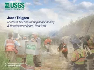
Who Uses Stream Gage Data? Janet Thigpen, CFM Flood Mitigation Specialist Southern Tier CentralRegional Planning & Development Board
USGS Streamgage Network in New York State
Water Withdrawals • Assessing the availability • Permit conditions Water source Gauge Municipal water system Water withdrawal site
Recreation and Navigation Swift Water Rescue Team • Recreational boating • Lake level management • Canal operations Target and actual lake levels Lock 13 on the Erie Canal
Water Quality • Monitoring • Permitted releases Wastewater treatment facility
Land Use • Floodplain management • Planning • Flood mitigation • Determining flood frequency FEMA Flood Insurance Rate Map Future Land Use Plan
Infrastructure • Bridges • Dams • Levees Tioga-Hammond Dam Project Installation of a levee closure structure
Flood Warnings and Response • Forecasts & warnings • Inundation maps • Road closures • Evacuation decisions River forecast Inundation map keyed to gage levels
Stream Gage Funding • Cooperative Water Program (CWP) • Other federal agencies • National Streamflow Information Program(NSIP) Stream gages serve as the stethoscope on our rivers. River gage used for dam operations, levee operations, river forecasts, and other purposes