Download
1 / 26
260 likes | 296 Vues
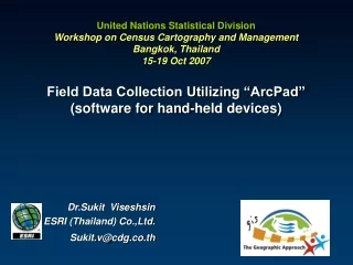
United Nations Statistical Division Workshop on Census Cartography and Management Bangkok, Thailand 15-19 Oct 2007 Field Data Collection Utilizing “ArcPad” (software for hand-held devices). Dr.Sukit Viseshsin ESRI (Thailand) Co.,Ltd. Sukit.v@cdg.co.th. Outline. Who we are? What is ArcPad?

E N D
United Nations Statistical DivisionWorkshop on Census Cartography and ManagementBangkok, Thailand15-19 Oct 2007Field Data Collection Utilizing “ArcPad” (software for hand-held devices) Dr.Sukit Viseshsin ESRI (Thailand) Co.,Ltd. Sukit.v@cdg.co.th
Outline • Who we are? • What is ArcPad? • What can ArcPad do? • ArcPad Demonstration
ESRI • Founded in 1969 (38 Years) • Privately Owned • Zero Debt • Focused Strictly on Geographic Information Systems (GIS) • Ranked as one of the Top Software Companies in the World • Over 1 Million Users Globally
ArcPad General Purpose (Strong GPS Integration) What is ArcPad • GIS & Field collection software for mobile / hand-held devices • Rich functionalities • Many devices supported • Customizable
What can you do with ArcPad? • Working for Map and GIS in the field • Support many mobile devices : • Pocket PC • Tablet PC • Pen-based PC • Combination of 4 Technologies • GIS (Geographic Information System) • Lightweight hardware • GPS Technology (Global Positioning System) • Wireless communication
What can you do with ArcPad? Using your existing data, Capturing data in the field
What can you do with ArcPad? Moving around your map,Querying your data
What can you do with ArcPad? Measuring distances on your map, Navigating with your GPS
What can you do with ArcPad? Editing your data
Customizing ArcPad • Using ArcPad Application Builder • Customization can be: • Input form design • Datavalidation • CustomizeApplication for user • Script withArcPad objects • Etc…
PocketGoods Window Case Or Surveyors Case Other Windows CE Devices RuggedField PC Pocket PC Industrial Leica’s GS5/5+ package is bundled with Panasonic Toughbook 01 Windows CE handheld device
ArcPad Connection Microsoft ActiveSync
ArcPad toolbars Edit toolbar Command bar
Moving around the map Zooming and panning Zooming with the fixed zoom tool
Customizing ArcPad • ArcPad Application Builder Form Designer Script Editor Tree View Control Properties Tool Palette Toolbar Designer & Manager
Orthophoto Map Personal Database andMedical TreatmentRecord integrated with map
E-Care Project Digital Camera Pocket PC GPS Collect coordinates of all building types by GPS, included personal attribute and pictures
Zoom in มาตราส่วน 1:4,000 Map for House location and picture
Let’s make sure that everyone counts!..and is counted! Source: doae.go.th Source: World Resources Institute Source: Robert Ford, LLU