Download

1 / 31
320 likes | 451 Vues
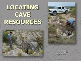
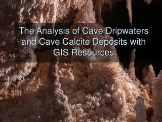
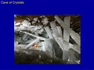
The Analysis of Cave Dripwaters and Cave Calcite Deposits with GIS Resources. Central Texas Cave Project. Central Texas Cave Project. Constituents of Concern Include:. Central Texas Cave Project. Constituents of Concern Include: Driprates of Cave Dripwaters. Pic of Dripping stalagtite.

E N D
The Analysis of Cave Dripwaters and Cave Calcite Deposits with GIS Resources
Central Texas Cave Project Constituents of Concern Include:
Central Texas Cave Project Constituents of Concern Include: Driprates of Cave Dripwaters Pic of Dripping stalagtite
Central Texas Cave Project Constituents of Concern Include: Calcite Growth
Central Texas Cave Project Constituents of Concern Include: Dripwater Geochemistry
Central Texas Cave Project Constituents of Concern Include: Dripwater Geochemistry • pH • Conductivity • Major Ions • Isotopic Compositions (Oxygen, Deuterium, Carbon) • Alkalinity
What affects the geochemistry of these waters? What affects the rates of calcite growth?
Project Objectives Use GIS to determine: • Precipitation • Overlying Soils • Land Cover
Study Area • Caverns of Sonora • Natural Bridge Caverns • Innerspace Caverns
Project Objectives Use GIS to determine: • Precipitation • Overlying Soils • Land Cover
Texas Average Annual Precipitation Source: Texas Water Development Board
Central Texas Average Annual Precipitation Source: Texas Water Development Board
Central Texas Average Annual Precipitation • Caverns of Sonora lies within 20-22 inches per year Source: Texas Water Development Board
Central Texas Average Annual Precipitation • Caverns of Sonora lies within 20-22 inches per year • Natural Bridge Caverns and Innerspace Caverns lie within 30-35 inches per year Source: Texas Water Development Board
Driprates Caverns of Sonora has average driprates much smaller than Innerspace Caverns and Natural Bridge Caverns
Are differences in precipitation evident in cave calcite growth?
Calcite Precipitation Caverns of Sonora isn’t growing much calcite!
Project Objectives Use GIS to determine: • Precipitation • Overlying Soils • Land Cover
Are differences in soil type above each cave evident in cave dripwater geochemistry?
Caverns of Sonora- MUID TX544 Natural Bridge Caverns- MUID TX105 Innerspace Caverns- MUID TX153 Source: Statsgo Soil Database
Caverns Of Sonora Innerspace Caverns Natural Bridge Caverns Source: Statsgo Soil Database
Project Objectives Use GIS to determine: • Precipitation • Overlying Soils • Land Cover
How do differences in land cover change the geochemistry of the cave dripwaters?
Caverns of Sonora Innerspace Caverns Natural Bridge Caverns Source: NLCD 1992 Land Cover Dataset
Conclusions • GIS is a useful tool for delineating spatial heterogeneity over land surfaces • GIS is useful in bringing together many different parameters in which relationships may exist
Future Work • Determine other factors (fractures, bedrock, evapotranspiration) that may be influencing the different chemical constituents that are analyzed in the caves • Use tracking analyst to determine driprate and geochemical response to rainfall events