Download
1 / 21
210 likes | 317 Vues
Learn about the weather systems that affected Dominica in 2012, including Tropical Storms Ernesto, Isaac, and Rafael, and their impact on rainfall patterns in areas like Melville Hall and Canefield. Stay informed about the significant weather events through this summary. Rehabilitation estimates surpassed EC$32 million.

E N D
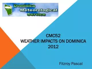
CMC52 WEATHER IMPACTS ON DOMINICA 2012 Fitzroy Pascal
Weather systems • TD 5 / TS ERNESTO (Aug) • TD 7 / TW (Aug) • TD 9 / TS ISAAC (Aug) • TS RAFAEL (Oct)
ernesto • Aug 1 TD 5 was 850 miles east of Windward Islands; a TS Watch was issued for Dominica • Aug 2 TS Warning issued at 5p.m. system now Ernesto and was expected to pass south of Dominica • At 11p.m. Ernesto was 240km SE of Dominica moving W near 22mph • Aug 3 at 8a.m. Ernesto was 140km S of Dominica moving W 24mph • At 11a.m. with Ernesto 140km SW of the island; the TS Warning was discontinued
TD #7 • Aug 9 TD 7 forms 1155 miles east of Windward Islands • Aug 10 At 5p.m. TS Watch was issued for Dominica when the system was 630 miles ESE of the island moving west near 24mph • Aug 11 TD7 degenerated to a TW at 11a.m. and the TS Watch was discontinued for Dominica
Isaac • Aug 21 TD 9 formed east of the Lesser Antilles • A TS Warning was issued for Dominica • At 5p.m. the system was upgraded to TS Isaac and was 495 miles east of Dominica moving west at 17mph • Aug 22 at 5p.m. Isaac was 50 miles north of Dominica • Aug 23 at 8a.m. the TS Warning was discontinued by then Isaac was 225 miles west of Dominica
Rafael • Oct 10 An Alert issued on an active TW 750 miles east of Windward islands which was expected to move across Dominica Fri 12 to Sat 13 • Oct 12 at 7a.m. a Special Weather Bulletin issued for Dominica for Strong TW & Assoc. Area of Low Pressure • At 2p.m. the Broad Area of Low Pressure was 100 miles west of Dominica • 8p.m. the system was upgraded to TS Rafael. Portions of the Lesser Antilles was placed under watches and warnings • Dominica was not placed under a watch or warning • Oct 13 5a.m. Rafael was 170 miles west of Dominica moving NW near 9mph
Wind and Rainfall data (tdpd & tdcf) Mellville Hall Canefield
Summary • Four systems had significant impact on the island of • Dominica • These were predominantly rainfall events • Rehabilitation was estimated to be in excess of • EC $32 million