WVU Mine Drainage Task Force Symposium
Morgantown, West Virginia April 22, 2008. WVU Mine Drainage Task Force Symposium. Innovative Mine Water Management Techniques for Submarine Coal Mines of the Sydney Coalfield. Sydney Coalfield. Sydney, NS. Morgantown, WV. Sydney Coalfield. Sydney Coalfield. 2001. More than 50 u/g


WVU Mine Drainage Task Force Symposium
E N D
Presentation Transcript
Morgantown, West Virginia April 22, 2008 WVU Mine Drainage Task Force Symposium Innovative Mine Water Management Techniques for Submarine Coal Mines of the Sydney Coalfield
Sydney Coalfield Sydney, NS Morgantown, WV
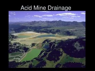
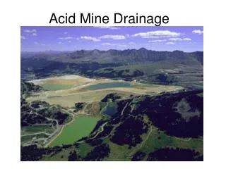
Sydney Coalfield Sydney Coalfield 2001 More than 50 u/g mine produced over 500 million tons Left behind voids for more than 50 billion gal of AMD And so began the …… No.2 1685 Port Morien
1B System 1B Hydraulic System *Note 1B Shaft location and No.26 location Port Morien
Geologic 1B System Geologic Structure -2760’ bsl B Bridgeport Anticline +128’ asl Glace Bay Syncline A Port Morien
Stratigraphic Section Through Coal Seams Mined in the 1B Hydraulic System(Section A - B through the Glace Bay Syncline) +128’ asl A B Reserve Mines Glace Bay Atlantic Ocean Sea level Hub Seam Sedimentary Section Harbour Seam Idealized Geology Between Coal Seams Hub Seam-2.5 m Phalen Seam 100 m Emery Seam Harbour Seam-1.8 m Peat Swamp Soil Horizons (Siderite & Calcareous nodules common 75 m Bouthllier-1m Red beds 30 m -2760’ bsl Backpit-1m 23 m River Channelling Phalen Seam-2.3m 40 m Lake/bay fill Emery Seam-1.1m Lake/bay Peat Swamp
Mining Methods within the 1B System • Room and pillar • Room and pillar with pillar extraction • Longwall
Flooding of the 1B System • Flooding soon follows for the 2 operating mines • Flooding begins for the 8 directly connected mines • 1B Shaft pumps – 1750 USgpm • are shut down • No. 26 lost to a fire • In 1984
Hydrograph 1B Shaft Hydrograph – 1B Hydraulic System Lingan In-rushes Mine Water chemistry From 1B Shaft 1991 Pumps prepared in 1B Shaft down dip flooding No.26 floods
Atlantic Ocean Start the pumps in the 1B Shaft ! 1100 ft Harbour Seam SHALE Lingan Colliery Coal Barrier Coal Barrier – 1100’ B Flooded No. 26 Colliery 430 ft Phalen Colliery Retreat Direction Phalen Seam 130 ft Emery sea Emery Seam Flooding of Lingan Colliery starts – Nov./92
1B Discharge Nov. 1992 – 10 days of pumping 1B Discharge
Hydrograph 1B Shaft Hydrograph – 1B Hydraulic System Emergency WTP Upgrade Phalen Pumping Capacity & build WTP Flooding rate increases Phalen closes Phalen effects slow flooding no treatment ! Lingan in rush and Mine closure New Mine Water chemistry from 1B Shaft Nov. 2002 Pumps prepared in 1B Shaft down dip flooding No.26 floods
Atlantic Ocean 1100 ft Harbour Seam SHALE Flooded Lingan Colliery Pillars >200’Barrier Flooded No. 26 Colliery 430 ft Phalen Colliery Retreat Direction ~300 USgpm/panel 130 ft Emery sea Emery Seam Phalen Longwalls receive mine water
Mine water is Getting Close ! • In mid 2002, monitoring boreholes along the shoreline intercept bad quality mine water • Less than 100 ft to overflow WHERE DO WE GO FROM HERE !
Late 2002, all focus is on mine water The location, quantity and mine water overflow date was calculated (3) All surface water entrance points sealed (4) Established expert groups to give advice (5) Additional boreholes drilled to sample mine water chemistry and geology in upper areas (6) Began immediate construction of an emergency WTP at the 1B Shaft site CBDC Developed a Stepped Approach to Deal With Rising Mine Water
1A Outfall projected to discharge by April 2003 at elev. +6’ asl No.1A Outfall at shoreline
Bootleg MacKay’s Corner “bootleg” workings and AMD formation
1B Shaft WTP 1500 US gpm capacity 1B Treatment Plant and Settling Pond
January 2003 – Less than 100’ to overflow B-175 B-171 B-172 B-174 Atlantic Ocean Phalen Seam Outcrop Reserve Mines No. 1A Outfall 1A Water Level Coal Pillar +100 Boreholes 2001 -100 Outline of Mine Workings No. 1A Outfall -100 0 -200 Boreholes 2002 Dominion Suspected infiltration zone hatched Approx 4500 acres -200 Neville Street No. 1A (1893-1927) -300 No. 5 (1872-1938) Coal Pillars -400 Atlantic Ocean -300 -500 -400 -500 No. 1B Shaft No. 1BShaft No. 3 (1900-1915) No. 2 (1899-1947) (Emergency WTP) Glace Bay
CBDC Stepped Approach Continued (7) In January 2003, borehole sampling in upper area of No.5 showed good mine water chemistry Needed to understand the reasons why (8) Intensive study of mine water flow paths, local geology, mining methods and infiltration areas carried out (9) Recommended that an untreated discharge should be established in area of good mine water chemistry
Borehole location Probable infiltration zone and flow path prior to flooding of 1B System Atlantic Ocean Phalen Seam Outcrop Reserve Mines No. 1A Outfall 1A Water Level Coal Pillar +100 Outline of Mine Workings -100 Dominion No. 1A Outfall 0 -200 Suspected Infiltration zones hatched Approx 4500 acres -100 No. 1A (1893-1927) -300 -200 No. 5 (1872-1938) Coal Pillars -400 Atlantic Ocean -300 -500 80+ years of flushing No. 1B Shaft Pumps @ 1750 USgpm Until 1984 -500 No. 1BShaft -400 No. 3 (1900-1915) No. 2 (1899-1947) Glace Bay
No.1A Room and Pillar workings borehole “LESS access to acid neutralizing roof strata” ROOF STRATA Limestone Limestone PILLAR AMD AMD ROOM COAL Mining Method – 92% Room and pillar Only 45% of coal removed
No.5 Pillar Extraction No.5 pillar extraction “MORE access to acid neutralizing strata” borehole Limestone AMD Mining Method – 75% Room and Pillar with pillar extraction Almost 85% of coal removed
Establish an Untreated Discharge • In Feb 2003 a pilot pumping program was implemented in upper area of No.5 near Neville Street. Very positive mine water chemistry – zero fish mortality – results accepted by regulators. • In March 2003, Neville Street upgraded to 3500 gpm capacity, discharge quality remained stable. • The flooding of the 1B System was now under control.(mine water level had reached –12’ bsl) • The operation of the WTP at 1B Shaft was halted and the plant was put in a state of readiness.
Flooding halted Flooding status halted in March 2003 flooded Only 5% left dry
Current Pumping Strategy • Since 2003 the Neville Street Well field has undergone several infrastructure upgrades. • It is now fully automated with 12 x 30 hp submersible pumps providing 5700 gpm at full capacity. • Pump startup priority is based on quality at individual wells. Maintain mine water level at –17’ to –19’ bsl. • Normally see increase in mine water volumes 24 hours after precipitation events. Increase pumping rate before major precipitation begins.
Neville Street Well Field – July 2007 N Well Field Discharge Neville Street Level Control B-172 B-202 B-201 B-200 B-177 B-199 B-198 B-185 West wells B-176 Cadegan Brook B-192 B-193 B-184 B-183 Glace Bay South Wells Major Surface Water Infiltration Zone Wetland Reserve Mines MacKay Corner Phalen Seam Outcrop
Neville Street Well Field – April 2008 Major Infiltration Zones Cadegan Brook South Wells West Wells
Automation Screen Pump screen
Pump Start Screen Pump start
Maint zone Major rain/snow melt events Automation
Fe concentration 2007 Maintenance zone -17 to –19 ft bsl Monitoring Well 2007 Contour Map - Mine water iron concentrations in mg/l
Alk vs Acidity Mine Water Alkalinity/Acidity Trends 2003-2007
Neville Street Well Field - Key Statistics • Annual precipitation of 60”, average pumping rate of 2200 US gpm • Infiltration rate is estimated to be 2.9 gallons per acre. The total infiltration varies from 450 gpm (summer) to 7000 gpm (rain/snow melt) • Currently pumping 1.2 billion US gallons annually without treatment • Annual cost to operate the Neville Street Well Field is $ 250k
Neville Street Well Field at Full Capacity Feb. 2008 NSWF Discharge
The Future – Near Term • Mine water quality is slowly deteriorating. • Assessing adjacent mines for leakage/pillar failure. • Drilling additional boreholes for strata information and looking for better quality mine water. Plan to use tracers to better identify u/g flowpaths. • Planning for an aerial survey using LIDAR technology to identify surface sinkholes. • Construct passive treatment wetland at Neville St. • Establish/support research in Mine Water Management at Cape Breton University.
The Future – Long Term • Our ultimate goal is to establish a compliant, passive discharge from the 1B Hydraulic System to the marine environment. • Work closely with CBU Mine Water Chair to help develop the plan to accomplish this goal. • Probable use of active treatment technology to flush the 2 billion gallons of AMD under the land portion of the 1B System before release – how many times will it have to be flushed is the question that needs to be answered.