Download
1 / 28
290 likes | 653 Vues
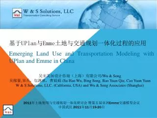
吴宋美加设计咨询(上海)有限公司 /Wu & Song 吴稼豪 , 宋兵,包渊秋,曹娟娟 /Jia Hao Wu, Bing Song, Bao Yuan Qiu, Cao Yuan Yuan W & S Solutions, LLC. (California, USA) and Wu & Song Associates (Shanghai). 基于 UPlan 与 Emme 土地与交通规划一体化过程的应用 Emerging Land Use and Transportation Modeling with UPlan and Emme in China.

E N D
吴宋美加设计咨询(上海)有限公司/Wu & Song吴稼豪,宋兵,包渊秋,曹娟娟 /Jia Hao Wu, Bing Song, Bao Yuan Qiu, Cao Yuan Yuan W & S Solutions, LLC. (California, USA) and Wu & Song Associates (Shanghai) 基于UPlan与Emme土地与交通规划一体化过程的应用 Emerging Land Use and Transportation Modeling with UPlan and Emme in China 2011年土地使用与交通规划一体化研讨会 暨第五届亚洲Emme交通模型会议 中国武汉 2011年11月19-20日
吴宋国际集团 美国W & S Solutions, LLC 吴宋美加设计咨询(上海)有限公司 交通一体化模型、规划和工程设计服务和咨询 一流人才 一流技术 一流产品 国际知名交通系统中国指定代理与合作伙伴 Emme, Dynameq, Aimsun, Autoturns, Synchro, Econolite 国际与国内技术与课程培训 电话,电邮,qq用户群 与年度用户会议
感谢 上海复旦规划建筑设计研究院 Research Center for Urban Planning and Development of Fudan University, China 国家自然科学基金 Natural Science Foundation of China (50808048) 漯河市政府 Luohe City Government, China 中国城市交通规划与温室排放研究(委员会筹)平台 National Urban/Transportation Planning and GHG Research Platform, China 加大戴维斯分校 团队 UPlan Support Team, UC Davis INRO Consultants, Canada
Transportation Technology 交通技术 • Vehicle: New Green Vehicle, Electric Vehicles (EV) • 车辆:新型绿色车辆 ,电子车辆 • Service: Better Life 服务:更优质的生活 • Battery and Environment 使用太阳能蓄电池更加环保 • Urban Planning 城市规划 • Urban Limit Line (rolling) 城市控制线 • Infill, Density, Mixed Use 密集型混合使用 • Multiple Centers 多中心开发 • Needs in Land Use Modeling 土地规划建模的必要性 POLICIES TO REDUCE GHGS降低温室气体排放政策
中国政府的最近承诺 胡锦涛主席在联合国气候变化峰会上,首次就气候变化课题阐述中方立场时指出:“我们将致力于按2005年的水平,在2020年之前,大幅度减少中国每单位国内生产总值所产生的二氧化碳。” 美日也承诺尽一分力美国总统奥巴马也指出,美国“决心”采取行动应对全球暖化问题。他呼吁发展中国家采取“强硬措施”减少温室气体排放量,以便在今年达成新的环球气候变化协议。
土地使用与交通规划及交通排污的关系一体化 • 城市形态与土地使用 • Urban Design 城市设计 • Urban Forms 城市发展形态 • Land Use Data 土地利用 • 3E 评价指标 • Economy 经济 • Environment 环境 • Equity 公平 • 城市交通排污 • Speeds 速度 • Vehicles 车辆 • Emissions 排污 • 交通系统 • TransportationSupply 交通供应 • Transportation Demands 交通需求 • Transportation Volumes 交通流量
车公里 VMT 基于TAZ的交通可达性 TAZ Based Accessibility 基于TAZ的拥挤度 TAZ Based Congestion Measure 平均出行距离 Average Distance 平均出行时间 Average Travel Time 人口密度 Population Covered by Bus Stops 岗位密度 Employment Covered by Bus Stops 土地使用评价指标 Evaluation Criteria
土地使用与交通建模 Land Use/Transportation Modeling • 阶段1:土地使用概念规划 • Stage 1: Land Use Sketch Planning • 阶段2:土地使用用地精细化调整 • Stage 2: Land Use Refinement • 阶段3:交通政策规划 • Stage3: Transportation Policy Planning • 两个反馈机制 • Two Special Feedbacks at Stage 1 and Stage 3 • 将Uplan 与 Emme 集成一体 • Uplan and Emme are used as part of the modeling process 8
土地使用与交通建模 Land Use/Transportation Modeling 9
1 0 0 0 1 1 0 0 1 1 .5 .5 .5 .5 .5 .5 • UPlan土地使用模型(Johnston B.et al, 2007),是一个的基于ArcGIS系统开发而成的模型,可以应用于县、都市区、子城市等。在明确城市土地分类面积和城市发展政策因子的基础上,计算土地开发密度,输出各种土地使用信息数据。其结果可以应用到交通模型中,得到交通出行量。The land use allocation model is developed by UC Davis • UPlan is a GIS based Land Use model that runs within ESRI’s ArcGIS. Shape files representing General Plans, specific plans, existing urban areas, infrastructure, roads, environmental, and others are converted to grid based rasters. UPlan allocates the land use into grids and TAZs based on the total populations and total employments and a set of rules and attraction factors. What Is UPlan?
地理吸引因子类别 Types of Attraction Factors In Layers UPlan模型针对性地将研究区域的适宜性评价因子分为三类: 鼓励开发(attracters) 限制开发(discouragers) 禁止开发(masks) 通过对适宜性评价因子划分评价值来计算土地使用布局和规模。 通过以上三类因子的叠合得到了Uplan的用地适宜性评价,然后评价值高的栅格,将按照土地使用总体规划(general land use plan)中的土地使用类型而被优先开发利用,以此类推,直到所有预测的土地需求被分派完为止。
地理吸引因子 Attraction Factors In Layers Attraction Factors In Layers 靠近高速公路匝道 将享有更加便利的交通,因而有利于吸引工商业 靠近湖泊,有利于高级住宅区的开发 靠近大型商业区,有利于吸引普通住宅 靠近公交站点,有利于吸引商业、住宅等 政府鼓励开发利用的、实施补贴的区域,开发利用的成本较低 基于TAZ的交通可达性 TAZ based transportation accessibility
漯河总规中的应用 Project Application for City of Luohe Region in China 漯河市是河南省的一个地级市,位于以郑州为中心、半小时通达的中原城市群的紧密层,作为地区性中心城市,其职能定位为:国家食品工业基地、城市群中原节点城市、区域物流中心。2008年漯河市区常住人口56万,用地规模61.77平方公里,属于典型的中等规模城市(市区常住人口50万—100万),其最新一轮的城市总体规划(2009-2030)正在修编过程中。 Luohe is a prefecture-level city in central Henan province, People's Republic of China.
漯河总规中的应用 Project Application for City of Luohe Region in China 漯河是一个特色鲜明、享誉四方的食品名城,培育了亚洲最大的肉类加工企业双汇集团、驰名中外的南街村集团、全国第一家葡萄糖饮料生产企业乐天澳的利集团、全国最大的可口可乐生产基地漯河太古可口可乐饮料有限公司等一批知名食品企业,形成了以肉类、粮食、饮料、果蔬四大加工产业集群为核心的18大类50多个系列的上千个品种。漯河是全国最大的肉食品加工基地、全国重要的粮食加工基地和中部地区重要的饮料生产基地。 It is famous for its food production, the national garden city and is rich in tourism resources with the forest coverage up to 44.5%. The streets are lined with green trees and fresh flowers.
研究范围 Study Area 2008年漯河市区常住人口56万,用地规模61.77平方公里,属于典型的中等规模城市(市区常住人口50万—100万),其最新一轮的城市总体规划(2009-2030)正在修编过程中,规划人口120万。 Its urban proper area has a population of 800,000 with 61.99 square kilo-meters and 1.2 million in 2030. It is a typical middle-sized city in China (a population between 0.5 and 1 million).
研究范围 Study Area 为了更好的配合新一轮的城市总体规划修编工作,契合国家住建部于2010年2月提出的城市综合交通体系规划须与总体规划同步编制的要求,同时也为了更好的研究中小城市在资源与环境约束下空间拓展与交通系统之间的关系,总体规划编制单位复旦院与吴宋共同以漯河城市交通数据为例,开发研究《城市土地使用与交通一体化规划决策支持系统》,通过该支持系统模拟规划决策过程,从空间规划决策阶段到规划方案深化阶段,再到交通规划决策阶段,通过定量分析以可视化途径实现土地使用与交通的反馈及一体化过程,得到新一轮城市土地使用布局、规模及交通政策发展方向。 To develop a general plan of the city with the new regulation, we developed the project to determine the future land use patterns with transportation infrastructure by applying this modeling method.
土地使用与交通 Land Use and Transportation Policies
土地使用与交通 Land Use and Transportation Policies Draft LU Allocation (2030) LU Allocation (2009)
漯河土地分配 Luohe City LU Allocations
三阶段结果比较 Comparison Results at Stage Three 平均车公里 Average VMT (in PCU-km) of Three Options for Two Applications • 反馈的方法能降低车公里 The integration with feedbacks does produce a lower VMT • 公交方案更好 Transit option is better than auto option
土地使用分配图 Land Use Type Allocations for Transit Option with Application Two
实现ArcGIS 信息平台 把市现有的土地使用资料,道路属性资料等导入Emme 实现GIS信息平台与宏观交通模型Emme 的数据转换 整合土地使用城市交通所有资料到一个平台
系统实现:Uplan and Emme Implementation: Uplan and Emme Modeller • New Emme Modeller can be used to call Uplan directly; • Iterations between Emme and Uplan can be streamlined automatically or manually; • A fixed point (or convergent solution) can be obtained and • Transportation results can be compared effectively.
Emme 中的出行量与交通流量 Trip Generations and Auto Volumes in Emme
本项目在美国交通工程师协会的报道 This Project was reported in the Recent ITE Planning News Letter
探讨了可持续发展政策与方案 Developed Sustainable Policies and Strategies • 建立了一套集成系统 Implemented An Integration Modeling System • 对三种土地与交通政策进行评价 Performed Evaluation of These Policies and Strategies • 反馈的一体化方法降低了车公里 Reduced VMT via Land Use and Transportation Feedbacks (Iterations) • 将其用到更大范围的城市中 Will apply this method to a larger area and regions • 进行中美对比研究 Will make comparison studies between the US and China 结论 Conclusions 28