Download
1 / 15
150 likes | 155 Vues
2016 Columbia River Basin Long-Term Water Supply and Demand Forecast. Dan Haller, PE dhaller@aspectconsulting.com 509.895.5462. 2011 Water Supply & Demand Forecast. Update required every 5 years Audience includes policy makers, water managers, general public Water and economic modeling

E N D
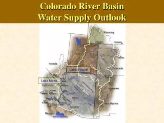
2016 Columbia River Basin Long-Term Water Supply and Demand Forecast Dan Haller, PE dhaller@aspectconsulting.com 509.895.5462
2011 Water Supply & Demand Forecast • Update required every 5 years • Audience includes policy makers, water managers, general public • Water and economic modeling • Interviews with water managers • Peer review • Predicts agricultural, municipal, instream, and hydropower needs • Guide for future investment • Emerging policy issues
2011 Forecast Findings: Supply • Water forecasted through 2030 • Modeled surface water supply / demand • Did not forecast GW supply / demand • Supply: surface water supplies estimated to increase statewide by 3% average • Climate change: water supply projected to shift earlier in the year • WDFW created an Instream Atlas to help characterize fish flow, habitat, and utilization
2016 Forecast Analysis Will… • Forecast through 2035 • Include groundwater evaluation • Improve hydrology, cropping models, consumptive loss simulation • Include climate change predictions • Forecast water right and reservoir curtailment • Evaluate potential for the forecast to be extended to Western WA in 2021 • Evaluate policy issues necessary for program administration and investments
Policy Issues in 2016 Forecast • Water Banking: How can water banking assist in meeting demand? • Cost Effects of Water: How is an applicant-pays model affecting program participation? • METRIC: How can remote sensing improve demand projections? • Groundwater Integration: Where and how much will declining groundwater supplies affect demand?
Water Banking In Washington Insert figure 5 here
Cost Effects of Water • Legislature has moved towards an applicant-pays system • Cost-reimbursement permitting • Recovery of water supply development costs • Some applicants are choosing to defer or postpone rather than receive new water rights when offered • This study will survey 500 applicants from various programs (Lake Roosevelt, Wenatchee, Yakima, Cabin Owners, etc.) to understand how time and financial terms of a program are affecting processing and demand for new service
Cost Effects of Water: Policy Considerations • What price points incentivize applicant participation? • What other program criteria affect participation (e.g. lead time, water right type, purpose of use, location)? • What should Ecology’s reaction be to applicants that decline processing? • Should application requirements be augmented to better reflect processing level of effort?
METRIC: Forecasting Irrigation Use • METRIC uses field-calibrated satellite imagery to improve consumptive use forecasting • Predict agricultural crop consumption and return flows at the field and watershed scales • Pilot 3 subbasins: Walla Walla Basin, Yakima Basin and Okanogan Basin • Model inputs from volunteer farms: • Soil moisture • Weather data (wind speed, temperature, heat flux) • Applied irrigation (Applied Water Duty) • Landsat flights
Groundwater Integration • New component for 2016 Forecast • Why: • 2011 Forecast did not evaluate effects of declining groundwater on demand • Users who rely on declining groundwater supplies may rely on surface water in the future • Surface and groundwater interactions can lead to water rights conflicts • Goals: • Improve forecasting of groundwater shortages by identifying data gaps and use existing tools to predict the scope of the problem • Estimate surface water demand changes caused by groundwater shortages
Forecast Report • 50+ page Summary Report • WRIA-focused pages • Large Technical Report • Web applications / content • Instream Flow Atlas Update
Schedule / Opportunities for Input • Data collection and modeling in 2015 • Presentations to stakeholder groups in 2015 • Watershed planning input in 2015 • Sector expert input in 2015 • Analysis and draft results in early 2016 • Public workshops and draft report in summer 2016 • Final Report Due November 15, 2016