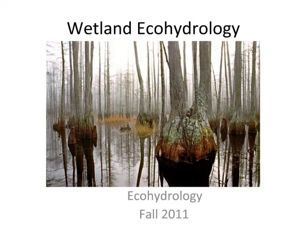
Welcome to Wetland Evaluation
580 likes | 1.2k Vues
Welcome to Wetland Evaluation . Break down. Presentation on ELC and OWES Break Field exercise will consist of (1h-1.5): Performing a soil survey Delineate a wetland boundary using plants Wetland community groups Break What your wetland is worth. Why are Wetlands Important?.

Welcome to Wetland Evaluation
E N D
Presentation Transcript
Break down • Presentation on ELC and OWES • Break • Field exercise will consist of (1h-1.5): • Performing a soil survey • Delineate a wetland boundary using plants • Wetland community groups • Break • What your wetland is worth
They are the heart of the ecosystem! • All things need water to survive • Food hub • Reproduction hub • Most biologically diverse areas of Ontario
Water Management • Flood prevention • Filters sediments and chemicals • Recharge areas for ground water (Drinking Water)
Why We Evaluate Wetlands • Categorize landscape • Relativity to other wetlands • Environmental impact assessments • Municipal and Provincial planning • Quantifying Significant • Determine value based on environmental and economical qualities
Benefits to Evaluation • Protect Existing Wetland • 72% of the wetlands present prior to European settlement have been destroyed in Southern Ontario. • Interest • Know what's on you property • Track changes and heath of your environment • Tax Break • The Conservation Land Tax Incentive Program offers 100 % tax exemption of PSWs • Land must be at least 1/5 of a hectare (1/2 acre) in size.
Controversy • The Provincial Policy Statement prohibits development and site alteration in and adjacent (PSWs). Problems • Assessment can impact neighbor • Exemptions allow for infrastructure works, agriculture and some resource extraction activities • MNR is responsible for evaluation approval
ELC Example Image: TRCA, 2013
OWES Components A numerical ranking of wetland values or functions 1. Biological Component: productivity and habitat diversity 2. Social Component: direct human including economically valuable products, recreational activities and educational uses 3. Hydrological Component: water-related values, such as the reduction of flood peaks and contributions to groundwater recharge and discharge, and water quality improvements. 4. Special Features Component: geographic rarity of wetlands, rare species, ecosystem age, and habitat quality for wildlife
Are You Significant? PSW defined as any evaluated wetland that scores: • 600+ total • 200+ in Biological Component or Special Features Component • Note each category capped at 250 points
Easy Points Special Features 200 points gets you PSW stats RARITY • Wetlands Type (80 points) • Endangered or Threatened Species Breeding (250 points) • Endangered or Threatened Species Feeding Habitat (150 points) SIGNIFICANT FEATURES OR HABITAT(25 to 150 points) • Colonial Waterbirds • Waterfowl Staging and Moulting • Migratory Passerine, Shorebird or Raptor Stopover • Ungulate Habitat • Fish Habitat
U.S. Fish and Wildlife Service, 2013 • Red-necked Grebe • Black-crowned Night Heron • Black Tern • Common Tern • Caspian Tern • (smaller) • Great Egret • Great Blue Heron • scored for nesting occurrences, only Photo: Philip Jeffrey Photo: Mdf CC Photo: Badjoby CC
International concern under the North American Waterfowl Management Plan. Goal of 640,000 breeding birds in the original breeding ground survey area.
Delineation Wetland boundaries uses the “50% wetland vegetation” rule is used. (BIRDS EYE VIEW or Relative Cover)
Categorize Your Wetland • Community Type • Wetland Type • Dominate vegetation type >25%
Wetland Types • M = marsh • W = open water marsh • S = swamp • F = fen • B = bog
Swamp (100 to 200yrs) • Swamps are wooded wetlands with 25% cover or more of trees or tall shrubs and standing water What about Ephemeral pools?
Trees of silver maple, hybrid soft maple, white elm, black/green ash and yellow birch are among the best indicators of a deciduous swamp Photo : UFORA Black spruce, eastern hemlock, and tamarack indicate conifer swamps. Photo: Ben Kimball
M-Marsh W-Open Water Marsh(10-15yrs) Marsh: communities dominated by narrow-leaved emergents, robust emergents, broad-leaved emergentsor herbs Open water marsh: communities dominated by submergents, floating plants or un-vegetated open water <1m deep • Marshes are wet. Standing or slowly moving water. No dominant trees species. Do not completely dry up.
Marsh Indicator Species W - Marsh • Myriophyllum sp. Water-milfoil • Potamogeton sp. Pondweed • Nuphar or Nymphaea sp. Water-lily M-Marsh • Carexemoryi Riverbank Sedge • Typha sp. Cattail • (also in swamps) Photo: Christian Fischer Photo: André Karwath Photo: User:Bogdan CC Photo: Marcus, Joseph A.
Fen (+500yrs) • Live tree cover can’t exceed 25%. • Peat-filled, chiefly Sphagnum. • Fens can be dominated by sedges, grasses, and low shrubs, e.g., sweet gale (Myricagale).
Fen species • Sphagnum moss sp. • Scheuchzeria sp. Pod-grass • Drosera sp. Sundew • Orchids James Lindsey at Ecology of Commanster James Lindsey at Ecology of Commanster Photo: Jacopo Werther
Bog (+1000yrs) • Peat-filled, chiefly Sphagnum. • Not diverse usually less than 14 species of vascular plants with over 25% cover • Surface water and peat are strongly acidic (pH 4.7) and deficient in mineral nutrients. Note: Do not use harvested peat for gardening!
Vegetation Forms Trees: >6m Tall shrubs: 1-6m Low shrubs: <1 m
Example Sheet • What looks 25% (absolute cover) • f,*ne water lily (f) • su*, f, ne pondweed (su) • Wetland Type (M<W<F<B<S) • Map Code: suW1 • Soil • % Fish Habitat ?
Field Work • Soil • Plant ID • Delineation • Community Groups • On your own
What is your Wetland Worth?Biological Component • Productivity Growing Degree Days
Biodiversity • 1.1.2 Wetland Type • 1.1.3 Site Type • 1.2.1 Number of Wetland Types
1.2.3 Diversity of Surrounding Habitat • 1.2.4 Proximity to Other Wetlands • 1.2.5 Number of Interspersions • 1.2.6 Open Water Type • 1.3 Size
Biological Component Final Score:
What is your Wetland Worth?Social Component Economically Valuable Products • 2.1.1 Wood Products • 2.1.2 Lowbush Cranberry • 2.1.3 Wild Rice • 2.1.4 Commercial Fishing (Bait/Coarse) • 2.1.5 Furbearers
2.2 Recreational Activities Landscape Aesthetics • 2.3.1 Distinctness • 2.3.2 Absence of Human Disturbance Education and Public • 2.4.1 Uses • 2.3.2 Facilities and Programs • 2.4.3 Research and Studies
2.5 Proximity to Human Settlement • 2.6 Ownership • 2.7 Size in relation to Social Component • Add 2.1, 2.2 and 2.5 / Total Wetland Size • 2.8 Aboriginal Values Social Component Score:
References • All photos not sited on slides are property of Adopt-A-Pond • All material taken from • 1st ed. 2013. Northern Manuel Ontario Wetland Evaluation System. 978-1-4606-0203-4 PDF • Ecological Land Classification SCSS Field Guide FG-02, Ministry of Natural Resources