Download
1 / 28
280 likes | 332 Vues
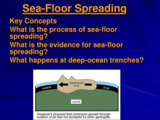
Mid-Ocean Ridges: sites of sea floor spreading (i.e., divergent boundaries) characterized by elevated position (one to three kilometers above the ocean floor) faulting (transform boundaries) and numerous volcanic structures extensive system covering ~65,000 km of ocean floor

E N D
Mid-Ocean Ridges: • sites of sea floor spreading (i.e., divergent boundaries) • characterized by elevated position • (one to three kilometers above the ocean floor) • faulting (transform boundaries) and numerous volcanic structures • extensive system covering ~65,000 km of ocean floor • active rift zone is the site of magma upwelling • from the underlying asthenosphere • frequent but relatively weak earthquakes
Abyssal Plains: • incredibly broad, flat, and featureless areas of the deep ocean floor • comprised of thick accumulations of sediment • sediments consist primarily of distal turbidites and deep-sea clays • typically depths range from 3,500 to 5,500 meters below sea level
Seamounts: • isolated (mid-plate) volcanic peaks • many associated with 'hot spots' resulting from rising plumes of mantle material • best example is the mid-Pacific volcanic system • extends from Hawaiian Islands to Midway, northward to the Aleutian Trench • volcanoes in the chain increase in age with increasing distance from Hawaii • successive volcanic mountains form as plates move across • stationary mantle plume • hot spots therefore track plate motion • seamounts also form near oceanic ridges • often eroded to near sea level during existence as islands • islands 'sink' as moving plate carries the volcano away from ridges or hot spots • submerged, flat-topped seamounts known as guyots
Atolls: coral reef complexes extending to depths of thousands of meters problematic because corals require warm, shallow, sunlit water explained as coral reefs forming on the flanks of sinking volcanic islands as islands slowly sink, corals continue to build reef complex upward
Volcanic activities Beerenberg is a stratovolcano and it is in fact the northern-most active volcano on Earth. The volcano is mostly covered by glaciers and it forms the north-end of Jan Mayen Island. Jan Mayen is 54 km long and has an area of 145 square miles (380 square km). The island is less than 700,000 years old. The southern part of the island is a mountainous ridge made of scoria craters, scoria mounds, and trachytic domes. Beerenberg is in a fairly unusual tectonic setting near the intersection of the Jan Mayen Fracture Zone, a transform fault and the Mohns mid-ocean ridge. Beerenberg has erupted six times between 1732 and 1985. All of these eruptions were on flank vents and produced lava flows and scoria cones. The most recent eruptions were in 1970, 1973, and 1985. The 1970 eruption began on September 18 and continued to January, 1971. Intense storms hid the onset of the eruption. A commercial pilot spotted the eruption cloud on September 20 and I have been told that he reported a forest fire. The island was evacuated immediately, but having decided that the situation was not as dramatic as feared, key personnel and geologists were transported to the island later the same day. The rest of the personnel returned within short time. This was the only historic eruption witnessed in modern times at the area. The eruption was large, erupting at least 0.5 cubic km of basalt from a 3.7 mile (6 km) long fissure that ran from sea-level to an elevation of 3,000 feet (1,000 m). The capacity of the eruption was 100 square meter lava/sec. There were at least five active craters and the lava that ran out into the sea produced 4 square km new land. The 1985 eruption began on January 6, 1985 and lasted only 35-40 hours. In that brief time about 7 million cubic meters of lava was erupted (roughly enough to bury a football field in 1400 yards of lava!). Earthquakes, with magnitudes up to 5, occurred during the eruption. The eruption was thought to be from a leaky fracture zone, not the Jan Mayen magma system proper. The vent was 22 miles (35 km) from the settlement called Olonkin City.