Download
1 / 53
540 likes | 565 Vues
Dive into the structure of the Earth's crust, tectonic plates, and volcanic processes. Learn about various plate boundaries and their impact on natural disasters. Explore the effects of volcanoes and the importance of disaster planning.

E N D
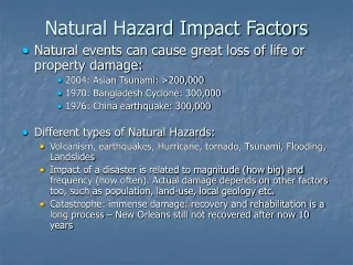
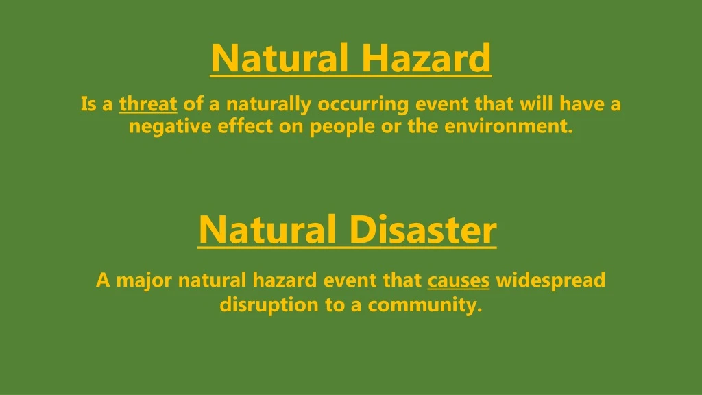
Natural Hazard Is a threat of a naturally occurring event that will have a negative effect on people or the environment. Natural Disaster A major natural hazard event that causes widespread disruption to a community.
Structure of the Earth Crust The outer layer of the earth. It is a thin layer between 0-60 km thick. The crust is the solid rock layer upon which we live. Outer Core The layer surrounding the inner core. It is a liquid layer, made up of iron and nickel. It is still extremely hot, with temperatures similar to the inner core. Mantle The widest section. It has a thickness of approximately 2,900 km. The mantle is made up of semi-molten rock called magma. In the upper parts of the mantle the rock is hard, but lower down the rock is soft and beginning to melt. Inner Core The centre and is the hottest part of the Earth. It is solid, made up of iron and nickel with temperatures of up to 5,500°C. With its immense heat energy, the inner core is like the engine room of the Earth. Oceanic Crust – Carries the seas = younger, denser (heavier), thinner and can be made & destroyed. Continental Crust – Carries the land = older, less dense (lighter), thicker and cannot be made or destroyed.
Tectonic Plates https://www.youtube.com/watch?v=zocutif0cQY
Convection Currents Magma (semi-molten rock) near the outer core is heated. As the magma warms it expands and becomes less dense. The less dense magma then starts to rise towards the crust. As the magma nears the crust it begins to cool. The cooling magma becomes denser and begins to sink. The rising and falling magma creates circular currents with the mantle. It are these currents that create friction with the crust above and causes it to move. https://www.youtube.com/watch?v=rSzjFvMFQhg
1. Constructive Plate Boundaries • A constructive plate boundary, is where plates move apart from each other. As they do this, magma wells up to fill the gap and when it reaches the surface new crust is formed, often in the form of a volcano. • Overtime, ridges can break the surface and form new islands, e.g. Iceland. • The Mid Atlantic Ridge was formed due to constructive plate movement.
2. Destructive Plate Boundaries • A destructive plate boundary occurs when oceanic and continental crusts move towards each other. • The oceanic plate is pushed underneath the continental plate because it is heavier, this forms the subduction zone. • The friction of these plates rubbing against each other causes melting of the oceanic plate and can cause earthquakes. • Magma from deep in the Earth’s mantle rises towards the surface through the cracks and erupts at the surface and a volcano can form. • Nazca and South American plates. The Nazca plate is forced under the South American plate.
3. Collision Plate Boundary • This type of plate boundary involves two continental plates colliding with each other. Neither plate can be forced under the other because they are both lighter continental crust, so both are forced up. This process forms fold mountains. • For example, the Himalayas were formed by a collision plate boundary.
4. Conservative Plate Boundaries • A conservative plate boundary, occurs when plates move alongside each other, in the opposite direction or in the same direction at different speeds. When plates slip past each other creating sudden movement the result is an earthquake. • The San Andreas Fault in California (USA) is an example of a conservative plate boundary.
Volcanoes Volcanoes are often cone shaped, formed by material from the mantle being forced through an opening in the Earth’s crust. Volcanoes are either . . .
Features of a Volcano An eruption occurs when pressure in the magma chamber forces magma up the main vent, towards the crater at the top of the volcano. Some magma will also be forced out of the secondary vent at the side of the volcano.
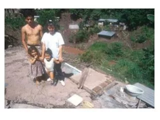
Effects of Volcanoes • LEDC’s are more Vulnerable than MEDC’s • Communication systems may be underdeveloped, so the population may not be well educated about what to do in the event of a volcanic eruption or an earthquake. • Construction standards tend to be poor in LEDCs. Homes and other buildings may suffer serious damage when a disaster occurs. • Buildings collapsing can cause high death tolls. • Evacuation and other emergency plans can be difficult to put into action due to limited funds and resources. • Clearing up can be difficult. There may not be enough money to rebuild homes quickly and safely. Many people could be forced to live in emergency housing or refugee camps.
Good Planning Reduces the Effect of Hazards Diversion channels: On some volcanoes it has been attempted to make diversion channels to direct the lava away from settlements. This is very expensive and hard because you can not predict which direction the lava will flow. Cooling lava: In Iceland in the past they have tried spraying seawater onto lava. The idea was to make the lava go cold and turn into rock before it destroyed nearby settlements. Sweeping roofs:If this is not done the ash will get so heavy that it will eventually cause the building to collapse. Making evacuation routes: It is also important to regularly practice these evacuation routes. Exclusion areas: If an eruption is happening or likley to happen it is important to create exclusion zones. This means evacuating everyone that could be effected by the eruption. Because pyroclastic flows can travel up to 30km, these exclusion zones can be very big. Hazard Mapping: It is very important to map the most dangerous areas near a volcano e.g. areas with the most unstable ground or areas where lava flows are likley to travel. Once you have mapped dangerous areas you can then stop settlements being built on them. Monitoring volcanoes: Because volcanoes do give warning signs (change in shape, temperature, etc.) it is very important to monitor them carefully so that you can nearby residents warnings. Looking at volcanic history (previous eruptions and flows): As part of monitoring the volcano you can look at its history and previous flows. You can then try calculate frequencies and areas likely to be effected.
Earthquakes Earthquakes occur at Converging or Transform Plate Boundaries. As the plates move towards each other, they get stuck. This causes pressure on the surrounding rocks. When this pressure is released it produces strong shockwaves called seismic waves. This is an Earthquake. The size of an Earthquake is measured using the Richter Scale. Vibrations are recorded and measured using a Seismometer. It is a Logarithmic scale, so an Earthquake with a measurement of 5 is 10 times stronger than one of 4. Most serious Earthquakes are between 5 -9 on the Richter Scale.
Features of an Earthquake The Epicentre is the point on the Earth’s surface immediately above the Focus. The Focus = the point where the Earthquake starts, the source of the seismic waves. Near the Focus the waves are stronger and cause more damage. Energy is released in Seismic Waves. Aftershock is a smaller Earthquake that happens after the main Earthquake. An Earthquake is a Primary Hazard. Can cause Secondary Hazards – Tsunamis, Fire, Dam failure, Landslides.
The affect an earthquake has on humans can depend on numerous human and physical factors. These factors include:1. The depth of the earthquake2. The magnitude of the earthquake3. The duration of the earthquake4. The local geology (soft or hard rock, solid or cracked rock)5. The location of the epicentre (in a rural or urban area)6. The population density around the epicentre.7. The building design and hazard mapping near the epicentre.8. The time of day 9. The preparedness of the population (evacuation routes, emergency services, etc.)10. The level of development – LEDC’s suffer more than MEDC’s. Vulnerability
Good Planning Reduces the Effect of Hazard • Earthquakes are harder to predict, but there seem to be some clues – changes in well water levels, gas emissions, cracks appearing in rocks, and strange animal behaviour observed by Chinese Scientists in 1974. • Disaster Plans • Public Information • Local Emergency Services are well prepared. • Earthquake Proof Buildings. • Strengthened Roads and Railways. • Emergency Supplies of Water and Food.
Opportunities? Volcanoes and Earthquakes aren’t all bad . . . Beautiful environment – attracts tourists. Volcanic Lava and Ash break down to form the most fertile soils on Earth = Good for farming. Precious Minerals and Fossil Fuels are found in Volcanic zones. Land is cheap in Volcanic and Earthquake zones and people feel safer with technological advances, such as “Earthquake proof” buildings. Opportunities for cheap, renewable energy sources, such as Geothermal Energy e.g. Iceland. Hot springs nearby. Many Earthquake zones are near the coast, and offer a good climate and easy fishing. Big events are rare, so people think they can risk it.
Tsunamis A tsunami is a huge wave, usually caused by volcanic or earthquake activity under the ocean, which can eventually crash onto the shoreline. The effects on a community can be devastating. = Secondary Effect
Features of a Tsunami • When an earthquake, volcano or landslide happens on the ocean floor, water is displaced. This water forms the start of the tsunami. • When the waves reach shallower water: • their height can increase by several metres • the shallow water slows the wave • the waves get closer together • It is hard to see that a tsunami is approaching. The most obvious sign is the coastal water retreats just before the waves reach the shore.
Effects of a Tsunami = Coastal Flooding Environmental Effects Social Effects Economic Effects
Good Planning Reduces the Effect of Hazards • Knowledge and Education • Warning Systems • Communication • Natural Barriers • Disaster Planning
Causes of Flooding A flood occurs when a river bursts its banks and the water spills onto the floodplain. Flooding tends to be caused by heavy rain: the faster the rainwater reaches the river channel, the more likely it is to flood. The nature of the landscape around a river will influence how quickly rainwater reaches the channel. • A steep-sided channel - a river channel surrounded by steep slopes causes fast surface run-off. • A lack of vegetation or woodland - trees and plants intercept precipitation (ie they catch or drink water). If there is little vegetation in the drainage basin then surface run-off will be high. • A drainage basin, consisting of mainly impermeable rock - this will mean that water cannot percolate through the rock layer, and so will run faster over the surface. • A drainage basin in an urban area - these consist largely of impermeable concrete, which encourages overland flow. Drains and sewers take water quickly and directly to the river channel. Houses with sloping roofs further increase the amount of run-off.
Flooding is a natural process, which only becomes a hazard when it has a direct or indirect effect upon the lives of people. This typically happens in the lower course of a river and is why flood plains are created by the river.
Effects of Flooding Social Effects Economic Effects Environmental Effects Who is more Vulnerable?
Flood Management Strategies need to be Sustainable
Opportunities? • Rivers deposit rich silt on fields = fertile – good for agriculture (Irrigation). • Rivers can be used for Transport/Communication • Leisure Activities = Tourism • Settlement = Flat building land and provide Clay. • Fishing • Hydro Electric Power
Key terms: Regional Migration (Internal) - When people move between regions of the same country, e.g. Rural – Urban Migration, Counter-urbanisation. International Migration (External) – When people move from one country to another, e.g. Economic migrants, Refugees.