Revolutionizing Asset Management with 3D Street Level Imagery in Australian Councils
Explore how the use of dense 3D stereo correspondence imagery technology is transforming asset management in Australian Councils. Learn about the benefits, process, and ROI of implementing this innovative approach.

Revolutionizing Asset Management with 3D Street Level Imagery in Australian Councils
E N D
Presentation Transcript
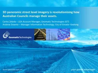
3D panoramic street level imagery is revolutionising how Australian Councils manage their assets. GT’s PowerPoint Template Option 2Presentation Subtitle GT’s PowerPoint Template Option 3Presentation Subtitle – GETTING CHANGED GT’s PowerPoint Template Option 4Presentation Subtitle GT’s PowerPoint Template Option 5Presentation Subtitle – NOT SURE ON THE LINES.. GT’s PowerPoint Template Option 5bPresentation Subtitle GT’s PowerPoint Template Option 1Presentation Subtitle Carlos Zelada – LGA Account Manager, Geomatic Technologies (GT) Andrew Downie – Manager Information Technology, City of Greater Geelong Presenter NamePresenter Email Contact Presenter NamePresenter Email Contact Presenter NamePresenter Email Contact Presenter NamePresenter Email Contact Presenter NamePresenter Email Contact Presenter NamePresenter Email Contact
Our Solutions and Services Government Transportation Water Power Property Insurance
Dense Stereo Correspondence • High quality 36 megapixel three-dimensional (3D) imagery • Dense 3D Point Cloud Data • Corresponding X, Y, Z coordinate for every pixel • Photogrammetric stereoscopic camera system with wide angle lenses • Capture spatial GPS location, measure height and depth of anything in the image
3D street level imagery - earthmine RAPID ASSET CAPTURE Collect 3D imagery Process 3D Imagery Deliver 3D Imagery Via GT Cloud
What was the issue? What were the options? What we did? Current State of Play R.O.I.
The Issue Victorian Road Management Act requires an inspection regime. Gap with the Road Sign Class. Insurance connotations around non feasance. Councils Asset Management strategy calls for all assets to be recorded. Parks Department wanted a maintenance system in particular for street trees.
The Issue Time was a factor Both categories were large 20,000 and 80,000 items with a big $$$$$ commitment. Only $65,000 identified budget
Available Options Traditional capture Other video capture Looking at laser capture options for 3D improvement earthmine solution But the budget
GT AIMS - earthmine Needed to be a quick turnaround Cost-effective High Accuracy and Quality Minimise Risk and Safety Issues
The Project Specification Established what would be captured- 2,000 km road network- included Vic Roads and major parks What signs would be recognised? What is the other value options of the resulting data set. Sell those benefits
Stage 1 - Capture GeomaticTechnologies drove the roads producing 360o image captureof all road environments. The high accuracy GPS provided location up to 50 cm and established a spatial relationship between every pixel. 36 mgp images every 10 metres (identity blurring) Asset management grade accuracy Took 4 Weeks produced lots of data – 2.5Tb
Stage 2 – Processing Post processing by GT. Loaded into GT Cloud and made available. GT engaged NICTA for road sign processing. Resultant database of 25,000 matching signs returned.
Stage 3 – QA & Maintenance Sign database loaded into Council’s in-house 3D model Used the model to do QA in the office. In-house development of a sign maintenance application using ESRI tools The Road Management Inspectors keep the data current.
Stage 4 – In House Capture Tools Tree capture interface by in-house development using ESRI ArcGIS V10 Add-ins. Allow capture of the asset by office based staff. Developed a maintenance application that Council’s Arborists use in the field to maintain tree condition assessments.
Problems & Resolutions NICTA process and recognition. 93% accuracy rate returned in QA Double bladed signs - 5% Caution signs without words - 2% 1st run through process Location issues (aerial images and common sense)
Current state of play Road signs through QA and in production. Both in Assets and GIS . 70,000 street trees captured, 20 to 30k estimated to go. Additional 3D deployment use. Delivered in Weave as a tab for use by all.
` 3D Image here
ROI • Sign capture by physical collection process - $4.00/sign • 25,000 road signs returned = $100,000. • Street tree capture by physical method - $4.50 • Current estimate at least 90,000 = $405,000 • Total project cost $167,000 delivering all road signs ($25,000 included) and the facility to begin tree capture. • Development of in-house interfaces = $15,000 • Outlay total of $182,000 and not $505,000 • Current Return on Investment = $323,000
Conclusion This initiative has allowed for the capture of significant roadside assets in an innovative, efficient and cost effective method. Features include linear and slope measurement tools Undertakings such as accessibility projects and tree clearance planning for plantings.
Questions and more information Thank you – Please visit the Geomatic Technologies booth (No. 24) today and visit the GT website for more information. Carlos Zelada czelada@geomatic.com.au (03) 9694 4244 www.geomatic.com.au www.twitter.com/GeomaticTech


![[Name of Presenter]](https://cdn1.slideserve.com/2943520/slide1-dt.jpg)