Download
1 / 37
380 likes | 514 Vues
This presentation by Lisa Morrison, DATCP GIS Coordinator and SAGIC Chair, provides an overview of Geographic Information Systems (GIS) and their significance in organizing, analyzing, and visualizing geographic data. GIS facilitates communication, enhances coordination among state agencies, and supports decision-making through iterative processes. The session highlights practical applications of GIS in various domains, including emergency response, resource management, and understanding spatial relationships. Ultimately, effective GIS integration can lead to improved public services and better resource management.

E N D
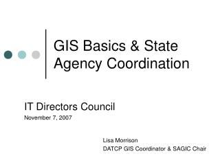
GIS Basics & State Agency Coordination IT Directors Council November 7, 2007 Lisa Morrison DATCP GIS Coordinator & SAGIC Chair
Geography is… • Information about the earth’s surface and things on it (which we all share) • Framework for organizing data • Science behind GIS Geography matters to all of us!
GIS is… • Geographic Information System • Tool to create, visualize, integrate, and analyze data from a geographic perspective • Automated map making to support business functions
GIS is… • Process for creating information that supports the actions and decisions of individuals and organizations • System of hardware, software, data, people, and methods that supports program and resource planning, inventory, management, and evaluation activities
View, interpret and understand data in ways not possible with other tools! Dairy Farms A picture is worth… a thousand rows of data!
GIS is used to… • Facilitate communication • Promote coordination • Solve problems • Measure resources • Make decisions • Understand past and present situations • Anticipate future scenarios
GIS is a way to model our world! events zoning transportation utilities ownership environment REAL WORLD Integrate data “layers” of different “themes” to model YOUR real world.
GIS is an iterative process… • Think about a place or topic… • Ask a question about it… • Make a map… • Explore patterns that appear… • Try different analyses…
Maps that tell a story… • Where is ____? • How many/dense ____? • What’s inside/outside ____? • What’s near ____? • How has ____ changed? • How do ____ relate? • What if ____?
Where is ____? • Find places and things • Determine optimum routes • Calculate driving time • Efficiently plan site visits • Define service areas • See where to take action
Where is ____? All of us have used a map to figure out where “it” is and how to get there. Google
Where is ____? GIS helps us identify the best responder and best route in emergency situations.
Where is ____? Orthophotography helps us visualize where we are in relation to other features.
How many/dense ____? • Map the quantity of features • find places with the “most” or “least” • find places that meet specific criteria • Map concentrations of features by area (density) to see distributions • Prioritize and manage actions based on number, least/most, or density
Earthquake hazard maps are essential for creating and updating building codes. earthquake.usgs.gov How many/dense ____? Patterns emerge when you look at the distribution of features.
How many/dense ____? 2005 Deer Population Density per square mile deer range Wisconsin DNR
What’s inside/outside ____? • What's located or happening inside or outside an area of interest • Prioritize and manage actions based on the location of features within a region, district, zone, territory, etc…
What’s inside/outside ____? Green Bay city ordinance uses buffer zones around places where children are likely to congregate.
2006 Bio-based Industry Opportunity (BIO) Grants by Senate District What’s inside/outside ____? Use GIS to help inform legislators about what’s happening in their districts!
What’s near ____? • What's located or occurring within some distance of a feature • Prioritize and manage actions near or around a feature
What’s near ____? Find the closest ATM location to the restaurant you’re eating in before the bill arrives!
What’s near ____? Potential Critical Facilities in the 100 Year Floodplain Sheboygan County
How has ____ changed? • Evaluate results of an action or policy • How things behave over time • Map conditions before and after an action or event to see the impact • Decide on a course of action based on historical perspective
How has ____ changed? Land cover change 1992 - 2001 Hudson, WI
How do ____ relate? • Overlay and analyze data that can only be combined by location or area • Integrate information • Develop models • See in 3-D • Decide on a course of action based on spatial analyses
How do ____ relate? • This groundwater contamination susceptibility model integrates: • - Bedrock depth • Bedrock type • Soil characteristics • Surface deposits • Water table depth
What if ____? • Integrate data from different sources to develop “what if” scenarios
Red areas of southern Florida are susceptible to a five-meter rise in sea level, based on elevation. Yellow denotes urban areas. What if ____? What if the Greenland Ice Sheet melts?
What if… …state agencies could easily share GIS resources and coordinate GIS activities to support their mutual interests and customers? …state agencies had a common data “view” that each could use to conduct its business?
Have you gotten on-line driving directions? Does your car have GPS? State Agency Coordination • Public expects and deserves efficient and effective state government services • Number of citizens, government agencies, and businesses using geospatial technologies (e.g., web maps, GIS, GPS) is increasing
State Agency Coordination • Benefits • Save time and money (in many ways) • Send unified message about geospatial issues to decision makers • Collaborate on business needs assessments, strategic plans, etc… • Collect “official” data once – use it many times • Share training, services, expertise
State Agency Coordination • Data sharing is critical! • What exists? • Who’s the custodian? • How can it be accessed? • How easy to integrate with other data? • What’s missing? a lot… • Examples: Emergency Response, Homeland Security Infrastructure Program (HSIP)
State Agency Coordination • State Agency Geographic Information Coordination (SAGIC) team • formerly known as WEGIS • collaboration, communication, quality, and sharing of best practices among state agency users and developers of geospatial data and technologies • Website: http://gis.wi.gov (SAGIC link)
State Agency Coordination • Many state agencies have similar technical GIS needs and issues • Infrastructure • Products • Desktop and Web Applications • Data and Data Sharing • Location-based Tools • Technical Support
State Agency Coordination • Many state agencies have similar administrative GIS needs and issues • License Management • Contract Management • Training and Customer Assistance • Policies, Standards, Best Practices • Communication • Planning and Project Management
State Agency Coordination • Example: ESRI Enterprise License Agreement (ELA) • Requested by the GIO and SAGIC • Issue Paper • Steps identified to finalize by July 1, 2008
Questions? Thanks!