Download
1 / 12
120 likes | 144 Vues
The Working Group on Calibration and Validation (WGCV) aims to create a standardized reference for level 1 TOA radiances/reflectances to ensure consistency across sensors. Users include satellite operators and L1 data product users. Key elements include understanding user needs, creating references, linking sensor measurements, and communication of information. The project involves creating a pilot project, agreeing on terminology, conversing with users, collecting sensor comparison data, and developing evaluation methods. The goal is to achieve SI traceability for sensor calibration.

E N D
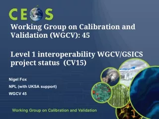
Working Group on Calibration and Validation (WGCV): 45Level 1 interoperability WGCV/GSICS project status (CV15) Nigel Fox NPL (with UKSA support) WGCV 45
L1 interoperability Scope and User (WGCV 42) VISION; To work towards establishing a community agreed reference (s) (potentially, to reflect different applications/observation characteristics) for level 1 TOA radiances/reflectances and the means of how sensors can and should link to it and subsequently communicate results • Objective is to provide a ‘reference’ which allows satellite operators and potentially their customers to readily obtain information relating to the radiometric calibration (initially Level 1) of a sensor and its relationship with others in a consistent manner but interpretation (and any other actions) is responsibility of individual agencies who have appropriate expertise • Users • satellite operators (public agencies and commercial) – informing them on calibration status • Users of L1 data products (e.g. L2 data producers, producers of data cubes, climate data records ..) to help obtain consistency across sensors and between bands – over time and for sensor independent products
What are the elements of a system to deliver? • Understanding user needs and the characteristics of sensors that would use the ‘service’ - who wants it?, why? and what must it be able to do? - data cubes, ARD, FCDR creation, data gaps, constellations • A means to formulate a reference (s) and assign its associated uncertainty – Internationally acceptable standard (proxy for SI) - Test-site, Reference sensor, virtual sensor, combo…. • The means to link sensor measurements to the reference and its associated uncertainty (‘Comparison’) – The process Tools to achieve (SBAFs, Ref. Solar Irradiance, Mathematics…), • Communication of information (data, results and methods) – Useability and awareness • Governance, review mechanisms, quality control, maintenance… .- Community acceptance
Next steps @ wgcv 42): Create (IVOS/GSICS) project as a pilot • Agree terminology / vocabulary • wider initiative WGCV/GSICS/GEO …In progress • Have conversations with users to understand requirements/desires and scope • Probably best done at WGCV level …In progress! • Collect information on existing and future sensor comparisons in common format in a ‘restricted’ section of Cal/Val portal • Working data-set to identify variances between methods & within methods • i.e. summary results (with ref to method etc) from SADE/Muscle, RadCalNet, Bi-laterals, publications etc • In parts? • Continue to develop and evaluate (as community projects) differences between ‘methods’ for similar activities e.g. Lunar, RadCalNet (BoA & ToA), PICS … - Ultimately leads to confidence in Uc and potential for SI traceability • Consider how best to combine/weight results/information from different methods and assign an Uc (ies) to sensors for particular types of observation Some individual agencies do to some extent • Hold 0.5/1 day open workshop
Spectral response function Solar Irradiance Atmospheric transfer - standardise? - comparison (ASIX) - New ‘community code’ ‘Eradiate’ ’ TOA reflectance/ radiance Angles of illuminationand observation Spectral BRDF of ground - high resolution spectral reflectance TOA spectrometer / measurements? - Community model? Parametrisation inputs PICSCAR PICSCAR
Achieving SI Traceable Cal infrastructure /methods PICS Dome C Combine information weighted by Uc for particular sensor and application noting individual sensor characteristics TRUTHS/CLARREO China Ocean Colour SI RadCalNet SI Natural Phenomena
Summary for CEOS action CV 15 • Workshop held to define requirements of a system (optical) • Elements of system initiated (or continued) as sub-projects (PICSCAR, RadCalNet, Moon …..all with methods and Uc) • Comparisons and databases of results (at sub-task level) • Solar irradiance spectrum • Spectral corrections… • RT code • ACIX comparisons • Collect data on best and typical capabilities • Template to be put on portal • Workshop planned on realisation of SI in-flight reference (2019) • Report will provide good baseline • Starting to think about how to combine results of elements (e.g. RadCalNet & PICS)