Download
1 / 16
160 likes | 285 Vues
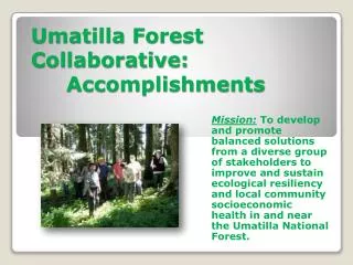
The Wallowa-Whitman Forest Collaborative brings together diverse stakeholders to enhance the social, economic, and ecological resilience of the Wallowa-Whitman National Forest and local communities. Initiated in June 2012, the collaborative formed to explore values at a larger forest level. With over 2.39 million acres spanning three states, the group aims to build strong relationships among participants while focusing on restoration projects such as the Lower Joseph Creek watershed. Future goals include expanding membership, completing NEPA assessments, and improving wildlife habitats.

E N D
Wallowa Whitman Forest Collaborative Nils D. Christoffersen Wallowa Resources
2,392,508 acres 3 states 10 counties bordered by the Umatilla and Malheur NFs Elevation varies from 9,985 to 875 feet Four ranger districts, one national recreation area, and four wilderness areas
Origins • Various collaborative efforts at county levels, including 17 year effort in Wallowa County • Three NE Oregon Counties extended the initial invitation to explore value in larger forest level collaborative. • First meeting 7 June 2012. 48 participants from 29 different stakeholders. Agreed on value to form and proceed.
Collaborative Purpose To improve the social, economic, and ecological resiliency of the Wallowa-Whitman National Forest and local communities through collaboration by a diverse group of stakeholders.
Structure • WR Project Manager – Fiscal Agent • NFF and DFZ funds • SNW Facilitator • 10 Member Operating Committee • State and County • Forest products • Environmental groups • OSU Extension • Local community and private landowners
Collaborative has met 9 times including its formative meeting Average of 37.4 participants per meeting (337 participant days) Also held one field trip in fall 2012 – Lower Joseph Creek Second field trip scheduled this week – East Face Project
Accomplishments • Building collaborative relationship amongst stakeholders. • Operations Manual Approved – 22 Signatories to date • General findings and recommendations for restoration of the Lower Joseph Creek Watershed Approved. • 5th HUC Integrated Resource Assessment • Recommendations across resource areas • Initiated stand level confirmation of implementation opportunities • Completed 3,000 acres – confirmed 2,515 acres • Initiating work on new project in Whitman District (Baker County) – potential pilot partnership with ODF, ODFW and Comprehensive Wildfire Strategy • Secured funds for Year 2 staffing.
Year 2 Targets • Expand and maintain diverse collaborative membership • Complete NEPA for Lower Joseph Creek Projects • Advance work on East Face Project • Explore opportunities for Landscape Learning • Model effects of different management scenarios on wildlife and fish habitat, fire regime condition classes, stand treatments in identified biophysical groups – moisture/temperature regimes, and riparian areas. • Explore opportunities for coordination and efficiency in staffing / facilitation with other Blue Mountain Collaboratives.
Average Annual Fire Suppression Cost 1986-2007: $6.7 million per year
Haypen 3 stewardship contract Biomass – (1.0”-4.9”) 23% of cut trees per acre. Pulp fiber – (5.0”-6.9”) 33% of cut trees per acre.
Lower Joe Integration • Forests and Fuels • Range • Wildlife • Riparian and Fisheries • Roads and Recreation • Cultural • Social and Economic