
Working with Cartographic Representations
E N D
Presentation Transcript
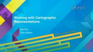
July 24, 2012 Working with Cartographic Representations Jamie Conley and David Watkins
Overview • What are representations? • Working with representation rules • Geometric effects and marker placement styles • Overrides
What are representations? • A way to symbolize features to solve common cartographic challenges • A storage model that stores symbols with data • Part of a feature class, managed through a layer
What are representations? Create custom symbols Add drawingbehavior Mask features Control markerplacement Move symbologyindependently of geometry
What licensing is required for representations? • Representations recognized by all ArcGIS products • Basic (ArcView) license: • View representations and properties • Standard (ArcEditor) license: • Create and edit representations • Some geoprocessing for representations • Advanced (ArcInfo) license: • View, create, edit representations • All geoprocessing tools
How are representations stored? • Attributes in the geodatabase • Properties of a feature class • Managed through a layer A
Multiple Representations • Feature classes can store more than one representation • Symbolize city differently for tourists and city employees • Give different users different views The same data represented two ways—both versions are stored in the data
What are representations rules? • Symbol layers • Geometric effects, marker placement styles
Building Representation Rules • Rule describes a unique symbol • Consist of symbol layers • Marker • Line • Fill • Geometric effects Dark blue line symbol layer Kayak marker symbol layer Smoothgeometric effect Place marker in center Blue fill symbol layer
Geometric Effects • Dynamically modify symbology • Affect all symbol layers, or just one • Can convert geometry type • Applied sequentially End with half dash Rotate to polygon angle Offset for drop shadows Add control points for corners A
Marker Placement Styles • Position representation markers • Along lines and polygon outlines • Within polygons • In relation to points On point with offset for drop shadows Along lines Randomly inside polygon Whole markers cross boundary A
Building Representation Markers • Marker Editor • Add and edit font glyphs* • Draw polygons and lines • Add and remove vertices • Align, order, group, rotate • Resize, erase, warp, explode parts, etc. *Glyph: any character element in a font
Representation override • Exceptions to the rule • Customize individual features • Made while editing • Property overrides • Change any property of the rule • Geometry overrides • Store alternate geometry
Property override Create an exception to the rule
Geometry override Reshape without changing feature geometry After:Representationmoved Before:Symbolsoverlap
Creating Overrides • Interactively with the representation toolbar • Explicitly change rule property • Use field in the attribute table to define override • Cartographic Refinement geoprocessing toolset
Representation Toolbar • Interactively create overrides • Graphic editing tools • Geometry overrides • Modify rule properties • Property overrides Drawing Properties Tool Properties A
Field Mapping Override • Link symbol layer properties to feature attributes • Size, width, angle, visibility, etc. • Draw symbols based on current data • Any rule property can useattribute values • Must use valid field data type • Reduce duplication of rules
Cartographic Refinement Geoprocessing Tools Align Marker To Stroke Or Fill tool Calculate Polygon Main Angle tool Create Overpass/Underpass tools
Free Representations • Unique representation for a feature • Complete control over feature display • Copy of the entire rule in theOverride field • Structure of the rule can change • Can undo by reassigning a rule • Use sparingly • Try more complex rules and overrides first Freerepresentation Representation rule A
Visual Specifications Tool Production Mapping extension • Manage representations across many layers • Link feature attribution to representation rule • Single production workflow for symbology and text • Apply symbology using relational queries
What’s New in 10.1 • Searchable representation markers and rules • Marker placement clockwise rotation • New geometric effects Extension Offset Tangent Suppress A
Steps to evaluate UC sessions • My UC Homepage > “Evaluate Sessions” • Choose session from planner OR • Search for session www.esri.com/ucsurveysessions
Thank you for attending • Have fun at UC2012 • Open for Questions • Please fill out the evaluation: • www.esri.com/ucsessionsurveys • First Offering ID: 639 • Second Offering ID: 943