Download
1 / 39
390 likes | 609 Vues
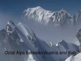
Ecological soil map of the Alps A cross-border pilot area between Italy and Slovenia. Sara Zanolla Stefano Barbieri Giuseppe Michelutti Borut Vrščaj. Why a cross-border pilot area?. To provide a first information on the main characteristics of alpine soils and their priority threats:

E N D
Ecological soil mapof the AlpsA cross-borderpilot area between Italy and Slovenia Sara Zanolla Stefano Barbieri Giuseppe Michelutti Borut Vrščaj
Why a cross-border pilot area? To provide a first information on the main characteristics of alpine soils and their priority threats: • organic carbon content • erosion risk with a grid based approach to minimise the “border effects”
The pilot area SLO I
The pilot area SLO FVG
The pilot area FVG SLO
The pilot area DIMENSIONS 400 km2 SHAPE Rectangular in LAEA, matching the INSPIRE grid 1X1 km ENVIRONMENT Julian Pre-Alpine ALTITUDE (min-max) 30-900 m AVERAGE SLOPE 15-60%
The pilot area FVG SLO
The pilot area FVG SLO
The pilot area FVG SLO
The pilot area FVG SLO
Cross-border 1:1M soil database WRB_full
Cross-border 1:1M soil database Mat_par_dom
Steps towards a common soil map • Definition of the pilot area in LAEA; • Exchange of the national projection files (*.prj); • Conversion of the data in the national projection systems; • Choice of a minimum set of ancillary data layers(DTMs, land use maps, annual rainfall,…) and common legends; • Joint field work; • Excavation and description of soil profiles; • Discussion and decisions on soil-landscape relationship; • Elaboration of vector databases with available soil information and ancillary datasets; • Elaboration of attribute tables To be continued...
Steps towards a common soil map • Exchange and revision of the preliminary vector data and tables; • Border edge-matching; • Common review of the attribute tables; • Rasterization at different resolutions INSPIRE; • Elaboration of the databases; • Elaboration of the final maps and report.
Steps towards a common soil map • Definition of the pilot area in LAEA; • Exchange of the national projection files (*.prj); • Conversion of the data in the national projection systems; • Choice of a minimum set of ancillary data layers (DTMs, land use maps, annual rainfall,…) and common legends; • Joint field work; • Excavation and description of soil profiles; • Discussion and decisions on soil-landscape relationship; • Elaboration of vector databases with available soil information and ancillary datasets; • Elaboration of attribute tables To be continued...
Steps towards a common soil map • Exchange and revision of the preliminary vector data and tables; • Border edge-matching; • Common review of the attribute tables; • Rasterization at different resolutions INSPIRE; • Elaboration of the databases; • Elaboration of the final maps and report. • ECALP field excursion (Spring 2005)
Steps towards a common soil map Some attributes need harmonisation: • aglim 1 • il • roo • … others need comparison: • agri_use • wm1 • ... others have to be integrated: • sur_urb • px_obs • ...
Steps towards a common soil map Soils in our pilot area, often have a lithic (or paralithic) contact within observation depth; but, usually, water can infiltrate and roots can explore soil in the cracks. Some lithic contacts can also be a root deepening limitation or/and impermeable layer, some others don’t. We suggest not to use lithic contact as synonym of root limitation or impermeable layer.
Steps towards a common soil map Some attributes need harmonisation: • aglim 1 • il • roo • … others need comparison: • agri_use • wm1 • ... others have to be integrated: • sur_urb • px_obs • ...
Steps towards a common soil map In our soil maps we don’t have polygons for urban areas and soil sealing is represented superimposing the topography. In urban areas the equation: SUR-BARE + SUR-URB + W-BODY + STU-TOT = 100 becomes: 0 + 100 + 0 + 0 = 100 How do we fill the pixels where SUR-URB is more than 50%?
Steps towards a common soil map Other attributes are affected by the same problem, such as WM1 and WM2. The information provided could be generally true for the dominant STU, but doesn’t fit in the pilot area. Then, the water management system lists mainly voices for plain agricultural soils. In mountainous or hilly areas, different methods would be used. Would it be possible to add new water management systems (in the format or in a further version of the manual)?
Steps towards a common soil map Some attributes need harmonisation: • aglim 1 • il • roo • … others need comparison: • agri_use • wm1 • ... others have to be integrated: • sur_urb • px_obs • ...
Steps towards a common soil map We filled the field for the pixels marked I and I/SLO according to Corine Land cover 1995, with the classes: 1.1.1 Continuous urban fabric 1.1.2 Discontinuous urban fabric 1.2.1 Industrial or commercial units 1.2.2 Road and rail networks 1.2.3 Port areas 1.2.4 Airports 1.3.2 Dump sites 1.3.3 Construction sites 1.4.1 Green urban areas 1.4.2 Sport and leisure facilities
Steps towards a common soil map • The total area has been assigned to the pixel. It has been discovered that, since the field allows 2 characters only, it’s not possible to indicate a 100% coverage by urban area. We used 99% instead. • The same procedure has been used for sur_bar and w_body
WRB-ADJ1 1st soil adjective dy eu WRB-ADJ2 2nd soil adjective sk WRB-LEV1 SoilRefer. Group CM CM WRB-FULL Full soil code CMskdy CMeu WRB codes Exchange format current version:
WRB-ADJ2 2nd soil adjective dy WRB-ADJ1 1st soil adjective sk eu WRB-LEV1 SoilRefer. Group CM CM WRB-FULL Full soil code CMskdy CMeu WRB codes Our proposal: