Download
1 / 19
190 likes | 202 Vues
Learn about the long-term daily observation of the Earth using imaging sensors on polar orbiting satellites. Discover how these observations can help detect and measure environmental changes on regional to global scales. Explore the advancements in spectral resolution, spatial resolution, geolocation accuracy, and radiometric calibration from AVHRR to MODIS to VIIRS. Find out how NASA and NOAA have built a valuable record of daily global observations and the potential for future observations with VIIRS.

E N D
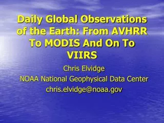
Daily Global Observations of the Earth: From AVHRR To MODIS And On To VIIRS Chris Elvidge NOAA National Geophysical Data Center chris.elvidge@noaa.gov
Why: • The earth systems are in constant motion. • Long term daily observation of the entire earth which can be used to establish baselines, from which it is possible detect and measure regional to global scale environmental changes.
How: • Imaging sensors on polar orbiting satellites provide consistent sun-synchronous observation of the earth at a spatial and spectral resolution suitable for observing: • Clouds and aerosols. • Snow and ice. • Ocean color and temperature. • Land surface, vegetation and fire.
Disadvantages of Geostationary Satellite Data: • Orbits at 35,000 km make it difficult to acquire sub-kilometer resolution imagery. • Global constellation with spectral bands suitable for air, land, sea and ice observations has not been achieved. • No polar coverage.
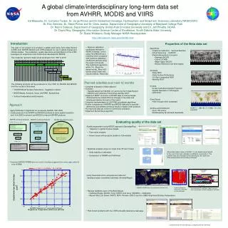
A Long Term Record Of Daily Global Observations of the Earth: • AVHRR – Advanced Very High Resolution Radiometer flown on NOAA’s Polar Orbiting Environmental Satellites from 1978 to the present. • MODIS – MODerate resolution imaging spectrometer flown on NASA Earth Observing System (Terra and Aqua satellites since December 1999. • VIIRS – Visible Infrared Imaging Radiometer Suite – to be flown on the NOAA-NASA-DOD National Polar Orbiting Environmental Satellite System (NPOESS) with first launch expected in 2008-09.
Science Driven Improvements From AVHRR - Spectral Resolution AVHRR Five Bands Vis, NIR, MIR, and two TIR MODIS 36 Bands VIIRS 20 Bands “The best of the MODIS Bands.”
Science Driven Improvements From AVHRR – Spatial Resolution AVHRR Four km GAC One km LAC & HRPT MODIS Internested Bands at 250 m 500 m And 1 km VIIRS 15 bands at 800 m Five bands At 400 m
Science Driven Improvements From AVHRR – Geolocation Accuracy AVHRR Variable. GCP’s Frequently Utilized. MODIS Sub- Kilometer. VIIRS Sub- Kilometer.
Science Driven Improvements From AVHRR – Radiometric Calibration AVHRR Inadequate On-board calibration. MODIS Very good On-board Calibration. VIIRS Very good On-board calibration.
Raw Data Volume. AVHRR 4 GB / day. MODIS 70 GB /day. VIIRS 150 GB / day.
Who Started Archiving AVHRR Data? • NASA. NOAA started its archiving effort year’s later.
Who Pioneered the Non-Meteorological Applications For AVHRR Data? • NASA. NOAA focused on the weather community, who needed global observations in near real time.
Summary • NASA and NOAA have built a long record of daily global observations of the earth. • The NASA-MODIS instrument provides data that are substantially better than the NOAA-AVHRR. • The VIIRS instruments will continue MODIS style observations into the next decade and beyond. • Establishing and operating new archives for MODIS and VIIRS for global environmental change research would require a very large effort in data transfer, data storage, and data processing.