Download
1 / 21
210 likes | 382 Vues
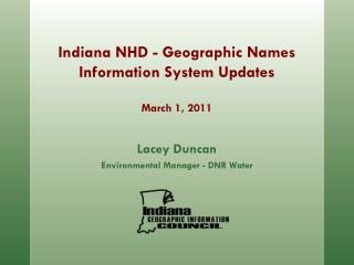
Lacey Duncan Environmental Manager - DNR Water. Indiana NHD - Geographic Names Information System Updates March 1, 2011. Introduction. History of Geographic Names Information System (GNIS) in the United States GNIS updates to the Indiana National Hydrography Dataset.

E N D
Lacey Duncan Environmental Manager - DNR Water Indiana NHD - Geographic Names Information System UpdatesMarch 1, 2011
Introduction • History of Geographic Names Information System (GNIS) in the United States • GNIS updates to the Indiana National Hydrography Dataset
Need for the Standardization of Geographic Names Late 19th Century • Surge in the demand of mapping and scientific reporting because of mining, exploration, and settlement of the West • Inconsistencies and contradiction among names and spellings • Became a serious detriment to mapmakers and scientists who required uniform and non-conflicting geographic nomenclature
Standardization of Geographic Names • Widely available nationally • Strongly related to local usage • Contributes to savings and efficiency in: • Government • Business & Industry • Communications • Education
US Board on Geographic Names • 1890 - Harrison Recognition that conflicts in naming geographic feature were a serious detriment to the orderly process of exploring and settling the country • 1906 - Roosevelt Extended the Boards responsibility to include the standardization of all geographic names for Federal use • 1947- Truman Signed into Public Law 80-242
US Board on Geographic Name • Function under Department of Interior • National network of State and academic authorities • Conjointly establish and maintain uniform geographic names for Federal Government • Work to improve body of names by approving new names and changing existing in a responsible manner
Proposing a Name for Unnamed Domestic Features • US Board does not initiate naming of unnamed features • Any person or organization, public or private may submit a proposal • Board coordinates with local, State, and Federal agencies to determine • Appropriateness • Acceptability • Need (relative to feature, location, • and community)
Guidelines for Proposing New Names • Recommended Kinds of Proposed Names • Duplication of Names • Recommended Name Form • Qualifying Words in Names • Generic Terms • Personal Names • Wilderness Areas • Lands Administered by State and Local Jurisdictions • Derogatory Names
Submitting a Name Proposal • Propose or Change Name • Feature Information • Supporting Materials • States and Counties • Geographic Coordinates • Administrative Areas • Maps and Documents with name • Other Names and Their Source • Authorities • Submitters and/or Preparers
Indiana GNIS Updates • GNIS Corrections for High-resolution NHD • $25,000 Grant from US Geological Survey • Critical step prior to upgrading NHD to local resolution • Correct names in GNIS • Match GNIS names to NHD Features • Add missing names, fix bad names
Obtaining the Data • Check Out NHD database from USGS • Complete review • Submit to David Nail • Submit to USGS • Accepted by USGS • Loaded into NHD Database
Data Needed • NHDFlowlines • NHDWaterbody • GNIS Data • Point • Polyline • HUC 8 Basin • USGS • Quadrangle Maps • Imagery
Indiana GNIS Data • 33,000 Point Features • 355 Line Features • To begin GNIS review: • Data should be • clipped to Basin
Prepping Data • Create New Field “IGIC_Checked” • Select All Features- “Not Checked” • Join features with GNIS- matched features “Checked” • Select all features outside State border- “Skipped – Outside State”
Error • GNIS • Exists in Database
Changes to NHD • Fixed- Incorrect GNIS • Missing GNIS- No GNIS but exists on QUAD • Skipped- Outside of State
Status Table Updated • Any changes are noted in the NHDStatus table • The COMID is entered into the Status table • Submitted to David Nail before final submission to USGS
Sources • Orth, Donald J. and Roger L. Payne. Domestic Names - Principles, Policies, and Procedures. Online Edition (revised) 2003. 23 June 2010. Web. • Monmonier, Mark. Drawing the Line: Tales of Maps and Cartocontroversy. New York: 1995. Print. • US Department of the Interior. Geographic Names Information System – GNIS. USGS. 03 January 2011. Web.