Download
1 / 26
260 likes | 430 Vues
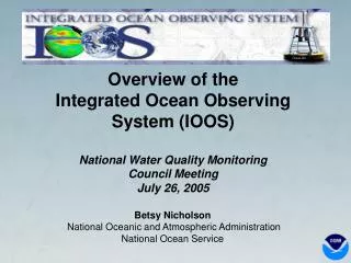
Ocean.US. Betsy Nicholson National Oceanic and Atmospheric Administration National Ocean Service. Overview of the Integrated Ocean Observing System (IOOS) National Water Quality Monitoring Council Meeting July 26, 2005. Vision of the IOOS.

E N D
Ocean.US Betsy Nicholson National Oceanic and Atmospheric AdministrationNational Ocean Service Overview of the Integrated Ocean Observing System (IOOS) National Water Quality Monitoring Council MeetingJuly 26, 2005
Vision of the IOOS The Integrated Ocean Observing System (IOOS) is envisioned as a coordinated national and international network of observations, data management and analyses that systematically acquires and disseminates data and information on past, present and future states of the oceans and the nation’s Exclusive Economic Zone.
Societal Goals for Sustained IOOS • Predict climate change and effects • Mitigate natural hazards • Improve coastal waters operations • Reduce public health risks • Protect and restore ecosystems • Improve EBM of natural resources
An Ocean Blueprint for the 21st Century • 31 Issue-based Chapters • 212 recommendations • 13 IOOS recommendations The United States simply cannot provide the economic, environmental, and security benefits listed above, achieve new levels of understanding and predictive capability, or generate the information needed by a wide range of users, without implementing the IOOS. http://www.oceancommission.gov
U.S. Ocean Action PlanInteragency IOOS Involvement "The U.S. Integrated Ocean Observing System (IOOS) is a major U.S. contribution to the international Global Ocean Observing System, which is a substantial component of the intergovernmental Global Earth Observation System of Systems (GEOSS). The First Annual Integrated Ocean Observing Development Plan is under preparation.” - from the President's U.S. Ocean Action Plan, December 2004
IOOS Legislation Ocean & Coastal Observation Act: • S. 361– Passed Senate with an amendment (7/1/05) • H.R. 1584 –Mirrors language of S. 361, referred to Resources and Science. Coastal Ocean Observation System Integration & Implementation Act: • H.R. 1489 – Still in Resources and Science Committees – Hearing held April 19, 2005, views letter under review at OMB. • Legislation Must Address the Need for Cooperation and Coordination – Evolution of NOPP • Legislation must recognize that the viability of IOOS relies on connectivity
Global Component Sea Surface Temperature, Sea Surface Height, Surface Vector Wind, Ocean Color, and Sea Ice from Space Tide Gauge Network 3˚x3˚ Argo Profiling Float Array 5˚x5˚ Surface Drifting Buoy Array Moored Buoy Existing Planned Ocean Reference Station Existing Planned High Resolution XBT and Flux Line Existing Planned Frequently Repeated XBT Line Existing Planned Carbon Inventory & Deep Ocean Line Global Survey @ 10 years
Coastal Component National Backbone • Operated by Federal • Agencies • EEZ & Great Lakes • Core variables • required by regions • Networks • sentinel stations • reference stations • Standards/Protocols • QA/QC, DMAC • Products Regional COOSs • Regional Associations • Design • Operate • Regional focus, priorities • Involve private sectors, • NGOs, State Agencies • Design, Operate • Use • Evaluate • Incorporate • Subregional systems • Elements thereof • Enhance the Backbone • based on User Needs
Regional Associations (RAs) • Primary interface with user groups outside federal agencies. • Focal point for prioritization and product development that will have local and regional applications.
Benefits of IOOS:Increased Cargo Throughput With better information about water levels, currents, and obstructions, the newer, deeper-draft ships can enter U.S. harbors and carry more cargo for export Water level sensor Source: NOAA’s Navigation Managers
Improved Accuracy of Warnings Saves Lives and Property
Start Position Ending Distribution Chesapeake Bay Oyster Larvae Tracker (CBOLT) • National Ocean Service working with NOAA Chesapeake Bay Office and other local partners • Requirements process: siting questions regarding exotic oysters • Enhanced observations (NOAA and academic) • Data drives 3-D hydrodynamic model • User inputs parameters • Tool delivers map of larval distribution • User makes decision (MD, VA, and DE fish and coastal management agencies, NERRs)
Orbimage - SeaWiFS Woods Hole Oceanographic Institution Harmful Algal BloomsIntegration • Requires knowledge of oceanographic processes and species ecology • Successful predictions require integrating (Stumpf et al. 2003): • Ocean color derived from chlorophyll from SeaWiFs (NASA) • C-MAN buoy winds (NOAA) • Field measurements (State & Local) • Satellite predicted winds (NOAA & NASA) • Meteorological information (NOAA) • Involves Federal, state, and local coordination
Take Home Messages IOOS … • Saves lives, saves livelihoods, and improves quality of life • Requires collaboration from multiple agencies and organizations—nationally and internationally • Increases interoperability among observational data and limits need for duplicative data collection
Your Challenges • How to make IOOS work for you – how can this system of systems assist the needs of the National Water Quality Monitoring Council? • Take advantage of political momentum • Identify gaps in nearshore monitoring and get behind these needs as a community • Plug into emerging structure - Regional Associations – get a seat at the table and articulate water quality resource management issues that can be met by existing or new observations systems in your region.
Challenges of IOOS Requirements • Diversity of requirements and goals to address • Importance of data management • Gaps in the observations data coverage – need requirements to determine what we have, what we need, and where to invest? Integration • Integrating diverse, single purpose capabilities and capacities • Coordinating existing federal efforts with regional and sub-regional observing systems • Coordination and execution across federal agencies and regions External • Linking to GEOSS/GOOS and Ocean Action Plan • Consistent message and approach to customers • Identifying the “right players” and gaining their support – including the private sector
April 18, 2005 Consistent with the Ocean Action Plan, interagency coordination is essential for all ocean science and technology priorities and policy and in particular for planning and implementation for an Integrated Ocean Observing System (IOOS). As such an interagency body should provide high level oversight for the IOOS and an interagency program office should develop plans and requirements for that interagency body’s ultimate approval. Administration and Department of Commerce views on S. 361
April 18, 2005 Administration and Department of Commerce views on S. 361 The administration, through the Joint Subcommittee on Ocean Science and Technology … is currently working to address this issue. However, for the purposes of implementation and operation of IOOS, the Department and the Administration recognize the importance of having a clear point of accountability. As such, the Department and the Administration believe that the National Oceanic and Atmospheric Administration should be the lead federal agency for the administration and implementation of IOOS.
EPA Impact evaluation Woods Hole Oceanographic Institution IOOS Coordination Example: Harmful Algal Bloom Impacts & Costs • Beach Closures • Fish kills • Public Health Threats • Costs to coastal communities* • Public Health--$22 M • Commercial Fisheries--$18 M • Recreation & Tourism--$7 M • Monitoring/Management--$2 M *Source: National Assessment of Harmful Algal Blooms in U.S. Waters (2000)
Ocean Action Plan Approved Governance Structure
U.S. IOOS - Two Interdependent Components Global Ocean Climate Component GOOS/GCOS Coastal Ocean Component GoA National Backbone NE GLs NW Regional Observing Systems MAB Cen Cal Pac Isl Go Mex SE So Cal Carr Lower Resolution Higher
Courtesy NCCOS Harmful Algal Bloom BulletinsEastern Gulf of MexicoNOAA provides state officials with tools for warning decisions • Made operational in NOAA/NOS, October 2004 • Federal/state/commercial collaboration • Future Expansion: • Western Gulf of Mexico (late 2005) • Pacific Northwest • Better predictions mean: • More precise beach closures • Reduced public health risks through more accurate warnings
EPA Impact evaluation Woods Hole Oceanographic Institution IOOS Coordination Example: Harmful Algal Bloom Impacts & Costs • Beach Closures • Fish kills • Public Health Threats • Costs to coastal communities* • Public Health--$22 M • Commercial Fisheries--$18 M • Recreation & Tourism--$7 M • Monitoring/Management--$2 M *Source: National Assessment of Harmful Algal Blooms in U.S. Waters (2000)