Download
1 / 26
260 likes | 426 Vues
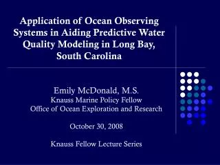
Application of Ocean Observing Systems in Aiding Predictive Water Quality Modeling in Long Bay, South Carolina. Emily McDonald, M.S. Knauss Marine Policy Fellow Office of Ocean Exploration and Research October 30, 2008 Knauss Fellow Lecture Series. Introduction & Background Information

E N D
Application of Ocean Observing Systems in Aiding Predictive Water Quality Modeling in Long Bay, South Carolina Emily McDonald, M.S. Knauss Marine Policy Fellow Office of Ocean Exploration and Research October 30, 2008 Knauss Fellow Lecture Series
Introduction & Background Information • Study Objectives & Hypothesis • Model Development • Modeling Results • NOAA’s Office of Ocean Exploration & Research
Introduction • National focus on ocean observing systems • Implementation & upkeep • New technology / concept • Providing vast array of data • Modeling Applications • Public Health Application • Beach Water Quality • South Carolina Beach Monitoring
Acronyms • IOOS – Integrated Ocean Observing System • SCDHEC – South Carolina Department of Health & Environmental Control • MPN – Most probable number (used for bacterial counts) • Caro-COOPS – Carolina’s Coastal Ocean Observing and Prediction System • SCDNR – South Carolina Department of Natural Resources • NERR – NI-WB – National Estuarine Research Reserve at North Inlet – Winyah Bay
Issues • IOOS Applicability • Questions of usefulness of observing systems and data they provide • Majority of observing system models are physical oceanographic models • Water Quality at Swimming Beaches • Closing beaches for health risks • Most accurate current predictive models require on-site visits
Study Objectives & Hypothesis • Longitudinal integration of regional IOOS efforts • Consistent with IOOS goals • Practical application of IOOS data • Models developed with IOOS data will improve upon predictive capability of current SCDHEC models • Data availability through IOOS • Minimize misclassification rates • Science & management connection
Study Location Area known as “Long Bay” extending from the Cape Fear River, NC to Winyah Bay, SC, includes highly-populated tourist destination of Myrtle Beach, SC
Beach Monitoring & Advisories in South Carolina • Weekly Sampling - May 15 – Oct. 15 • Contamination Advisory Issuance • Two successive samples with in 24 hours >= 104 MPN / 100ml • Single Sample > 500 MPN /100ml • Preemptive Advisories • Currently based on rainfall & CART model decision tool Myrtle Beach
Balancing Public Health & Economics • Large tourism industry in area • 13.8 Million annual visitors • 60-70% jobs tourism-based • Increasing population & development • Linked to bacterial abundance (Mallin, 2000)
Predictive Modeling of SC Beaches • CART model decision support tool – Johnson, 2007 • Determine MPN / 100ml at Beaches • Rainfall variables; preceding dry days; weather; tidal range; moon phase & station • Three Levels of Models • Level 1 Model – Currently implemented • Level 2 & 3 models not currently in use • Data Collection constraints • Level 3 most accurate – additional variables including salinity; wind speed & direction; current speed & direction Enterococcus faecalis
CART Modeling • Classification And Regression Tree • Clear visual picture • No transformation of data • Multivariate approach • Numerical & Categorical • Variables split at ‘nodes’ • Recursive Partitioning algorithm • Pruning • Decrease complexity &/or redundancy
Methodology • Study Location Variable Selection • Data Assimilation from regional IOOS platforms • May 15 – October 15, 2006 & 2007 • Application of Modeling Techniques • SCDHEC Predictive Model • CART Model Construction
Data Assimilation • Easily accessible ocean observing system platforms • Caro-COOPS • Sunset Array • EPA – STORET • SCDNR Apache Pier • NERR – NI-WB Met station • SCDHEC • Manipulation to fit model parameters
Application of Modeling Techniques • Model Groups • Replicate of current SCDHEC model with data for 2006-2007 • Data from regional IOOS • Combination using regional IOOS data and DHEC inputs • R – Statistical programming • CART Model Construction
Analysis & Modeling Results • Key Variables • What was important in predicting bacterial levels • Misclassifications • Incorrect predictions • Comparison with initial studies • Similar Trends • Lower Misclassification Rates
Key Variables • Previous 24-hours rainfall • Previous 72-hour rainfall • Tidal Range / Water Level • Salinity • Wind Direction • Current Direction
Implications of Research • Increase accuracy and predictive modeling capabilities • New focus for predictive models • Improving management decision tools • Applicability of IOOS for management needs • Near & off-shore observations predicting shoreline parameters • Biological Modeling
“To support NOAA and National objectives by exploring the Earth's largely unknown oceans in all their dimensions for the purpose of discovery and the advancement of knowledge, using state-of-the-art technologies in evolutionary and revolutionary ways”
NOAA Ship – OKEANOS EXPLORER Image: NOAA America’s Ship for Ocean Exploration
OKEANOS EXPLORER • Explore unknown areas of the ocean • Multi-beam Mapping • 6000m Remotely Operated Vehicle • Telepresence Technology Image: NOAA Multi-beam map of Alaskan Seamount ROV on the back deck of the OKEANOS EXPLORER Image: Dave Lovalvo, Eastern Oceanics
What’s Telepresence? • Connects ship to shore in near-real time • Allows Scientists on shore thousands of miles away to participate in the expedition! Image: NOAA Image: Paul Oberlander, WHOI
Image: Lophelia II 2008: Deepwater Coral Expedition: Reefs, Rigs, and Wrecks Image: NOAA Thunder Bay Sinkholes 2008 Image: AUVfest 2008: Partnership Runs Deep, Navy/NOAA Exploration Expeditions • AUVfest 2008 • Archaeology in Narragansett Bay, Rhode Island • Thunder Bay Sinkholes • Mapping & Biological sampling in Lake Huron, MI • Lophelia II • Deep Corals in the Gulf of Mexico A redeye gaper at 240 m depth seen during an ROV dive AUV Side-Scan-Sonar image of a shipwreck in Narragansett Bay Scientists and crew work to deploy and ROV in Lake Huron
Questions? Twenty years from now you will be more disappointed by the things that you didn't do than by the ones you did do. So throw off the bowlines. Sail away from the safe harbor. Catch the trade winds in your sails. Explore. Dream. Discover. -Mark Twain