Download
1 / 25
250 likes | 355 Vues
Dive into the fundamentals of estuaries, including tides, water density, and circulation types like salt wedge and fjords. Learn about the geological formations and environmental significance of estuaries worldwide. Discover the unique characteristics of salt wedge, fjords, and vertically mixed estuaries, and where to find them. Explore the fascinating world where freshwater and saltwater meet in harmony.

E N D
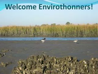
Estuaries • What is an estuary? • Merriam-Webster defines: a water passage where the tide meets a river current or an arm of the sea at the lower end of the river
Fundamentals • Tide: Rise and fall of sea levels as a result of the moon’s gravity, the sun’s gravity, and the rotation of the earth all of which effect the dynamics of the tide (Height/Flow Rate) • Water density: Cold water is denser than warm water, and saltwater is denser than freshwater • Seiches (sayshes): atmospheric or seismic conditions that may cause a landlocked body of water (freshwater) to resemble tidal effects.
Types of estuaries Two ways to classify estuaries • Water Circulation • Salt wedge (highly stratified) • Mississippi River • High river flow/low tidal push • Low mixing • Fjords • Norway, Alaska, B.C. • Freshwater rides on top of salt • Low mixing • Slightly stratified • Chesapeake Bay • Some moderate mixing • Saltier deeper • Vertically mixed • Delaware Bay/N. Edisto river, SC • Low river flow/heavy tidal push • Well mixed • Geologically • Coastal Plain • East Coast U.S. • Sea level rise covered low lying river valleys • Deltas • Mississippi River, Nile river • Deposits of silt/mud • Fjords • Norway, Alaska, B.C. • Large, glacial cut valleys • Bar built • Outer banks of NC • Formed by sand deposits/barrier islands • Lagoons • Tectonic • San Francisco Bay • Caused by faulty faults
Salt wedge estuary • What is it? • Estuary where freshwater floats on top and salt penetrates up river in the deeper part of the water column • highly stratified • Why is it? • Where fast flowing rivers meet low – moderate tidal influence • Saltwater denser than freshwater • Where are they found • Eastern U.S., Mississippi River
Types of estuaries Two ways to classify estuaries • Water Circulation • Salt wedge (highly stratified) • Mississippi River • High river flow/low tidal push • Low mixing • Fjords • Norway, Alaska, B.C. • Freshwater rides on top of salt • Low mixing • Slightly stratified • Chesapeake Bay • Some moderate mixing • Saltier deeper • Vertically mixed • Delaware Bay/N. Edisto river, SC • Low river flow/heavy tidal push • Well mixed • Geologically • Coastal Plain • East Coast U.S. • Sea level rise covered low lying river valleys • Deltas • Mississippi River, Nile river • Deposits of silt/mud • Fjords • Norway, Alaska, B.C. • Large, glacial cut valleys • Bar built • Outer banks of NC • Formed by sand deposits/barrier islands • Lagoons • Tectonic • San Francisco Bay • Caused by faulty faults
Fjords • What are they? • Narrow gorges along sea coast • Why are they? • Glaciation • High river input/low salt input • Low mixing (low D.O.) • Where are they found? • Pacific NW U.S./Canada • Scandinavia
Types of estuaries Two ways to classify estuaries • Water Circulation • Salt wedge (highly stratified) • Mississippi River • High river flow/low tidal push • Low mixing • Fjords • Norway, Alaska, B.C. • Freshwater rides on top of salt • Low mixing • Slightly stratified • Chesapeake Bay • Some moderate mixing • Saltier deeper • Vertically mixed • Delaware Bay/N. Edisto river, SC • Low river flow/heavy tidal push • Well mixed • Geologically • Coastal Plain • East Coast U.S. • Sea level rise covered low lying river valleys • Deltas • Mississippi River, Nile river • Deposits of silt/mud • Fjords • Norway, Alaska, B.C. • Large, glacial cut valleys • Bar built • Outer banks of NC • Formed by sand deposits/barrier islands • Lagoons • Tectonic • San Francisco Bay • Caused by faulty faults
Slightly stratified • What are they? • Estuaries where River input is less than Marine input • Salinity is higher deeper (why?) • Why are they? • The mixing results from turbulence more than other things (i.e. tide or river flow) • Generally very deep • Where are they found? • San Francisco Bay, Chesapeake Bay
Types of estuaries Two ways to classify estuaries • Water Circulation • Salt wedge (highly stratified) • Mississippi River • High river flow/low tidal push • Low mixing • Fjords • Norway, Alaska, B.C. • Freshwater rides on top of salt • Low mixing • Slightly stratified • Chesapeake Bay • Some moderate mixing • Saltier deeper • Vertically mixed • Delaware Bay/N. Edisto river, SC • Low river flow/heavy tidal push • Well mixed • Geologically • Coastal Plain • East Coast U.S. • Sea level rise covered low lying river valleys • Deltas • Mississippi River, Nile river • Deposits of silt/mud • Fjords • Norway, Alaska, B.C. • Large, glacial cut valleys • Bar built • Outer banks of NC • Formed by sand deposits/barrier islands • Lagoons • Tectonic • San Francisco Bay • Caused by faulty faults
Vertically mixed • What are they? • Estuarieswhere salinity is similar at all depths • Why are they? • Low river input, moderate/strong tidal input • Where are they found? • Delaware Bay • Bay of Fundy
Types of estuaries Two ways to classify estuaries • Water Circulation • Salt wedge (highly stratified) • Mississippi River • High river flow/low tidal push • Low mixing • Fjords • Norway, Alaska, B.C. • Freshwater rides on top of salt • Low mixing • Slightly stratified • Chesapeake Bay • Some moderate mixing • Saltier deeper • Vertically mixed • Delaware Bay/N. Edisto river, SC • Low river flow/heavy tidal push • Well mixed • Geologically • Coastal Plain • East Coast U.S. • Sea level rise covered low lying river valleys • Deltas • Mississippi River, Nile river • Deposits of silt/mud • Fjords • Norway, Alaska, B.C. • Large, glacial cut valleys • Bar built • Outer banks of NC • Formed by sand deposits/barrier islands • Lagoons • Tectonic • San Francisco Bay • Caused by faulty faults
Coastal Plain Estuaries • What are they? • Areas where Sea level rise since end of the last Ice Age (10,000-18,000 years ago) have flooded low lying river valleys • Why are they? • Low lying river valleys were easily covered with water (low points) • Where are they found? • Eastern U.S. (Chesapeake Bay) • Bay of Fundy?
Types of estuaries Two ways to classify estuaries • Water Circulation • Salt wedge (highly stratified) • Mississippi River • High river flow/low tidal push • Low mixing • Fjords • Norway, Alaska, B.C. • Freshwater rides on top of salt • Low mixing • Slightly stratified • Chesapeake Bay • Some moderate mixing • Saltier deeper • Vertically mixed • Delaware Bay/N. Edisto river, SC • Low river flow/heavy tidal push • Well mixed • Geologically • Coastal Plain • East Coast U.S. • Sea level rise covered low lying river valleys • Deltas • Mississippi River, Nile river • Deposits of silt/mud • Fjords • Norway, Alaska, B.C. • Large, glacial cut valleys • Bar built • Outer banks of NC • Formed by sand deposits/barrier islands • Lagoons • Tectonic • San Francisco Bay • Caused by faulty faults
Deltas • What are they? • Estuaries that form at the mouth of LARGE rivers. Resemble the shape of Δ. • Why are they? • Silt deposits build up rather than wash away • River carves channels through delta to its destination • Where are they found? • Mississippi River, Nile River
Types of estuaries Two ways to classify estuaries • Water Circulation • Salt wedge (highly stratified) • Mississippi River • High river flow/low tidal push • Low mixing • Fjords • Norway, Alaska, B.C. • Freshwater rides on top of salt • Low mixing • Slightly stratified • Chesapeake Bay • Some moderate mixing • Saltier deeper • Vertically mixed • Delaware Bay/N. Edisto river, SC • Low river flow/heavy tidal push • Well mixed • Geologically • Coastal Plain • East Coast U.S. • Sea level rise covered low lying river valleys • Deltas • Mississippi River, Nile river • Deposits of silt/mud • Fjords • Norway, Alaska, B.C. • Large, glacial cut valleys • Bar built • Outer banks of NC • Formed by sand deposits/barrier islands • Lagoons • Tectonic • San Francisco Bay • Caused by faulty faults
Fjords • What are they? • Narrow gorges along sea coast • Why are they? • Glaciation • High river input/low salt input • Low mixing (low D.O.) • Where are they found? • Pacific NW U.S. • Scandinavia
Types of estuaries Two ways to classify estuaries • Water Circulation • Salt wedge (highly stratified) • Mississippi River • High river flow/low tidal push • Low mixing • Fjords • Norway, Alaska, B.C. • Freshwater rides on top of salt • Low mixing • Slightly stratified • Chesapeake Bay • Some moderate mixing • Saltier deeper • Vertically mixed • Delaware Bay/N. Edisto river, SC • Low river flow/heavy tidal push • Well mixed • Geologically • Coastal Plain • East Coast U.S. • Sea level rise covered low lying river valleys • Deltas • Mississippi River, Nile river • Deposits of silt/mud • Fjords • Norway, Alaska, B.C. • Large, glacial cut valleys • Bar built • Outer banks of NC • Formed by sand deposits/barrier islands • Lagoons • Tectonic • San Francisco Bay • Caused by faulty faults
Bar Built Estuaries • What are they? • Estuaries that are lagoon-like areas often found behind barrier islands or large sand bars. • Why are they? • Occur where wave deposition has built up sand bars or barrier islands • Where are they found? • Folly Beach, SC? • Cape Hatteras OBX, NC
Types of estuaries Two ways to classify estuaries • Water Circulation • Salt wedge (highly stratified) • Mississippi River • High river flow/low tidal push • Low mixing • Fjords • Norway, Alaska, B.C. • Freshwater rides on top of salt • Low mixing • Slightly stratified • Chesapeake Bay • Some moderate mixing • Saltier deeper • Vertically mixed • Delaware Bay/N. Edisto river, SC • Low river flow/heavy tidal push • Well mixed • Geologically • Coastal Plain • East Coast U.S. • Sea level rise covered low lying river valleys • Deltas • Mississippi River, Nile river • Deposits of silt/mud • Fjords • Norway, Alaska, B.C. • Large, glacial cut valleys • Bar built • Outer banks of NC • Formed by sand deposits/barrier islands • Lagoons • Tectonic • San Francisco Bay • Caused by faulty faults
Techtonic Estuaries • What are they? • Estuaries found near fault lines that result from tectonic activity • Why are they? • Tectonic forces cause areas to drop below sea level, allowing seawater to rush in and fill it • Tectonic forces also cause freshwater drainages to empty into them • Where are they found? • Coastal mountainous areas • San Francisco Bay
Freshwater Estuary • Area where a freshwater river flows into a large body of freshwater such as a lake • Function similar to brackish water estuary • Little to no tidal influence • Chemically different waters of the rivers (input) and the lakes (sink) can mix in similar ways as the brackish water estuaries • Temperature differences can also imfluence mixing (why?) • Most mixing between the systems is caused by seiches. • May have a tidal effect but without regularity. • Where are they? • Large bodies of freshwater… • Hint: Lake Cumberland is NOT big enough.
Estuary of Concern http://www.dfo-mpo.gc.ca/
Remember… • Tides, river flows, and geology define estuaries • There are two ways to classify estuaries • Mixing and geologically • Mixing is result of tides, river flow and geological shape of estuary • Geology generally results from glaciation, physical action (i.e. erosion, waves, storms, plate techtonics etc), even anthropogenic causes (dredging, beach renourishment, etc) • There are also freshwater estuaries • Think of brackish estuaries (minus the tides, plus the seiches)