Download
1 / 61
610 likes | 799 Vues
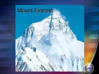
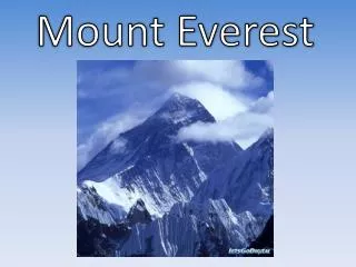
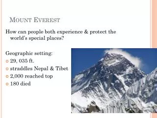
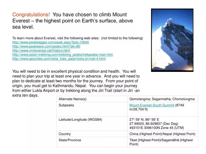
Congratulations! You have chosen to climb Mount Everest – the highest point on Earth’s surface, above sea level. To learn more about Everest, visit the following web sites: (not limited to the following) http://www.peakbagger.com/peak.aspx?pid=10640 http://www.peakware.com/peaks.html?pk=80

E N D
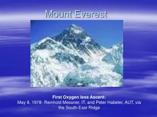
Congratulations! You have chosen to climb Mount Everest – the highest point on Earth’s surface, above sea level. To learn more about Everest, visit the following web sites: (not limited to the following) http://www.peakbagger.com/peak.aspx?pid=10640 http://www.peakware.com/peaks.html?pk=80 http://www.mnteverest.net/history.html http://www.asian-trekking.com/trekking_peaks/trekpeaks-main.htm http://www.geocities.com/lukla_kala_patar/lukla-jiri-trail-4.html You will need to be in excellent physical condition and health. You will need to plan your trip at least one year in advance. And you will need to plan to dedicate at least two months for the journey. From your point of origin, you must get to Kathmandu, Nepal. You can begin your journey from either Lukla Airport or by trekking along the Jiri Trail (start in Jiri -an extra ten days.
WorldAtlas.com Mount Everest is located at 27° 59' N; 86° 56' E. Locate that point on the map, and locate your point of origin on the map.Also, locate Kathmandu, Lukla and Jiri on the map. How far do you have to travel to get to Lukla Airport or Jiri, the starting point for an Everest expedition?
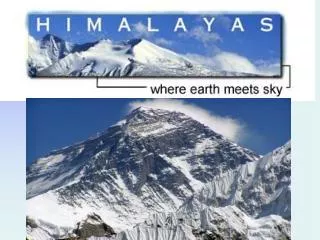
Satellite image of Mount Everest: http://visibleearth.nasa.gov/view_rec.php?id=564 These are two comparison images of Mount Everest and its surroundings, along the border of Nepal and Tibet. The peak of Mount Everest, the highest elevation on Earth at 8,848 meters (29,028 feet), can be seen near the center of each image. The image at the top was acquired through thick cloud cover by the Spaceborne Imaging Radar-C/X- band Synthetic Aperture Radar (SIR-C/X-SAR) aboard the space shuttle Endeavour on April 16, 1994. The image on the bottom is an optical photograph taken by the Endeavour crew under clear conditions during the second flight of SIR-C/X-SAR on October 10, 1994. Both images show an area approximately 70 kilometers by 38 kilometers (43 miles by 24 miles) that is centered at 28.0 degrees north latitude and 86.9 degrees east longitude. North is toward the upper left. The colors in the radar image were obtained using the following radar channels: red represents the L- band (horizontally transmitted and received); green represents the L-band (horizontally transmitted and vertically received); blue represents the C- band (horizontally transmitted and vertically received). Radar illumination is from the top of the frame. The optical photograph has been geometrically adjusted to better match the area shown in the radar image. Many features of the Himalayan terrain are visible in both images. Snow covered areas appear white in the optical photograph while the same areas appear bright blue in the radar image. The radar image was taken in early spring and shows deep snow cover, while the optical photograph was taken in late summer and shows minimum snow cover. The curving and branching features seen in both images are glaciers. The two wavelengths and multiple polarizations of the SIR-C radar are sensitive to characteristics of the glacier surfaces that are not detected by conventional photography, such as the ice roughness, water content and stratification. For this reason, the glaciers show a variety of colors in the radar image (blue, purple, red, yellow, white) but only appear as gray or white in the photograph. Field data from other SIR-C/X-SAR test sites, such as the Alpine glaciers of Austria, are being used to help interpret data from remote regions like Mount Everest. NASA/JPL//NIMA
The airport and village of Lukla, starting point for Everest expeditions.
For additional information on the Tyengboche Monastery visithttp://www.pbs.org/wgbh/nova/everest/history/tyengboche.html
For additional information on Khumbu Ice Fall:http://www.pbs.org/wgbh/nova/everest/earth/glacier.html