Table of Contents
460 likes | 662 Vues
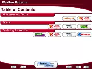
Table of Contents. Air Masses and Fronts Storms Predicting the Weather. - Air Masses and Fronts. Classifying Air Masses. Four major types of air masses influence the weather in North America: maritime tropical, continental tropical, maritime polar, and continental polar.

Table of Contents
E N D
Presentation Transcript
Table of Contents • Air Masses and Fronts • Storms • Predicting the Weather
- Air Masses and Fronts Classifying Air Masses • Four major types of air masses influence the weather in North America: maritime tropical, continental tropical, maritime polar, and continental polar.
- Air Masses and Fronts Types of Air Masses • Air masses can be warm or cold, and humid or dry. As an air mass moves into an area, the weather changes.
- Air Masses and Fronts How a Front Forms • The boundary where unlike air masses meet is called a front.
- Air Masses and Fronts Types of Fronts • Colliding air masses can form four types of fronts: cold fronts, warm fronts, stationary fronts, and occluded fronts.
Current Front Analysis http://www.intellicast.com/National/Surface/Current.aspx
- Air Masses and Fronts Weather Fronts Activity • Click the Active Art button to open a browser window and access Active Art about weather fronts.
- Air Masses and Fronts Cyclones and Anticyclones • Winds spiral inward towards the low-pressure center of a cyclone. Winds spiral outward from the high-pressure center of an anticyclone.
- Air Masses and Fronts Comparing and Contrasting • As you read, compare and contrast the four types of fronts by completing a table like the one below. Types of Weather Front How It Forms Cold front A cold air mass overtakes a warm air mass. Clouds, possibly storms with heavy precipitation Warm front A warm air mass overtakes a cold air mass. Clouds, light precipitation Stationary front Cold and warm air masses meet, but neither can move the other. Clouds, precipitation Occluded front A warm air mass is caught between two cold air masses. Clouds, precipitation
- Storms Thunderstorm Formation • A thunderstorm forms when warm, humid air rises rapidly within a cumulonimbus cloud.
- Storms Tornado Formation • Tornadoes can form when warm, humid air rises rapidly in thick cumulonimbus clouds—the same type of clouds that bring thunderstorms.
- Storms Tornado Alley • Tornadoes in the U.S. are most likely to occur in a region known as Tornado Alley.
- Storms Structure of a Hurricane • In a hurricane, air moves rapidly around a low-pressure area called the eye.
- Storms Hurricane Andrew • The path of Hurricane Andrew over three consecutive days can be seen below.
- Storms Lake-Effect Snow • As cold dry air moves across the warmer water, it becomes more humid as water vapor evaporates from the lake surface. When the air reaches land and cools, snow falls.
- Storms Sequencing • As you read, make a flowchart like the one below that shows how a hurricane forms. Write each step of the process in a separate box in the order in which it occurs. Hurricane Formation Begins as a low-pressure area over warm water,or a tropical disturbance. Warm, humid air rises and begins to spiral. As air rises, more warm, moist air is drawn into the system and the hurricane gains energy. As winds spiral inward, bands of high windsand heavy rains form.
- Storms More on Thunder and Lightning • Click the Planet Diary button for an activity aboutthunder and lightning.
- Storms Tornadoes • Click the Video button to watch a movie about tornadoes.
- Storms Hurricanes • Click the Video button to watch a movie about hurricanes.
- Predicting the Weather Red Sky • A red sky is one kind of observation that helps people to predict the weather.
- Predicting the Weather Computer Weather Forecasting • Scientists use computers to develop different models of how a front may move. These predictions are then used to make weather forecasts. As more data become available, some models are found to be incorrect, while others are found to closely fit the predicted conditions. The upper graph shows the predicted air pressure from two models. The lower graph shows actual data for air pressure.
Time of day and air pressure Reading Graphs: What two variables are being graphed? - Predicting the Weather Computer Weather Forecasting
According to model A, air pressure will drop slightly then increase. According to model B, air pressure will steadily decrease. Interpreting Data: How is air pressure predicted to change according to each model in the top graph? - Predicting the Weather Computer Weather Forecasting
Model B Inferring: Which computer model most closely matches the actual air pressure data? - Predicting the Weather Computer Weather Forecasting
Stormy weather, clouds, and precipitation accompany low air pressure. Predicting: What weather would you forecast for Monday and Tuesday? Explain. - Predicting the Weather Computer Weather Forecasting
- Predicting the Weather Reading Weather Map Symbols • The figure below shows what various weather symbols mean.
- Predicting the Weather Reading Weather Maps • This is the type of weather map produced by the National Weather Service. It shows data collected from many weather stations.
- Predicting the Weather Reading Weather Maps • Weather maps in newspapers use symbols to show fronts, high- and low-pressure areas, and precipitation. Color bands indicate different temperature ranges.
Weather Links • http://www.nws.noaa.gov/outlook_tab.php • http://www.weatherforyou.com/cgi-bin/hw3/hw3.cgi?config=&forecast=asus01&usemap= • http://www.weather.com/maps/maptype/currentweatherusnational/index_large.html
- Predicting the Weather Previewing Visuals • Before you read, preview Figure 21, a weather map. Then write four questions that you have about the map in a graphic organizer like the one below. As you read, answer your questions. Previewing Figure 21 Q. What type of front is located west of Okalahoma City? A. A cold front Q. What do the stick symbols indicate? A. Amount of cloud cover, atmospheric pressure, wind direction and speed, and temperature Q. What are the slender, curvy lines? A. Isobars, which join places with the same air pressure Q. What does the symbol to the east of Florida mean? A. A hurricane
- Predicting the Weather More on Weather Maps • Click the Planet Diary button for an activity aboutweather maps.
More on Doppler Radar • Click the PHSchool.com button for an activityabout Doppler radar.
Graphic Organizer Typical Time of Year Type of Storm Where Forms Safety Rules Within large cumulonimbus clouds Seek shelter, avoid trees and water. Thunderstorms Spring or Summer Move to a storm shelter or basement if possible; stay away from windows and doors. Tornado Cumulonimbus cloud Spring, early summer Over warm ocean water Late summer and into autumn Evacuate or move inside a well-built building. Hurricane