Download
1 / 64
680 likes | 982 Vues
MAP SKILLS REVISION PART 1. ACCESS INFORMATION POINT. TODAY WE WILL FOCUS ON SKILLS REVISION. OBJECTIVES. TO BE ABLE TO INTEPRET OS MAPS AT 1:25 000 & 1:50 000 TO BE ABLE TO UNDERSTAND 3 & 4 FIGURE GRID REFERENCES TO BE ABLE TO CALCULATE DISTANCES FROM SCALE

E N D
MAP SKILLS REVISION PART 1
ACCESS INFORMATION POINT
TODAY WE WILL FOCUS ON SKILLS REVISION
OBJECTIVES • TO BE ABLE TO INTEPRET OS MAPS AT 1:25 000 & 1:50 000 • TO BE ABLE TO UNDERSTAND 3 & 4 FIGURE GRID REFERENCES • TO BE ABLE TO CALCULATE DISTANCES FROM SCALE • TO BE ABLE TO DESCRIBE ALL THE DIFFERENT TYPES OF LAND USE ON A MAP • TO BE ABLE TO UNDERSTAND PATTERNS AND DISTRIBUTIONS ON MAPS (CHOROPLETH, DOT MAPS) • TO BE ABLE TO INTERPRET PHOTOGRAPHS & SKETCHES (INCLUDING SATELLITE & AERIAL PHOTOGRAPHS)
TICK OFF WHEN YOU HAVE REVISED AND KNOW EACH SECTION ON YOUR CHECK LIST
SECTION A Section A is worth 25 marks and tests your OS map skills and other skills. There are also some other skills marks in the other questions on both exam papers. Don’t forget you must answer all questions in section A. There is normally 3 parts to section A IT WILL BE A LOCATION IN THE UK
QUESTION 1 Study Figure 1, the Ordnance Survey map extract for Reading in southern England. MAKE SURE THIS IS IN FRONT OF YOU NOW
Points to remember about OS maps • You will always have a either a 1:25 000 or a 1:50 000 scale map. • The one in front of you is 1:50 000 scale • 1:25 000 means that 1cm on the map is equal to 25 000 cm in real life. This means 1cm is equal to 250m on the ground or 4cm is equal to 1km • 1:50 000 means 1cm is equal to 500m on the ground or 2cm is equal to 1km • The top of an OS map is always North • You will always be given an OS key for that map it includes the scale as a bar to help you work out distances
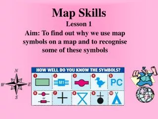
USING A MAP KEY Ordnance survey maps use a series of symbols to indicate features of the landscape. In the examination you will be given a key to the symbols. This is exactly the same as the one you now have in front of you. Study this lots at home. You are not expected to know it off be heart but a good general understanding of some of the key features will help you save time in the exam. Take care with the following symbols that are often confused. Look at your symbol key now
AQUEDUCTS & BRIDGES POST OFFICE & PARKING ROADS BEACONS & LIGHTHOUSES SYMBOLS OFTEN CONFUSED Parking Lighthouse Post Office Beacon
WINDMILL & WINDPUMP SYMBOLS OFTEN CONFUSED CONIFEROUS WOOD & NON CONIFEROUS Use the following web site to help you http://www.geograph.org.uk/article/Ordnance-Survey-Map-Symbols This presentation and links to other sites can be found at www.gorgeousgeography.co.uk (look under GCSE Revision)
GRID REFERENCES PUT YOUR HAND UP IF YOU KNOW THEM
NOW YOUR TURN Q1 Study Figure 1, the Ordnance Survey map extract for Reading in southern England. • Give the Six figure grid reference for the principle railway station in Reading. (2 marks) 714/715 = 1 737/738 = 1 2 marks You are allowed a tolerance level in this case because it covers two points
WHAT DO YOU NEED TO KNOW Study Figure 1, the Ordnance Survey map extract for Reading in southern England. (b) Measure the distance along the M4 between the motorway service area in grid square 6769 and the western edge of the map. (1 marks)
COMPASS DIRECTIONS The minimum you should know is the eight point compass although it would be better to know the 16 point compass shown here.
MEASURING DISTANCE • You can do this using two different methods. • Use your ruler to pivot and add up the centimetres as you travel along the line then calculate using the scale line. • Use a piece of paper to make marks on it as you twist it. • REMEMBER WHICH EVER WAY YOU USE YOU MUST USE THE SCALE TO WORK OUT THE DISTANCE IN KILOMETRES (FOR A 1:50,000 MEASURE IN CM AND THEN DIVIDE BY 2 AS 1 KM IS EQUAL TO 2CM)
On the paper's edge • Another method of measuring distance is to take a sheet of paper and place the corner of a straight edge on your starting point. Now pivot the paper until the edge follows the route that you want to take. • Step 1 • Every time the route disappears or moves away from the straight edge of your paper, make a small mark on the edge and pivot the paper so the edge is back on course.
Step 2 Repeat this process until you reach your destination
Step 3 You should be left with a series of marks along the edge of your paper. You can now place the sheet against the scale bar on your map. The last mark you made will tell you the real distance you need to travel
QUESTION 1b Study Figure 1, the Ordnance Survey map extract for Reading in southern England. (b) Measure the distance along the M4 between the motorway service area in grid square 6769 and the western edge of the map. (1 marks) 6 kilometres 1 mark
QUESTION 1C Study Figure 1, the Ordnance Survey map extract for Reading in southern England. (c) Compare the relief and land uses in grid squares 7877 and 6677. (2 marks)
Describing Human & Physical Features from Maps
RELIEF My goodness, I am quite RELIEVED I got to the top Relief means the height and shape of the land. I like to remember it by thinking about how relieved I am when I get to the top. – This associates it with land height and shape. Take care with the spelling though.
DRAINAGE This is the surface water features such as:- Rivers – drawn as blue line but not to be confused with motorways!!! Lakes – Looks like a large blue puddle Marsh-
VEGETATION This includes the obvious green wooded areas but look out for which means rough grassland. On the OS 1:25 000 map vegetation is shown in more detail – check the symbols key carefully Non Coniferous Trees Coniferous Trees Rough Grassland
Coniferous Woodland Rough Grassland Non Coniferous
When asked what the land use is you must explain what the land is USED for. In this case depending on which grid square you can see a variety of land uses e.g. a golf course, residential areas, lakes used for recreation, Roads, Allotments and many more. LAND USE
SETTLEMENT This includes:- Its location – Where is it? Its shape – (linear, star shaped, nucleated) Its pattern – (nucleated, dispersed or evenly spread)
PATTERNS OF COMMUNICATION This includes:- Canals Railways Roads don’t forget to know the difference between A roads, Motorways, B Roads, Rough Tracks. Look at your OS key carefully
River Motorway
Four Figure Grid Reference 7877
Four Figure Grid Reference 6677
COMPARE 7877 6677 RELIEF RELIEF LAND USES LAND USES
Four Figure Grid Reference 7877 Four Figure Grid Reference 6677
COMPARE The word COMPARE in an exam means you must do the following • Don’t list the features of each grid square • You must compare so use words like the ones below HIGHER STEEPER DENSER SPARSER Use connectives such as WHERE AS – as this will force you to compare 3. Use figures to COMPARE e.g. site one is 3m higher than site 2 for example.
COMPARE 7877 6677 RELIEF RELIEF LAND USES LAND USES
ANSWER LEVEL 1: May be listed, and separate accounts, and imbalanced, i.e. land use or relief only, e.g. in 7877 school, telephone, railway, houses main road, low land, two contours 40 and 50 metres, etc. In 6677 river, transmission line, road, woodland, sloping land, 40 – 90 metres. May be only 2 simple points. IF YOU WANT TO GET MORE THAN 2 POINTS YOU MUST COMPARE LEVEL 2: (3 – 4 marks) Clear contrasts made; reference to land use and relief, e.g. 6677 has much steeper land, heights vary from below 40 metres to over 90 metres, max height of 110 metres, whereas in 7877 the relief is lower, from below 40 metres to over 50 metres. In 6677 there is only a minor road whereas in 7877 there is a main road. Max 3 if only Relief described. 4 marks
QUESTION 2 Study Figure 1, the ordnance survey map extract and Figure 2, on the next page, an aerial photograph of reading • Name the land uses shown at X, Y and Z on the aerial photograph (3 marks)
ANALYSING AERIAL PHOTOGRAPHS As well as Ordnance Survey maps you will also be given a photograph of part of the area shown on an OS map. The first thing to do is make sure you orientate your photograph correctly so you know exactly which part of the map is shown. Lets do this now for Reading What are the key points to look at?
Z X Look for key features on the map to find out where it is on the OS map then use the OS map to identify the features. For this example the stadium is easy to see as is the roads and shape of the fields Y
ANSWERS Study Figure 1, the ordnance survey map extract and Figure 2, on the next page, an aerial photograph of reading • Name the land uses shown at X, Y and Z on the aerial photograph (3 marks) X = Train track, Track, Railway Y = Gravel Pit, Lake, Water Reservoir Z = Trees, Wood, Woodland, Forest, Non-coniferous wood, deciduous woodland. 3 marks IN THE EXAM IT WILL BE IN COLOUR AND EASIER TO SEE
Question 2B (b) Describe and explain the shape of the built –up area of Reading. Use evidence from the photograph and the Ordnance Survey map in your answer.
A CHECK LIST TO HELP YOU TO DESCRIBE FEATURES ON A MAP
ANSWERS Level 1: (1 – 2 marks) only descriptive e.g. follows roads, most to south of Railway. Level 2: (3 – 4 marks) needs both description and explanation for top Level 2, although may lack detail from map/photo, e.g. star shaped along roads for good communications, avoids flood plains of rivers, most south of the railway line and River Thames where more flat land. May only be description or explanation for 3 marks. Level 3: (5 – 6 marks) detail from use of map and photo, e.g. star shaped along main lines of communication, e.g. Purley on Thames (6575) area close to both main road and railway. Town largely built-up between railway to north and the M4 to the south except for Caversham area over the bridge to the north. Reading avoids the floodplains and lakes in the low lying valleys of the rivers, e.g. the Thames, Holy Brook – these areas would be prone to flooding and make them unsuitable for settlement. Can refer to map and/or photograph. Shape words accepted = cross-shaped, clover leaf, butterfly. No credit for site or morphology features. 6 marks