Download
1 / 38
380 likes | 662 Vues
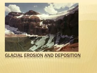
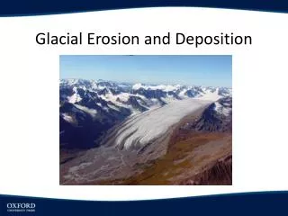
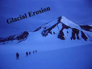
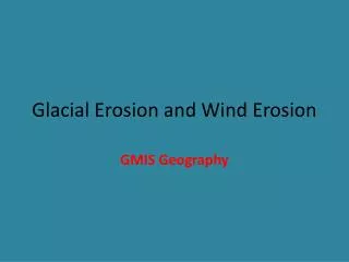
Glacial Erosion and Wind Erosion . GMIS Geography. Glacial Erosion Processes. The rocks in the previous picture have been broken down by:. Erosion Processes. Involve movement. Abrasion. Plucking. Frost shattering. Weathering Processes. happen in situ (one place). Frost Shattering.

E N D
Glacial Erosion and Wind Erosion GMIS Geography
The rocks in the previous picture have been broken down by: ErosionProcesses Involve movement Abrasion Plucking Frost shattering Weathering Processes happen in situ (one place)
Frost Shattering Jagged, angular rocks of different sizes • Happens in mountainous or hilly areas where the temperature regular rises above and falls below freezing. • Water collects in cracks in rocks. • Overnight the water freezes and expands. • This expansion puts stresses and pressure on the sides of the crack. • During the day when the temperature rises the ice thaws/melts and contracts releasing the pressure on the crack. • This happens over and over again and eventually the rock cracks open. • The rocks that break off are jagged and angular - scree. • If they are on a slope they roll down hill and collect on what are known as scree slopes.
Plucking • The water at the bottom of the glacier freezes onto rock on the valley base. • As the glacier moves the rock is pulled away from the valley base. • Plucking mainly occurs when the rock is well-jointed. Well-jointed rock
Abrasion As a glacier slides over its bed, it picks up rock fragments that act like sandpaper, on a giant scale, rubbing against and wearing away the sides and floor of the valley. This leads to the valley getting steeper, deeper and wider. Rocks carried by the glacier grind at the base and sides of valley Rock fragments and ground-up bedrock incorporated into the base of a glacier.
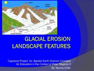
Moraines - deposited particles once glacier recedes 1.Ground moraines - in glacier before deposited 2.Lateral moraines - deposited on sides of glaciers 3.Medial moraines -deposited on the sides of two converging glaciers, resulting between the two 4.End moraines - deposited at the ice front MORAINES
Examples of a Medial Moraine, End Moraine, and Terminal Moraines.
Picture of an End Moraine: End moraine of a piedmont glacier (large valley glaciers meet to form an almost stagnant sheet of ice), Bylot Island, Canada. The sharp-crested ridge of till (end moraine) was pushed up at the ice margin during the glacier's maximum advance, probably during the Little Ice Age.
Lateral and terminal moraines of a valley glacier, Bylot Island, Canada. The glacier formed a massive sharp-crested lateral moraine at the maximum of its expansion during the Little Ice Age. The more rounded terminal moraine at the front consists of medial moraines that were created by the junction of tributary glaciers upstream.
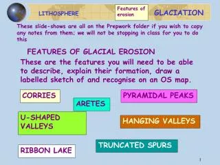
Corrie, cirque, cwm – hollow where a glacier formed Armchair shaped hollow – usually northerly aspect in UK and N. Hemisphere. Steep back wall e.g. LlynCau on CaderIdris
Llyn Cau -Corrie lake - Or tarn Back wall of corrie – plucking Overdeepening of hollow – abrasion Rotational slip at base of glacier Corrie lip at front edge
Looking down into a tarn From high up on the backwall Backwall subject to freeze thaw weathering in post-glacial – periglacial times
An arete A knife edge ridge formed where two cories developed back to back This example is Striding Edge on Helvellyn in the Lake District.
A pyramidal peak or horn e.g. Matterhorn Where 3 or more corries form back to back
A glacial trough or U shaped valley. Steep sides are truncated spurs prexisting river valley profile altered by glacial erosion Ice more effective at eroding by Plucking and abrasion
A hanging valley and waterfall called Bird Woman Falls near Mt. Oberlin, Canadian Rockies. A smaller tributary glacier could not erode the base of its valley as deep as the main valley glacier. Thus after the ice melts the smaller valley is left hanging above the main valley floor and enters it at up to 90*.
A fjord is a drowned glaciated valley. The ice did not use present day sea level as its base level The ice could erode much deeper than today’s sea level. So after the Ice Age the sea enter and drowned glaciated valleys. Many examples in Norway
In some areas the glaciated valley can be overdeepened by glacial erosion. Perhaps the rocks locally were less resistant. Alluvial fans may be formed where a post glacial stream flows into the lake. The lake may be split into two.
Keswick lies between Derwentwater and Bassenthwaite. Interlaken is another example. Lakes are temporary features – they fill up with sediment or the post glacial reiver cuts down through the dam blocking the lake so that all the water drains away.
These striations are on rocks in the Indian Peaks Wilderness, Utah. They were formed as individual particles carried at the base of a glacier moved across the bedrock and scratched the rock. The striations provide important clues to the orientation of ice flow, particularly important if we were not around to observe the glacier when it existed.
Definition: rock hills shaped by the passage of ice to give a smooth up-ice side and a rough, plucked and cliffed surface on the down-ice side. The upstream surface is often marked with striations.
1) Deserts: where & why Earth’s dry regions: 30% of all land • 2 climate types of dry regions: • desert (arid) • steppe (semi-arid, surrounds deserts) Question:how much rain do we get in Tempe every year?
1) Deserts: where & why What causes deserts? Important factors: Global distribution of • air pressure • wind Relationship between • rainfall • evaporation www.weatherchannel.com
1) Deserts: where & why Low-latitude deserts (recall: “latitude” = east-west line on the globe) • Tropic of Cancer • Tropic of Capricorn In contrast…. • Equator: • hot air • rises to 15-20 km • low pressure belt
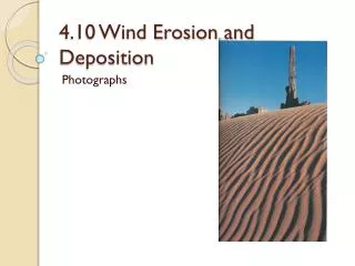
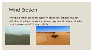
3) Wind erosion/ deposits Deserts & winds Wind erosion: Important in arid environments Example: Types of sand dunes: • Sand dune shape depends on: • Flat or hilly? • How much sand? • Winds steady or intermittent? • Wind direction constant? • Vegetation present?
3) Wind erosion/ deposits Deserts & winds Sand dune formation