THE OBSERVATIONS FROM SATELLITES TO HELP IN THE STRUGGLE AGAINST FIRES.
300 likes | 541 Vues
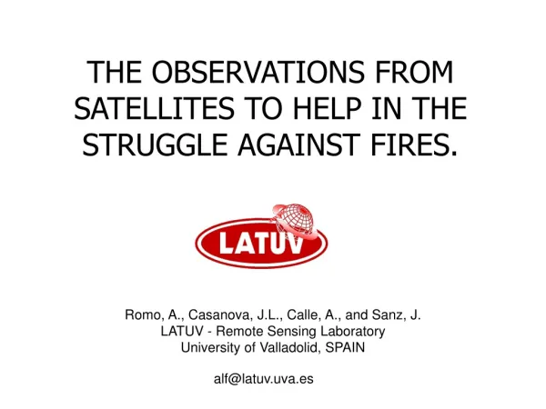
THE OBSERVATIONS FROM SATELLITES TO HELP IN THE STRUGGLE AGAINST FIRES. Romo, A., Casanova, J.L., Calle, A., and Sanz, J. LATUV - Remote Sensing Laboratory University of Valladolid, SPAIN. alf@latuv.uva.es. Index Introduction Fire’s phase and add value products from remote sensing data.

THE OBSERVATIONS FROM SATELLITES TO HELP IN THE STRUGGLE AGAINST FIRES.
E N D
Presentation Transcript
THE OBSERVATIONS FROM SATELLITES TO HELP IN THE STRUGGLE AGAINST FIRES. Romo, A., Casanova, J.L., Calle, A., and Sanz, J. LATUV - Remote Sensing Laboratory University of Valladolid, SPAIN alf@latuv.uva.es
Index • Introduction • Fire’s phase and add value products from remote sensing data. • LATUV installation. • LATUV antennas. • LATUV-MODIS processing chain. • Remote sensing products. • LATUV: some project.
Introduction • The use of space technologies provides a new perspective in the management of large event situations or natural disasters. • In the particular case of fire, this needs to have in real time information about these. • The information from satellites are ideal. • LATUV from 1993, send different fire information layer to fire fighter authority. • Here I present the different layer of information depending on the phase of the fire.
Fire’s phase Area Remote sensing products Prevention Structural parameter Vulnerability Structural risk Contextual spatial information Infrastructures, towns, city, etc. Land use, combustible Alerts Vegetation stage Meteorological products Dynamic risk NDVI .vs. historical NDVI Humidity, wind, etc Fire risk Detection Hot spots detection Hot spot DDBB Fire alarm & Fire alarm Active fire Crisis time Fire monitoring Behavior prediction Fire evolution Fire line Propagator model Fire line evolution Post-crisis Damage estimation Damage evolution Burned area Burned area time evolution Fire’s phases and add value products from remote sensing data MODIS dataMSG, NOAA and FengYun dataGFS Data
Principal Laboratory Cold Room Robot Saver Cluster – 8 nodes LATUV: Installations
LATUV: Antennas MODIS Antenna 2 NOAA Antennas MSG Antenna NOAA & Fengyun & Seawifs Antenna
LATUV-MODIS processing chain • LATUV MODIS processing chain • The LATUV’s MODIS processing chain is carry out through a NASA Institutional Algorithm. • LATUV runs the next PGE. • All PGE are running in a cluster with 8 nodes. • HDFLook is used to project the final maps in equirectangular projection.
LATUV-MODIS processing chain LATUV processing areas
BT band 21 BT band 31 NDVI LST Aggregate band 1 Aggregate band 2 Reflectivity band 2 LATUV-MODIS processing chain Fires MODIS basic products For each MODIS pass, LATUV uses to obtain the fire add value products: + MOD14
Remote sensing products: ALERTS • Vegetation stage • This product is a report and it is composed by 8 maps and comments about these. • LATUV estimated the average NDVI maps, the maximum and minimum NDVI maps (each 16 days) from historical MODIS data (2000-2004). These are our historical reference, the average, the better and the worse year. • LATUV estimate the GREENESS index, the ratio and different between average and current NDVI maps and the historical NDVI tendency and current NDVI tendency. • The spatial resolution is QKM. • The product’s periodicity is twice/week.
Remote sensing products: ALERTS Example over Spain
Remote sensing products: ALERTS Meteorological products The weather products are obtaining from GFS data. The weather forecast products were: ground temperature, humidity, accumulated rainfall, Cloudiness, CAPE instability index and wind speed. The final resolution of this product is 10x10 km2 through “krigging’s interpolation”. The product’s periodicity is each 3 hours. Wind Speed Forecast Air Humidity Forecast Air Temperature Forecast
INPUT IMAGES: 60 daily NDVI images MODULE MVC Function to obtain a series of dynamic maximum value composite NDVI images ASCII file containing the list of images MVC IMAGES NDVI IMAGE Geographical parameters of country to analysis MODULE PARABOLIC REGRESSION Function to obtain a image of residual values between extrapolated and actual NDVI Geographical parameters of country to analysis INPUT IMAGES ·NDVI ·LandSurface temperature Geographical parameters: number of cells, size of cell analysis MODULE TS-NDVI SLOPE Function to obtain a image of slope regression values Slope values image Residual values image MODULE RISK FUSION Map of forest fire risk Remote sensing products: ALERTS Fire risk maps: General Outline
Risk zone No-Risk zone + 1.0 · ---> L1 = LOW Extrapolated NDVI NDVI, current day + 2.0 · ---> L2 = MODERATE current day + 2.5 · ---> L3 = HIGH + 3.0 · ---> L4 = EXTREME Time Province Average Remote sensing products: ALERTS Fire risk maps: Vegetation decrease algorithm For each aggregate NDVI pixel (1x1 km2): • Fitting of the MVC images to a parabolic spline: Period: 2 months----> 6 NDVI-MVC. • Calculation of the “residual”: difference between the NDVI extrapolated by the spline and the real NDVI of the current day Risk Quantification: Designation of fire hazard from the distribution of residuals in provincial normalisation.
LST Risk threshold L1 L2 L4 L3 NDVI Remote sensing products: ALERTS Fire risk maps: Stress Algorithm • LST vs. NDVI : Indicator of the level of the real evapotranspiration. • The Ts vs. NDVI relationship analyzed cell by cell can be represented by means a linear relationship. • The slope “m” characterizes the humidity level of the whole cell. This humidity level is assigned to the whole cell (10x10 km2) m>0 Exceptional situations with very high humidity content. m<0 Normal situation, to be analyzed The slope increases -> Evapotranspiration decreases Risk threshold: m= -30 m<-30 --->L1 =LOW m<-50 --->L2 = MODERATE m<-70 --->L3 = HIGH m<-90 --->L4 = EXTREME
D R O U G H N E S S I N D E X VEGETATION EVOLUTION INDEX LOW MODERATE HIGH EXTREME LOW LOW MODERATE MODERATE HIGH MODERATE MODERATE MODERATE HIGH HIGH HIGH MODERATE HIGH HIGH EXTREME EXTREME HIGH HIGH EXTREME EXTREME Remote sensing products: ALERTS Fusion of the two indicator The fusion of the risks coming from the first two indicators is done accordingly to the following table, obtained through empirical analysis of the fuzzy type.
Remote sensing products: ALERTS Forest Fire Risk index maps example MODIS False color composite and Fire Risk Map examples. Date acquisition: 03/09/2005. MODIS image show the fire’s smoke in Asturias and Galicia´s region. The fire risk over this area have extreme risk fire (magenta and red colours).
Remote sensing products:DETECTION • Operation • When the MSG, TERRA, AQUA, NOAA and FENGYUN satellites pass over the LATUV, Hot Spot maps are create for different regions in Europe. • MODIS-Terra and MODIS-Aqua satellites • The hot spot detection from Terra and Aqua satellites is carry out through a NASA Institutional Algorithm. • LATUV runs the PGE30-version 4.0.1. • In the case that a pixel appears on fire, the temperature and extension are obtaining by Dozier’s method. • With fire temperature and extension, we estimated the Power fire through Stefan-Boltzmann law. • We compare the real time hot spots with hot spot DDBB and eliminate the false alarm. • The new hot spots table is convert in shape vector file.
Remote sensing products:DETECTION Hotspots Map example Hotspots Map example estimated from MODIS-AQUA image. The zoom show the Fire released power.
15 minutos Escena 51 Escena 52 Remote sensing products:DETECTION Active Fires LATUV use the MSG data. The temporal resolution of this data is very high 15 min. For detection LATUV analyze the gradient between two continuous MSG temperature sequences. The result is store in DDBB and show in internet.
1 2 3 4 5 6 7 8 9 Remote sensing products:CRISIS TIME • MODIS-Terra and MODIS-Aqua satellites FLAMING FRONT • We separate in two different case the estimation of flaming front: • CASE 1: When we have 1 or 2 continues hot spots pixel … • CASE 2: When I have 3 or more continues hot spots pixel ... Groups of hot-spots CASE 2 #1: 4 hs #2: 7 hs #3: 4 hs #4: 5 hs #5: 13 hs #6: 5 hs #7: 2 hs #8: 5 hs #9: 2 hs CASE 1
Remote sensing products:CRISIS TIME • MODIS-Terra and MODIS-Aqua satellites FLAMING FRONT • When I have 1 or 2 continues hot spots pixel … • During the detection through Dozier’s method we estimate the flaming area from 1KM resolution. • From NIR (QKM resolution) band the flaming can be located where the reflectance is very low inside the 1KM pixel. • We convert the flaming area in number of pixel. • After, we choose the pixels with minimum reflectance. 1KM QKM
MW 750 1200 350 350 350 750 K 1200 Remote sensing products:CRISIS TIME • MODIS-Terra and MODIS-Aqua satellites FLAMING FRONT • When I have 3 or more continues hot spots pixel ... • During the detection through Dozier’s method we estimate the flaming area and fire temperature from 1KM resolution. With these we calculate the power. • Through clustering technique, we merge the hot spot with similar power.
INPUT Central image co-ordinate of burnt area Coordinate from hot spots list • INPUT IMAGESNDVI • ·before fire • NDVI post fire • Analysis parameters • Size of analysis matrix • Standard deviation factor Interactive INPUT Default parameters Contextual algorithm Difference algorithm Threshold NDVI based on contextual analysis of difference image Regression algorithm Threshold NDVI based on contextual analysis of regression image Filter of isolated points Mask image of burnt area Area (Ha.) of burnt area image of burnt area Remote sensing products:POST CRISIS MODIS-Terra and MODIS-Aqua satellites BURNED AREA - General Outline
Remote sensing products:POST CRISIS DIFFERENCE: Contextual algorithm (NDVIb – NDVIa) > b-a + 1.5 b-a REGRESSION: Contextual algorithm NDVIa = a . NDVIb + b NDVIa < NDVIa,f – 1.5 S
Remote sensing products:POST CRISIS BURNED AREA OVER GALICIA – 2005-08-21
Remote sensing products:POST CRISIS BURNED AREA EVOLUTION Through the multi-temporal analysis is possible to obtain the average burned velocity.