Download
1 / 57
570 likes | 702 Vues
This presentation addresses key GIS data management challenges faced by the City of Vancouver, including discrepancies between branch and corporate data needs, issues of data duplication, and the divergence between designed and as-built data. It highlights Vancouver's innovative approach using new technologies to resolve historical data inconsistencies. As one of Canada’s largest cities, Vancouver manages extensive infrastructure data essential for effective governance. We explore how a shift towards collaborative services is enhancing the accuracy and utility of geospatial information for all stakeholders. ###

E N D
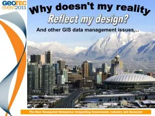
Why doesn't my reality Reflect my design? And other GIS data management issues… The New Geospatial Enterprise: Integrating Government, Industry and Research
Purpose of the presentation • To describe GIS data management issues encountered at the CoV including: • Branch need vs. Corporate need • Data duplication • Design vs. As-built • To describe how the CoV is using a new technology to address some of our historical data discrepancies The New Geospatial Enterprise: Integrating Government, Industry and Research
The City of Vancouver • 8th largest city (578,000) and 3rd largest metropolitan area (2.1 million) in Canada • Considered to be one of the most livable City’s in the world (42nd most expensive) • Hosted the 2010 Winter Olympics • Home of the ‘almost’ Stanley Cup champion Vancouver Canucks
GIS at the City • We manage • Over 232 kms of Sewer pipes • Over 412 kms of Water lines • 4647 Parking meters • Over 100,000 property parcels • 50,000 + Street poles • VanMap and Open Data web sites winning numerous innovation awards and kudos like: ‘City of Vancouver Wins Top Innovator Award from BC Business for Open Data site’ So what issues could we possibly have!!??? The New Geospatial Enterprise: Integrating Government, Industry and Research
Imagine you are god… You design the most beautiful creature ever to be seen on earth…. The New Geospatial Enterprise: Integrating Government, Industry and Research
Then one day you are walking around down there… The New Geospatial Enterprise: Integrating Government, Industry and Research
And you run into your creation… Hi God! The New Geospatial Enterprise: Integrating Government, Industry and Research
Seems someone made some changes during construction and forgot to tell you… Welcome to the world of GIS data management! The New Geospatial Enterprise: Integrating Government, Industry and Research
Overview • Data has been compiled over many years using: • a variety of tools • a wide assortment of accompanying methodologies • Variation in acquisition and input create discrepancies in: • positional accuracy • completeness • currency The New Geospatial Enterprise: Integrating Government, Industry and Research
Culture • In 1997 the CoV: • de-centralized Mapping & CADD function • gave control of the GIS data entry staff to the individual branches • Rationale primarily administrative • Impact of decision not felt until many years later The New Geospatial Enterprise: Integrating Government, Industry and Research
Branch vs. Corporate need ‘the needs of the many don’t always outweigh the needs of the few’ • Data isn’t always ‘wrong’ • ‘Input based on the needs of the data owners at the time • creating node–arc–node connectivity was secondary to a good looking map The New Geospatial Enterprise: Integrating Government, Industry and Research
Requirement interpretation • An example is the sewer main below 15.5m 5.2m 5.7m The New Geospatial Enterprise: Integrating Government, Industry and Research
Data Duplication • Silos • Shared responsibilities The New Geospatial Enterprise: Integrating Government, Industry and Research
Data Duplication The New Geospatial Enterprise: Integrating Government, Industry and Research
As-builts • Business process issue • GIS data entered based on the designed version • Modified in the field • Changes not brought back into the office • Result = GIS does not reflect reality The New Geospatial Enterprise: Integrating Government, Industry and Research
Issues well-hidden • 1990’s data issues were annoyances only • Impact on the business was small • Data access limited • Silos restricted sharing The New Geospatial Enterprise: Integrating Government, Industry and Research
Web Mapping 1999-2001 • GIS web mapping technologies made access to the data much simpler • Users not really using the data beyond viewing and printing it out The New Geospatial Enterprise: Integrating Government, Industry and Research
Asset Management • Engineering implements asset management system in 2009 • Assets needed to be • tracked • valued • Depreciated (and appreciated ) • available to assign work orders and service requests to • Primary source was GIS data • Data migration raised questions • Analytics required ‘good’ data The New Geospatial Enterprise: Integrating Government, Industry and Research
Open Data • Decision by council to make all of our data available to the public • Exposed the data to further scrutiny and raised questions as to the overall value of the data released • Disclaimers • ‘as is, where is’ • ‘buyer beware’ The New Geospatial Enterprise: Integrating Government, Industry and Research
Shared Services • Shift in the City’s cultural paradigm • Reversal of the decentralization model of the mid to late 90’s • Brought the departmental GIS groups together with a new common mandate • Corporate onus shifted from application development to data management • GIS data entry staff remain decentralized The New Geospatial Enterprise: Integrating Government, Industry and Research
Asset Management group • Engineering department • Mandate includes: • metrics and tools to mine the asset data for the purposes of advanced asset analysis • Relationship established with the Corporate GIS group • intent of addressing data management issues The New Geospatial Enterprise: Integrating Government, Industry and Research
Mobile GIS data collection pilot • Pilot project • McElhanney acquired the Canadian rights to a mobile mapping technology called GeoAutomation • CoV saw a presentation at a GIS conference and could envision it as one solution to the issues described The New Geospatial Enterprise: Integrating Government, Industry and Research
Business value • Keys are: • Capability to use the imagery and tracking points captured to confirm and clean up our existing data • ability to capture data that we don’t currently have spatial records for • Above ground data issues only • Doesn’t address ‘sustainment’ process issues The New Geospatial Enterprise: Integrating Government, Industry and Research
Project scope • Entire length of Kingsway, Boundary Rd to Main St • City supplied much of the ground control • Contracted vendor was required to fill in stretches with appropriate photo control points as needed The New Geospatial Enterprise: Integrating Government, Industry and Research
GeoAutomationOverview Survey-Enabled Streetscape Imagery The New Geospatial Enterprise: Integrating Government, Industry and Research
So, what exactly, is survey-enabled imagery? Imagery that allows users to simply point and click on their office workstation screen to “survey” or map features. x, y and z values are directly input to your CAD or GIS. Each pixel has a potential x, y and z value. Direct input of points, line strings and polygons. Plug-ins for ArcGIS, MicroStation and AutoCAD. The New Geospatial Enterprise: Integrating Government, Industry and Research
Cameras and Collection • Cameras collect and compress 11 frames per second • Each camera has it’s own computer with a 1.5 TB or 2.0 TB storage capacity • Optimal collection speed is 35km (22 miles) per hour • 30 - 40 GB of image data per km The New Geospatial Enterprise: Integrating Government, Industry and Research
Image Overlap The New Geospatial Enterprise: Integrating Government, Industry and Research
Image Processing Processed Feature Point Cloud Processed Feature Points or ‘Tracks’ The New Geospatial Enterprise: Integrating Government, Industry and Research
Track Points • Track points are easy to find in urban digital imagery: • At intersections of linear features; • Along linear features; and • At locations of image contrast The New Geospatial Enterprise: Integrating Government, Industry and Research
Accuracy Expectations The New Geospatial Enterprise: Integrating Government, Industry and Research
Asset Inventory: The New Geospatial Enterprise: Integrating Government, Industry and Research
Auto Feature Recognition: 3D or 2D location Signs Manholes Valve Covers Hydrants Catch Basins The New Geospatial Enterprise: Integrating Government, Industry and Research
GIS Data Collection and Verification: The New Geospatial Enterprise: Integrating Government, Industry and Research
Engineering Survey and Design: • Most useful in road redesign projects: • Cross Section Surveys • Topographic Mapping • Volumes • Site Surveys • Other Applications: • Slope Analysis • Terrain Modeling • Pavement Distress Evaluation • Route Condition Inventory The New Geospatial Enterprise: Integrating Government, Industry and Research
Pavement / Road Condition Inventory: The New Geospatial Enterprise: Integrating Government, Industry and Research
Virtual As-Builts: Vectors overlain on imagery Camera view angle The New Geospatial Enterprise: Integrating Government, Industry and Research
3D Modeling: The New Geospatial Enterprise: Integrating Government, Industry and Research
Additional Applications: • Property Assessment • Forensics / Accident Investigation • Code Enforcement The New Geospatial Enterprise: Integrating Government, Industry and Research
Benefits: • 24/7 Virtual Visits. • Reduced Field Collection Time. • No GPS Problems. • No Weather Delays. • Workplace Safety Improvements. • Improved Database Confidence. • Additional Value from Image Library. • Productivity Improvements. • Reduced Carbon Footprint. The New Geospatial Enterprise: Integrating Government, Industry and Research
GeoAutomation Demo The New Geospatial Enterprise: Integrating Government, Industry and Research
Benefits: The New Geospatial Enterprise: Integrating Government, Industry and Research
Study Area • Kingsway Westbound • North side of Kingsway • Ormidale St to Sidney St • 19 block stretch • Focus on • Street Light Poles (49) • Litter Cans (12) • Hydrants (25) The New Geospatial Enterprise: Integrating Government, Industry and Research
What do we want to know? • Given that variation in acquisition and input create discrepancies in: • positional accuracy • completeness • Currency Questions: • How complete & up-to-date is the data? • What is the range of variation in positional accuracy? The New Geospatial Enterprise: Integrating Government, Industry and Research
Completeness & Currency • Newly installed assets • Uninstalled assets still showing • Moved assets The New Geospatial Enterprise: Integrating Government, Industry and Research
Poles have been uninstalled New Pole installed The New Geospatial Enterprise: Integrating Government, Industry and Research
New Litter Can installed The New Geospatial Enterprise: Integrating Government, Industry and Research
Completeness & Currency There is an installed asset here. The New Geospatial Enterprise: Integrating Government, Industry and Research
New data collection *Bulk collected using Auto Feature Recognition* The New Geospatial Enterprise: Integrating Government, Industry and Research
Variation in positional accuracy • GeoAutomation assumed to be accurate • locations mapped with relative confidence (Projection Error < 1) • Compared our dataset with asset locations collected using GeoAutomation • CoV data accuracy is determined by relative offset to GeoAutomation location The New Geospatial Enterprise: Integrating Government, Industry and Research