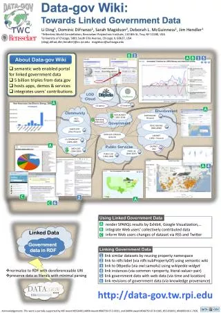
Linked Data Practices for the Geospatial Community
Linked Data Practices for the Geospatial Community. Talk subtitle. Presented at GEOSS Workshop on Climate Boulder Colorado, 23 September 2011 Stephan Zednik, zednis@rpi.edu RPI / Tetherless World Constellation. Value Proposition of Linked Data. Discover

Linked Data Practices for the Geospatial Community
E N D
Presentation Transcript
Linked Data Practices for the Geospatial Community Talk subtitle Presented at GEOSS Workshop on Climate Boulder Colorado, 23 September 2011 Stephan Zednik, zednis@rpi.edu RPI / Tetherless World Constellation
Value Proposition of Linked Data • Discover • Web resources ‘easy’ to generate and link to • Access • Leverage HTTP methods • Integrate • RDF is a standard mechanism for specifying the existence and meaning of connections between items described in the data • Use • Web standards for data access and representation simplify data consumption while providing (extreme) expressivity
Principles of Linked Data There are 4 principle expectations (rules) for Linked Data • Use URIs as names for things • Use HTTP URIs so that people can look up those names • When someone looks up a URI, provide useful information, using the standards (RDF*, SPARQL) • Include links to other URIs, so that they can discover more things
Linked Data Languages • SKOS (Simple Knowledge Organizational System) • Thesauri, Taxonomies, Topical Hierarchies • RDFS (RDF Schema) • Vocabularies • OWL (Web Ontology Language) • Ontologies • RDFS+ • RDFS + Subset of OWL
Reuse • Key factor in re-usability of data: structure • Regular and structured is • Easier to find • Easier to make tools for • More likely to be referenced • and therefore beneficiary of network effect
Re-use Concerns • Usage & Uptake • Maintenance & Governance • Coverage • Expressivity • Modularity
Finding Vocabularies • No current definitive directory to find existing vocabularies • SchemaWeb, SchemaCache, Swoogle • Statistics on usage of vocabularies in the wild • Section 2.3 of the State of the LOD Cloud • http://lod-cloud.net/state#terms
Using Vocabularies • If suitable terms are found, they should be re-used • Maximizes potential for consumption • Network effect on re-used vocabulary • New terms should be mapped to well-established existing vocabularies • Standards bodies useful to establish & promote vocabularies • Network effect long-term driving factor • Example: FOAF
W3C Geo Vocabulary • Basic RDF vocabulary that provides a namespace for representing latitude, longitude, and other spatially located things using WGS84 as a reference datum • http://www.w3.org/2003/01/geo/ • Wideusage, but far toosimple for GIS tools <rdf:RDFxmlns:rdf="http://www.w3.org/1999/02/22-rdf-syntax-ns#" xmlns:geo="http://www.w3.org/2003/01/geo/wgs84_pos#"> <geo:Point> <geo:lat>55.701</geo:lat> <geo:long>12.552</geo:long> </geo:Point> </rdf:RDF>
OGC GeoSPARQL • Includes • RDF/OWL Vocabulary for representing spatial information • A set of functions for spatial computations • A set of query transformation Rules • Expressivity for GIS tool requirements • http://www.opengeospatial.org/projects/groups/geosparqlswg
Discovering Linked Data • ‘Standard’ discovery of linked data is via other linked data… • OpenSearch • Version 1.1 Geo extension (very basic) • Semantics? • DataCasting • ProductCasting • InventoryCasting • ServiceCasting
Querying Linked Data • SPARQL Endpoint • Requires understanding of structure • Generally domain agnostic • Faceted Browsing • Pelorus • http://clarkparsia.com/pelorus • S2S • http://tw.rpi.edu/web/project/sesf/workinggroups/s2s • Supports Widgets
Services & Linked Data • SOAP Web Services and Linked Data are not complementary • Document exchange vs Web of Data • SOAP ignores HTTP access semantics • REST (Representational State Transfer) • HTTP as a mechanism for retrieval of resource representations exposed via URIs • Resource Orientated Architecture (ROA) • Stateless interactions • Linked Data and RESTful services can be complementary • Will take care in design
Questions? • Stephan Zednik, zednis@rpi.edu
References • Tom Heath and Christian Bizer (2011) Linked Data: Evolving the Web into a Global Data Space (1st Edition) Synthesis Lectures on the Semantic Web: Theory and Technology, 1:1, 1-136. Morgan & Claypool. • DOI: 10.2200/S00334ED1V01Y201102WBE001 • http://linkeddatabook.com/editions/1.0/ • GeoSPARQL SWG • http://www.opengeospatial.org/projects/groups/geosparqlswg • JPL Datacasting • http://datacasting.jpl.nasa.gov/ • Pelorus • http://clarkparsia.com/pelorus • S2S • http://tw.rpi.edu/web/project/sesf/workinggroups/s2s