Download
1 / 20
220 likes | 421 Vues
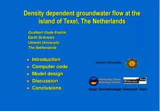
Density dependent groundwater flow at the island of Texel, The Netherlands. Gualbert Oude Essink Earth Sciences Utrecht University The Netherlands. Introduction Computer code Model design Discussion Conclusions. Introduction. Salt water intrusion at Texel. Introduction.

E N D
Density dependent groundwater flow at the island of Texel, The Netherlands Gualbert Oude Essink Earth Sciences Utrecht University The Netherlands • Introduction • Computer code • Model design • Discussion • Conclusions
Introduction Salt water intrusion at Texel
Introduction Present ground surface in the Netherlands
Introduction The island of Texel • Tourist island in summer time • Land surface: 130 km2 • Polder areas: • 1. Eijerland • 2. Waal en Burg • 3. Dijkmanshuizen • 4. Hendrik polder • Sand-dune area at western side • ‘De Slufter’ is a tidal salt-marsh • North Sea surrounds the island
Introduction Present phreatic water level in top layer 2000
Introduction Present chloride concentration in top layer 2000
Computer code MOCDENS3D = MOC3D (Konikow et al., 1996) but adapted for density differences • density dependent groundwater flow • Darcy • continuity • solute transport • advection • hydrodynamic dispersion • displacement of fresh, brackish and saline groundwater • linear relation between density & concentration
Computer code Groundwater flow equation (MODFLOW, 1988) Darcy Continuity Freshwater head Advection-dispersion equation (MOC3D, 1996) Equation of state: relation density & concentration
Model design • Effective porosity: 0.3 • Anisotropy: 0.4 • Hydrodynamic dispersion: • aL=2 m, aTH=0.2 m, aTV=0.2 m • molecular diffusion=10-9 m2/s • Density groundwater: • fresh rf=1000 kg/m3, saline rs=1024 kg/m3 Boundary conditions: • No flow at sea side • Neumann in dunes: natural recharge of 1 mm/day • Dirichlet in polder area: constant phreatic water level Subsoil parameters:
Model design ---> aquifer 1: kh=~5 m/day (intersected by aquitards) ---> aquifer 2: kh=~30 m/day (intersected by aquitards) ---> aquitard 1: kh=0.01 to 1 m/day ---> aquifer 3: kh=~30 m/day (intersected by aquitards) ---> aquifer 4: kh=2 m/day ---> aquifer 5: kh=10 to 30 m/day Subsoil composition (simplified):
Model design • Number of elements nx=80, ny=116, nz=23 total number of active elements: ~125000 • Sizes of elements: Dx=250 m, Dy=250 m, Dz=1.5 to 20 m • Particles per element: 8 • Flow time step: 1 year • Convergence criterium: 10-5 m Model parameters:
Discussion Calculated present seepage and infiltration at -1.5 m M.S.L. 2000
Discussion Calculated present salt load at -1.5 m M.S.L. 2000
Discussion • Modelling of two sea level rise scenarios: • I. Present mean sea level during 200 years • II. Relative sea level rise of 0.75 m/century during 200 years Interest is focused on: A. Change in concentration in top layer B. Change in seepage in polders C. Change in salt load in polders
A. Change in concentration in top layer Scenario I: present mean sea level during 200 years 2000 2200
A. Change in concentration in top layer Scenario II: relative sea level rise of 0.75 m/c during 200 years 2000 2200
A. Change in concentration in row 76: East-West profile Scenario II: relative sea level rise of 0.75 m/c during 200 years 2000 2200
B. Change in seepage Scenario II: relative sea level rise of 0.75 m/c during 200 years 2000 2200
C. Change in salt load Scenario II: relative sea level rise of 0.75 m/c during 200 years 2000 2200
Conclusions: • numerical dispersion is limited (no Peclet number problems) • initial density distribution is difficult to determine • present situation is not in a dynamic equilibrium • salinisation during coming 200 years is significant due to: • the present difference in polder level and sea level • the sea level rise • effect of sea level rise: • accelerates the salinisation process • salt load and seepage in polders increases substantial