Download
1 / 39
400 likes | 754 Vues
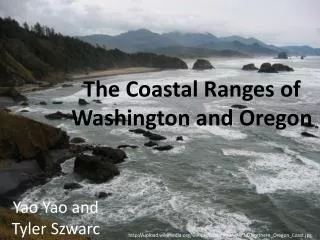
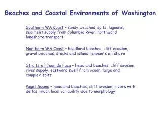
Beaches and Coastal Environments of Washington. Southern WA Coast – sandy beaches, spits, lagoons, sediment supply from Columbia River, northward longshore transport Northern WA Coast – headland beaches, cliff erosion, gravel beaches, stacks and island remnants offshore

E N D
Beaches and Coastal Environments of Washington Southern WA Coast – sandy beaches, spits, lagoons, sediment supply from Columbia River, northward longshore transport Northern WA Coast – headland beaches, cliff erosion, gravel beaches, stacks and island remnants offshore Straits of Juan de Fuca – headland beaches, cliff erosion, river supply, eastward swell from ocean, large and complex spits Puget Sound – headland beaches, cliff erosion, rivers with deltas, much local variability due to morphology
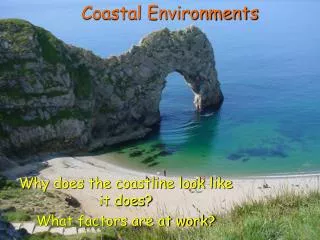
Wind patterns affecting WA state Winter Conditions Low-pressure systems generate winds from S and SW, which push water against coast – causing storm surge Summer Conditions High-pressure systems generate winds from N and NE, which pull water away from coast – causing deep water to upwell with nutrients Winter conditions dominate longshore transport
Seasonal changes in water level and wave height May August December March Sea level ~0.5 m rise due to winds during winter Wave height increases from ~1 m in summer to ~4 m in winter
Seasonal changes in wave period and direction May August December March Wave periods (and wavelengths) reach a maximum in winter 290 deg 250 Wave direction from SW during winter, from NW during summer
Pathways for Columbia River sand Predominant direction of transport is northward Sand going to beach is small portion of total supply
Sediment source for southern WA coast beaches Dams placed on Columbia River during 20th century likely trapped much of sand supplied to beaches Columbia discharge ~10 million tons/y [Mississippi ~200 million tons/y Amazon ~1000 million tons/y]
Southwest Washington Coastal Erosion Study Beach profiles collected seasonal from a number of beach-perpendicular transects
Observations of submarine beach profile Very difficult to obtain accurately Data now collected using jet skis with depth recorder and GPS
Changes in beach profiles S 00 S99 S 98 S 97 W 99 W98 W97 Winter 98 profile (yellow) is lower than Summer 97 profile (red) due to seasonal erosion Summer 98 profile (green) is higher and shows berm and bars moving onto beach 2- and 3-m contours (above MLLW) show erosion during winter (landward migration) and deposition during summer, with a net movement landward between S 97 and S 00
Shoreline changes over many decades Sand accumulation occurred before 1950 Rate of accumulation slowed since then Severe erosion on north side of Willapa Bay Inlet has continued through period South side of Grays Harbor Inlet accumulated much sediment before 1950, but has eroded since building jetty
Pathways for Columbia River sand Predominant direction of transport is northward Sand going to beach is small portion of total supply
Elwha River Drainage basin within Olympic Mountains, supplies sediment to Straits JdF Two dams have trapped sediment since 1912 and 1926, nearly eliminating supply Scheduled for removal
Elwha River Delta Paleo spits? Subaqueous topset Paleo spits similar to the present Ediz Hook Modern spit Ediz Hook Mouth Valley Elwha River 4 km
Multibeam Bathymetry -29 m -22m 1 -16m 2 3 Bathymetric Profile -29 m -16 m -22 m 1 2 3
Puget Sound Predominant north-south orientation Complex morphology Glacial history River supply and cliff erosion Energetic, but variable wave activity Strong tidal currents
Holocene sea-level rise Glacial rebound had strong impact on local sea level during early Holocene, especially in northern Puget sound – sea level fell
Recent rise in Puget Sound sea level For past century, sea-level rise has been ~2 mm/y, similar to global sea-level rise
Puget Sound Predominant north-south orientation Complex morphology Glacial history River supply and cliff erosion Energetic, but variable wave activity Strong tidal currents
Skagit River northfork Skagit River southfork Saratoga Passage Skagit Bay Tidal flats
Local variability in longshore transport Due to orientation of land masses and direction of winds Results in dramatic heterogeneity of transport processes: convergent and divergent transport causes deposition and erosion differences over small scales
Typical Puget Sound Beach Gravel foreshore and sandy low-tide terrace
Impact of waves and tides Water level rises, exposing higher areas (including cliffs) to erosion Wave energy increases, moving sediment seaward and alongshore Equilibrium profile develops, depending on importance of across-beach and alongshore transport
Differences in beach profiles Where across-beach transport dominates, sediment profile changes depending on wave conditions Where alongshore transport dominates, profile remains similar but moves landward or seaward
Impacts of biogenic materials Oyster beds Drift Wood Stabilize intertidal and supratidal regions of beach profile
Impacts of seawalls They help stabilize shoreline, but increase wave energy Waves reflect back, rather than break Superimposed wave height causes stronger wave motions – coarsens seabed and removes subtidal eelgrass (which is important for stabilizing seabed, and providing biohabitats)
Other stupid human tricks Other Stupid Human Tricks Sand mining and slope failures destabilize beach profile