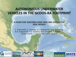
GCOOS Update
GCOOS Update. Ann E. Jochens GCOOS Regional Coordinator Texas A&M University College Station, Texas GCOOS Education and Outreach Council Meeting Spanish Fort, Alabama 18 June 2007. GCOOS Update. Board Semi-Annual Meetings GCOOS Workshops 2006-2007 Grant Proposals in Process.

GCOOS Update
E N D
Presentation Transcript
GCOOS Update Ann E. Jochens GCOOS Regional Coordinator Texas A&M University College Station, Texas GCOOS Education and Outreach Council Meeting Spanish Fort, Alabama 18 June 2007
GCOOS Update • Board Semi-Annual Meetings • GCOOS Workshops 2006-2007 • Grant Proposals in Process
Board Semi-Annual Meetings • 24-25 August 2006, St. Petersburg, FL • 6-7 March 2007, New Orleans, LA • Major topics were stakeholder priorities, selection of pilot projects to try to move forward, and funding sources (see workshops, pilot project, and proposal status reports given below) • Meeting reports, including presentations shown, are in the GCOOS web at http://www.gcoos.org
GCOOS Workshops 2006-2007 • General GCOOS Workshop Information • Storm Surge And Inundation Workshop results • Future Workshops • Status of Pilot Project selected by the Board for advancement
Identification of Stakeholder Requirements • We are working to: – identify observations and products needed by users – estimate economic benefits of these needs – prioritize these needs – plan and initiate pilot projects to enable these needs to be met • Mechanisms used: – Workshops & Meetings with Stakeholders • Development of Business Plan • Development of Observing System Plan • Task Team on Public Health
GCOOS Workshops Goal of Focused Sector Workshops: The primary objective is to identify prioritized measurements and products of value to the sector. This is important to build the GCOOS user base, identify and implement needed observing system elements, provide rationale and priorities for developing GCOOS, and build advocacy.
GCOOS-SECOORA Storm Surge and Inundation Workshop, 23-25 Jan. 2007, New Orleans, LA • To identify, with priorities, measurements and products needed to better predict and mitigate effects of storm surge and inundation in the southeastern U.S. and Gulf of Mexico. • To suggest a few high priority pilot projects that might be undertaken soon to advance the development of the higher priority measurements and products. • To provide estimates of annual economic benefits of the identified measurements and products as feasible.
Workshop priorities (1) 1. Accurate bathymetry and topography with consistent vertical control between various data sets 2. Data on sea level, winds, waves, etc. for use in forecast models, nowcast analyses, and forensic reports. Hardened data collection and communications. 3. Improved forecasts of inundation. Ensemble forecasts are needed. These should include heights of surge, tides, wave set up, precipitation, and river flow, as well as waves. 4. Improved inundation maps for hazard mitigation planning. This requires updated probabilistic methods, improved models, use of forensic data, and improved, easy access to archived data.
Workshop Priorities (2) 5. Inreach communication among emergency managers, community planners and others to develop and present consistent messages, to build expertise, and to develop a sense of "community". 6. A clearing house for pre- and post-storm information. This might have both a public access and an access only for operational users. It should include both pre-storm data (e.g., areal photos and post-storm information) for use by teams during rescue and adjustors. 7. Forensic engineering studies to access wind and flood inundation damage
Workshop Priorities (3) Others, unranked: • Augmented Safir-Simpson scale for hurricanes with additional information. • Improved public outreach • A clear process for moving storm surge models from research to operational status
Recommended Pilot Projects (1) • Benefit-cost analysis to determine value of having current 24-hour-quality forecast at 48 hr. Use data from various past events (Floyd, Rita, Georges, Katrina) • Compile/develop standardized methods to measure surge elevations. Include gages, other sensors, HWMs. Utilize best practices that are out there.
Recommended Pilot Projects (2) • Work with EM community to develop sample inundation forecast products for decision-making at various time steps (96/72/48/24 hr). Products should give easily digestible info, and not overwhelm individual with too many separate maps for each step. • Develop prototype of surge event clearinghouse. Needs assessment to get components/players. Must include min. standards/QC for data (avoid “landfill” syndrome). Can include key staff/ capabilities wanted for EOC (e.g., Science Coord., GIS expertise)
Recommended Pilot Projects (3) Sensistivity runs of storm surge models to help determine required horizontal and vertical resolutions of bathymetry.
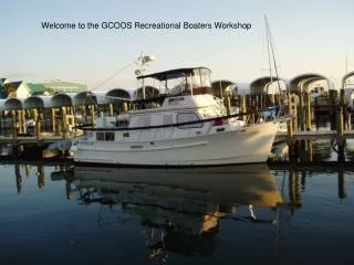
Future Focused Stakeholder Workshops • Fisheries—Commercial, recreational, and regulatory. Seeking assistance from the Gulf of Mexico Fishery Management Council (meeting held), Gulf States Marine Fisheries Commission (meeting held), and NOAA Southeast Fisheries Research Center (in planning), & state fishery agencies (to be planned). • Maritime transportation elements—including tanker traffic, container ships, cruise ships, shipping agents, port authorities, pilots, LNG carriers, intercoastal waterway traffic, and commercial transportation of people. • Recreational boating—including marina operators, power squadrons, yacht clubs, marina operators, and retailers. • Urban planners/developers
Public Health • High level of activities on public health have resulted in recommendations • IOOS Public Health Workshop, Jan. 2006 • The Gulf of Mexico Alliance • Standing GCOOS Task Team on Public Health has been created and work is in progress • Terms of Reference call for Team to advise GCOOS Board regarding priority measurements and products • Efforts underway to make beach water quality data in Florida available, either through NCDDC or GCOOS-RA site; other states will then be addressed
Status of Pilot Projects:Moving Forward 1 • Water quality measurements for human pathogens (Bart Bibler) • Florida system well-underway to being established • Discussions with other states initiated • Improving forecasts of hurricane severity (Cort Cooper) • Assessment of existing activities completed • Letter of support for NOAA research project • Letter of endorsement for research concept stated in HiFi project
Status of Pilot Projects:Moving Forward 2 • Pilot GCOOS Operations Center (Raymond Toll) • Community comments received and incorporated • Data Portal proposed to NOAA (see Proposal Progress report) • Forecasts of three-dimensional surface currents (Cort Cooper) • Community comments received and incorporated • Proposed to NOAA (see Proposal Progress report)
Status of Pilot Projects:Prospectii in Preparation • Instrument tankers (Mark Luther) • Probability maps of bottom hazards and maps of hydrocarbon seeps (Alfredo Prelat) • Measurement and products archive (Worth Nowlin) • Maps of marine mammals and endangered turtles (Deferred)
Proposals in Process - NWQMC National Water Quality Monitoring Network for U.S. Coastal Waters and their Tributaries: Announcement of Pilot Studies and Request for Statement of Interest • GCOOS-RA partnered with the Gulf of Mexico Alliance (GOMA); GOMA was lead • NO FUNDS WERE OFFERED by NWQMC • GCOOS-RA to provide relevant inventory and gap analysis information, expertise on DMAC and ocean observing systems, and report review • GOMA Submitted to NWQM Council on 23 February 07 • NWQMC did not select the GOMA/GCOOS pilots
Grant Proposals in Process-NOAA • Notification from NOAA on 15 June 2007 • Focus Area 2: 3-D Model - Declined • Focus Area 3: Local Data Nodes - fully funded, years 2 and 3 are contingent on NOAA appropriations • Focus Area 1: HF Radar and Data Portal - $500K for year 1 only
Focus Area 3: Local Data Nodes • Fully funded: $898,304 over 3 years • Years 2 and 3 contingent on NOAA appropriations • E/O components (~1/2 of E/O funds each) • Training to Nodes personnel • Training to E/O personnel (will be through subcontract) • E/O subcontract (excludes TAMU indirect) • Year 1: $10,500 • Year 2: $16,000 • Year 3: $19,100
Task 6 Building Education and Outreach (E/O) User Utility in IOOS DMAC A key goal of the GCOOS-RA is to build user utility into the data sets and products. One aspect of this is to provide training to those who will interface with stakeholders and the public—train the trainers. Task 6 is designed to entrain part of the GCOOS education and outreach community into the world of IOOS Information Technology, data standards and protocols, and data nodes. We plan to form a small working team of educators, consisting of the GCOOS E/O Coordinator and a group of 4-6 members selected from the GCOOS Education and Outreach Council (EOC) and/or others as identified by the EOC. The E/O Coordinator will interface with the Data Nodes IT team and obtain comparable training to understand technologies, protocols, and standards. A subset of the Education and Outreach Council or others selected by that council, who have interest and some IT skills will be identified. Our target is to have at least one member from each of the 5 Gulf Coast states. The E/O Coordinator will provide training to the identified personnel so they can serve as a user interface and work as a subgroup on IT related issues associated with the education and outreach side of the IOOS DMAC. As funding allows, this subgroup, including the E/O Coordinator, will assist in identification and development of IT-related products for the education/outreach community stakeholders. We anticipate that the work will be conducted under a subcontract to the J.L. Scott Marine Education Center, University of Southern Mississippi, with Sharon Walker, PI, and Tami Wells, GCOOS E/O Coordinator. The subcontractor will be assisted by Mike Spranger, EOC Chair, and the GCOOS Education and Outreach Council (see Appendix C4 for Dr. Spranger's resume and Appendix F for a listing of EOC members). We have set the E/O milestones to coincide with the regional planning meetings.
Task 6 Building Education and Outreach (E/O) User Utility in IOOS DMAC EOC Action: Identification of E/O Working Team Members GCOOS Office Action: Set up subcontract with USM for E/O Coordinator work
Focus Area 1: HF Radar and Data Portal • $500K for year 1 only • Reviewer Comments • Observations not well integrated for costs • E/O not clear for costs • Data portal needed • Revision submittal in process - due to NOAA 22 June 2007 • E/O component would be $50K (including indirect)
Focus Area 1: HF Radar and Data Portal Proposal Quote • “The PIs will work closely with the Education and Outreach Council and Coordinator to design survey documents, make personal contacts and lead group efforts to further identify user needs, particularly determining the data and low-level products needed for education/educators that could be delivered through the data portal. This needs assessment will require establishing strong linkages between data providers and our Education and Outreach team (by, e.g., HF Radar and Data Portal Workshop, Section 2.4.2.3).”
Focus Area 1: HF Radar and Data Portal Proposal Quote • “This project also will result in education and outreach activities of benefit to the development of GCOOS. We will integrate our E & O community with data providers. We will provide via the portal those products identified by a needs assessment as requirements by a broad base of users in so far as the products can be produced routinely by computer from available data streams. Initial focus bill be on development of new products provided via the portal that support decision support tools of promise to the IOOS and educators. The latter case will include data and products tailored for classroom use to supplement or as part of curricular modules. We will prepare an assessment of user satisfaction with and, as feasible, benefits derived from information served via the portal. We will prepare exhibits for use in GCOOS E &O actions.”
Focus Area 1: HF Radar and Data Portal • GCOOS Office will work with Sharon Walker, USM, and Tami Wells to set up E/O subcontract • E/O statement of work will be needed • EOC Action: Discussion and advice to Walker, Wells, Jochens on statement of work by COB Monday, 6/22 • GCOOS Office Action: Work with Walker, Wells to get necessary paperwork by Wednesday, 6/24
Proposals in Progress - Other Possible Partnership on a Homeland Security Center of Excellence • For study of natural disasters, coastal infrastructure, and emergency management • Major partners are University of Washington, Texas A&M University and Massachusetts Institute of Technology • Center would be housed at the University of Washington • GCOOS effort would be to enhance the storm surge and inundation workshop results through outreach
Questions? Contact Ann Jochens GCOOS Regional Coordinator ajochens@tamu.edu; 979-845-6714
Harmful Algal Blooms: GCOOS Role in Detection, Monitoring, and Prediction Workshop held 13-15 April, 2004 St. Petersburg, FL Objectives: • Review HAB data and information needs of state agencies, coastal zone managers, and scientists in the Gulf • Assess current capabilities of HAB observing system and related efforts in Gulf • Formulate a plan to improve capabilities
Harmful Algal Blooms: The Role of GCOOS in Detection, Monitoring, and Prediction • Formal presentations and breakout sessions focused on needs and priorities. • Agreement on needs for observations, model development, common standards and protocols, research and development. • NOAA Coastal Services Center published a workshop report, “Action plan for harmful algal blooms and the Gulf of Mexico Coastal Ocean Observing System: Results from a regional workshop” (NOAA/CSC/20516-PUB). http://www.csc.noaa.gov/crs/habf/HAB_GCOOS_report.pdf. • The EPA Gulf of Mexico Program prepared a document giving needed enhancements and budgets following the workshop. • Using that information, Tom Malone prepared a draft plan for a HAB observing system for the Gulf of Mexico.
GCOOS and the Private Sector: Oil and Gas and Related Industry Workshop2-4 November 2005Houston, Texas Workshop Objectives: • Obtain agreement on a short list of recommended products of highest priority to these industry sectors. • Identify users for these priority products. • Obtain guidance regarding what observations are needed to produce these products. • Discuss which products are for common use, and so likely produced at government expense, and which are niche products, best produced by the private sector.
Heather W. Atkinson, BP Exploration & Production Inc. Gail Baxter, Marathon Oil Co. Mr. Landry Bernard, National Data Buoy Center Dr. Lisa Campbell, Texas A&M University Andrew Clark, Ocean.US Bob Cohen.Weathernews Americas Inc. Dr. Cortis Cooper, Chevron Dr. Steven DiMarco, Texas A&M University David Driver, BP America Inc. Mr. James Feeney, Horizon Marine Inc. Dr. Sergey Frolov, Accurate Environmental Forecasting Inc. Mr. Michael Gamble, The Boeing Company Ms. Sherryl Gilbert, The Alliance for Coastal Technologies, GoM Tom Gustafson, Nova Southern University Jill Hasling, Weather Research Center Fred Hefren, Minerals Management Service Jim Hiney, Texas Sea Grant College Program Dr. Ann Jochens, Texas A&M University Jim Kruse, TTI/Texas Sea Grant Dr. Mark Luther, University of South Florida / ACT Mr. John Macleod, Evans Hamilton, Inc. Dr. Robert Martin, Texas General Land Office Dr. Thomas McGee, University of Mississippi Michelle McIntyre, Alliance for Coastal Technologies Dr. Tom Mitchell, Consultant Dr. Paul Moersdorf, National Data Buoy Center Mr. Geoffrey Morrison, International SeaKeepers Society Prof. Worth D. Nowlin, Texas A&M University Anthony Pesek, U.S. Coast Guard Marine Safety Unit Galveston Mr. Henry (Tucker) Pierce, SAIC Dr. Alfredo Prelat, PAR Government Mr. Ralph Rayner, Ocean Numerics Mr. Glenn Roach, Citgo Petroleum Mr. James Robinson, BP Exploration & Production Inc. Dr. Dail Rowe, Accurate Environmental Forecasting Inc. Mr. Kenneth Schaudt, schaudt.us Prof. Alex Soloviev, NOVA Southeastern University Oceanographic Center Mr. David Szabo, Ocean Numerics Ray Toll, SAIC Dr. Rex Tracy, PAR Government Mr. Jan van Smirren, Fugro GEOS Inc. Mr. Michael Vogel, Shell International EP Dr. Ian Voparil, Shell Mark Walquist, Wilkens Weather Technologies Prof. Robert Weisberg, University of South Florida Attendees at Oil & Gas Workshop–November 2005
GCOOS O&G Workshop’sRecommended Products and Measurements:ResultsPresentedatWorkshopConclusion
GCOOS Pilot Projects:A Workshop Product Definition: A pilot project is defined as an organized, planned set of activities with focused objectives designed to provide an evaluation of technology, methods, or concepts within a defined schedule and having the overall goal of advancing the development of the sustained, integrated ocean observing system. A pilot project may be targeted to improvements in measurements, data management, products, education, outreach or a combination of these. Each GCOOS Pilot Project will have a tangible result within a known time frame on which we can build for the future. Specifically, the outcome of a pilot project should result in a recommended pathway for converting the workshop deliverables into an operational product.
Recommended Pilot Projects • Forecasts of three-dimensional currents • Measurement and products archive • Maps of marine mammals and endangered turtles • Probability maps of bottom hazards and maps of hydrocarbon seeps • Improving forecasts of hurricane severity