Download

1 / 62
620 likes | 880 Vues
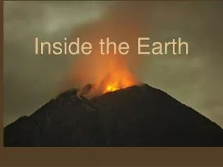
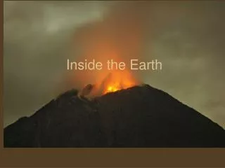
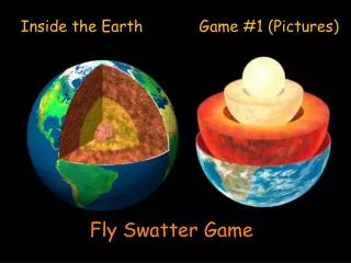
Inside the Earth. This drilling ship samples sediment and rock from the deep ocean floor. It can only sample materials well within the upper crust of the earth, however, barely scratching the surface of the earth's interior. History of the Earth’s Interior.

E N D
This drilling ship samples sediment and rock from the deep ocean floor. It can only sample materials well within the upper crust of the earth, however, barely scratching the surface of the earth's interior
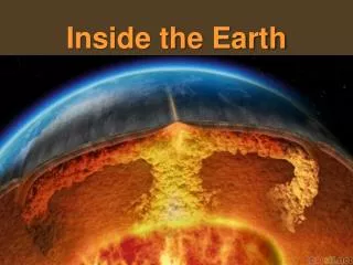
The Earth is thought to have formed some 4.6 billion years ago. • It is thought to have formed from a disk of particles and grains that condensed and then were pulled together by gravitational attraction until it became massive enough to eventually become planet sized.
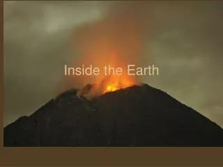
In the early years the Earth was bombarded by fragments that were left over from the formation of new planets and satellites. • This bombardment heated up the Earth’s surface, liquefying the surface to hot, molten lava. • Eventually this magma cooled and formed igneous rocks.
A second heating of the Earth occurred from the inside as uranium, thorium, and other isotopes began to decay. • As the rate of nuclear decay began to slow down, the outer layer (the crust) slowly cooled. • Today the inside is still molten and the crust is cool and hard.
The center of the Earth is an extreme place. • Pressure estimates are 3.5 million atmospheres. • Temperature estimates are 6,000OC (11,000OF)
Seismic Waves • A vibration that moves through the Earth. • Body waves • Seismic waves that travel through the Earth’s interior, spreading outward from a disturbance in all directions.
Two types of body waves • P-waves • A pressure wave where the material vibrates back and forth in the same direction as the wave movement. • Can pass through rock. • Can pass through a liquid
S-waves • A sideways wave in which the disturbance vibrates material side to side, perpendicular to the direction to the wave movement. • Can pass through rock. • Can not pass through a liquid
(A)A P-wave is illustrated by a sudden push on a stretched spring. The pushed-together section (compression) moves in the direction of the wave movement, left to right in the example. (B) An S-wave is illustrated by a sudden shake of a stretched rope. The looped section (sideways) moves perpendicular to the direction of wave movement, again left to right.
Surface Waves • Seismic waves that travel on the Earth’s surface.
Seismograph • The velocity of both S- and P-waves is determined by the density and rigidity of the material. • Waves travel faster in denser more rigid material. • Waves are reflected at boundaries where elastic properties differ. • If the reflected waves reach the surface, they can be measured by a seismograph. • Wave refraction can also be used to determine properties of the interior of the Earth. • Waves are refracted (bent) when they pass from a layer with higher density to a layer with lower density.
Seismic waves require a certain time period to reflect from a rock boundary below the surface. Knowing the velocity, you can use the time required to calculate the depth of the boundary.
(A)A seismic wave moving from a slower-velocity layer to a higher-velocity layer is refracted up. (B) The reverse occurs when a wave passes from a higher-velocity to a slower-velocity layer.
(A)This illustrates the curved path of seismic waves between an explosion and a recording seismograph van. The curved path is caused by increasing seismic velocity with depth in uniform rock. (B) This illustrates increasing seismic velocity with depth in uniform rock. The waves curve out in all directions from a disturbance.
The Crust • The crust is the thin layer of solid, brittle material that covers the Earth. • There are some differences in the crust depending on where on the surface you are. • The crust under the ocean is much thinner than the crust under the continents. • Seismic waves move faster through the oceanic crust that through the continental crust. • The material that makes up the crust is called sial • This is due to the fact that it is mostly made up of rocks containing silicon and aluminum. • The oceanic crust is called sima as it is made up mostly of rocks containing silicon and magnesium.
There is a sharp boundary between the crust and the mantle that is called the Mohorovicic discontinuity or Moho for short. • This is an area of increased velocity of seismic waves as the material is denser in the mantle (due to higher proportion of ferromagnesium materials and the crust is higher in silicates). • There are differences in the material that makes up the continental crust and the oceanic crust. • The continental crust is at least 3.8 billion years old, while the oceanic crust is 200 million years in the oldest parts. • Continental crust is made mostly of less dense (2.7 g/cm3) granite type rock, while the oceanic crust is made of more dense (3.0g/cm3) basaltic rock.
Continental crust is less dense, granite-type rock, while the oceanic crust is more dense, basaltic rock. Both types of crust behave as if they were floating on the mantle, which is more dense than either type of crust.
The Mantle • The mantle is the middle part of the Earth’s interior. • 2,870 km thick between the crust and the core.
At about 400 and 700 km the pressure and temperature of the mantle increase and change the structure of the olivine minerals found. • above 400 km the typical tetrahedral silicate olivines are found with one silicon surrounded by 4 oxygen atoms. • At 400 km, the increase pressure and temperature result in a structure that collapses on itself and produces a silicate that is more dense than that found in the upper 400 km. • At 700 km the structure is changed again, this time to a silicon atom surrounded by 6 oxygen atoms.
Seismic wave velocities increase at depths of about 400 km and 700 km (about 250 mi and 430 mi). This finding agrees closely with laboratory studies of changes in the character of mantle materials that would occur at these depths from increases in temperature and pressure.
700 km is the boundary between the upper mantle and the lower mantle. • No earthquakes occur in the lower mantle.
A Different Structure • Asthenosphere. • A thin zone in the mantle that is from 130 to 160 km deep, where seismic waves undergo a sharp decrease in velocity. • This is a layer of hot, elastic semi-fluid material that extends around the entire Earth. • Lithosphere. • The solid, brittle rock that occurs just above the asthenosphere • Includes the crust, the Moho, and the upper part of the mantle. • Mesosphere. • The material below the asthenosphere.
The earth's interior, showing the weak, plastic layer called the asthenosphere. The rigid, solid layer above the asthenosphere is called the lithosphere. The lithosphere is broken into plates that move on the upper mantle like giant tabular ice sheets floating on water. This arrangement is the foundation for plate tectonics, which explains many changes that occur on the earth's surface such as earthquakes, volcanoes, and mountain building.
Earth’s Core • An earthquake will send out P-waves over the entire globe, except for an area between 103O and 142O of arc from the earthquake. • This is called the P-wave shadow zone, as no P-waves are received here. • P-waves appear to be refracted by the core, which leaves a shadow.
The P-wave shadow zone, caused by refraction of P-waves within the earth's core.
There is also an S-wave shadow zone that is larger than the P-wave shadow zone. • S-waves are not recorded in the entire region more than 103O away from the epicenter. • There appear to be 2 parts to the core. • The inner core with a radius of about 1,200 km (750 mi) • The inner core appears to be solid • The outer core has a radius of about 3,470 km (2,160 mi) • The core begins at a depth of about 2.900 km (1,800 mi)
The S-wave shadow zone. Since S-waves cannot pass through a liquid, at least part of the core is either a liquid or has some of the same physical properties as a liquid.
Isostasy is an equilibrium between adjacent blocks of the crust as they float on the upper mantle. • There is an upward buoyant force that is exerted on the crust by the upper mantle. • This is because there is greater pressure upward from the upper mantle than there is downward from the crust.
Isostatic adjustment. • The crustal plates sink to a depth where the pressure is greater than the downward pressure and they are buoyed up by this increased pressure. • The crust can be viewed as a tall block with a deep root that extends into the mantle.
(A)Isostasy is an equilibrium between the upward buoyant force and the downward force, or weight, of an object in a fluid. (B) The earth's continental crust can be looked upon as blocks of granitelike materials floating on a more dense, liquidlike mantle. The thicker the continental crust, the deeper it extends into the mantle.
The Earth’s magnetic field is produced by the slowly moving liquid part of the iron core. • The Earth’s magnetic field circulates around the geographic poles. • It also undergoes occasional flips of polarity, called Magnetic reversal. • The magnetic orientation that we are currently experiencing has persisted for about 700,000 years and is currently about to undergo another reversal. • Since the magnetic field also deflects cosmic rays, solar wind, and charged particles, this reversal could represent a major environmental hazard for all life on the Earth.
Formation of magnetic strips on the seafloor. As each new section of seafloor forms at the ridge, iron minerals become magnetized in a direction that depends on the orientation of the earth's field at that time. This makes a permanent record of reversals of the earth's magnetic field.
There are several lines of evidence for this reversal of field. • Iron particles found in Roman artifacts show that the Earth;s magnetic field was 40% stronger then than it is now. • At this rate the field strength would be zero in 2,000 years. • Iron minerals that are crystallized on igneous rock, point toward the magnetic poles like compasses. • These give us evidence of the strength and the direction of the magnetic field in the past.
The earth's magnetic field. Note that the magnetic north pole and the geographic North Pole are not in the same place. Note also that the magnetic north pole acts as if the south pole of a huge bar magnet were inside the earth. You know that it must be a magnetic south pole, since the north end of a magnetic compass is attracted to it, and opposite poles attract.
Magnetite mineral grains align with the earth's magnetic field and are frozen into position as the magma solidifies. This magnetic record shows the earth's magnetic field has reversed itself in the past.
Introduction • When one looks at a globe, it is easy to visualize how the continents at one time in the Earth’s history could have been bound together. • North and South America seem to fit into Europe and Africa in a slight s-shaped curve. • Alfred Wegener proposed that the continents were at one time part of a super continent, called Pangaea • Wegener further hypothesized that the continents had moved apart during the history of the Earth by what is called continental drift.
(A)Normal position of the continents on a world map. (B) A sketch of South America and Africa, suggesting that they once might have been joined together and subsequently separated by a continental drift.
Recall that the crust floats on the more liquid mantle and is buoyed up by its density. • Recall also that the mantle is molten, which gives it great pressure and temperature. • Given these lines of thought, it is not hard to see how the continents, already floating on the magma which is at great pressures, could be forced apart at certain areas where perhaps the crust was weaker or could be forced to break (fault).
Evidence from the Ocean • The ocean contains chains of mountains called oceanic ridges. • The ocean also contains long, narrow trenches that always run parallel to the continents, called oceanic trenches.
Three kinds of observations started scientists to wonder in the direction that allowed an explanation for Wegener’s continental drift. • All submarine earthquakes that were found and measured were found to occur in a narrow band under the crest of the Mid-Atlantic Ridge • There is a long valley that runs along the crest of the Mid-Atlantic Ridge, called a rift. • There was a large amount of heat escaping from this rift.
The Mid-Atlantic Ridge divides the Atlantic Ocean into two nearly equal parts. Where the ridge reaches above sea level, it makes oceanic islands, such as Iceland.
It was thought that the rift might be a crack in the Earth’s crust. • This lead to the formation of the Seafloor Spreading hypothesis • Hot, molten rock moved from the interior of the Earth to emerge alone the rift, flowing out in both directions to create new rocks along the rift.