Download
1 / 16
160 likes | 520 Vues
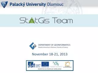
November 18-21, 2013. Palacký University Olomouc. est . 1573 23,000 students 2,500 employees. Sts . Cyril and Methodius Faculty of Theology Faculty of Medicine and Dentistry Philosophical Faculty Faculty of Science Faculty of Education Faculty of Physical Culture Faculty of Law

E N D
Palacký University Olomouc • est. 1573 • 23,000 students • 2,500 employees • Sts. Cyril and Methodius Faculty of Theology • Faculty of Medicine and Dentistry • Philosophical Faculty • Faculty of Science • Faculty of Education • Faculty of Physical Culture • Faculty of Law • Faculty of Health Sciences
est. 2001 • 166 students • Bc 64% • MSc 27% • PhD 9% • 22 in staff • 9 academicstaff • 11 researchstaff • 2 administrationstaff
Academicstaff • prof. dr. Vít Voženílek – thematic and atlas cartography • assoc. prof. dr. Jiří Dvorský – software engineering • assoc. prof. dr. Vilém Pechanec – GIS in environment • dr. Jaroslav Burian – GIS in humangeography • dr. Jan Brus – GISc, spatialanalysis • dr. Zdena Dobešová – database systems • dr. Jakub Miřijovský– Earthremotesensing, GNSS • dr. Jana Svobodová – GIS in physicalgeography • dr. Pavel Tuček – matematics, spatialstatistics • dr. Alena Vondráková – digitalcartography
RESEARCH STREAMS Spatial modelling of geographical phenomena in GIS • modelling of natural phenomena • modellingof urbanization processes • geostatisticsin transport • environmental statistics • analysis of surveys Digital cartography • productionofthematicatlases • syntheticmap-making and map-use • usability evaluation of map reading • geovisualizationon web • visualisationofuncertainity Remotemonitoring oflandscape • small format landscape photography in visible andnear infrared spectrum • continuous monitoring of abiotic factors using sensornetworks, telemetry stations and single- or multifunction data loggers, • identification and analysis of landscape structurewith the use of GIT • creation and analysis of records
PhD study Geoinformatics & Cartography Vít Voženílek – Palacký University, Olomouc Jiří Dvorský – Palacký University, Olomouc Jan Andres – Palacký University, Olomouc Radomír Halaš– Palacký University, Olomouc LenkaMotyčková– Palacký University, Olomouc Jana Talašová – Palacký University, Olomouc Ján Tuček – Technical University in Zvolen (Slovakia) Milan Konečný – Masaryk University, Brno Jaroslav Hofierka– University of Prešov in Prešov (Slovakia) BohuslavVeverka– Czech Technical University VáclavSnášel– Technical University of Ostrava Jaromír Kolejka – Masaryk University, Brno Ján Feranec– SlovakAcademyof Science, Bratislava (Slovakia) Jakub Langhammer– Charles University in Prague JiříHorák– Technical University of Ostrava Jan Kolář– Charles University in Prague Jaromír Kaňok Lukáš Marek Vít Pászto Aleš Vávra Alžběta Brychtová Rostislav Nétek Stanislav Popelka JustynaPastwa Jan Caha Vendula Hejlová Lenka Zajíčková Jitka Doležalová Zbyněk Janoška Pavel Samec Jana Měřičková
prof. Jonathan Raper City University London prof. FerjanOrmeling Utrecht University prof. Sara Irina Fabrikant University ofZurich
prof. ItzhakBenenson Tel Aviv University prof. TerjeMIDTBØ Trondheim University prof. Menno-Jan Kraak University ofTwente
Monday18.11. (KGI) Tuesday19.11. (Hotel Flora) Wednesday20.11. (Hotel Flora) Thursday21.11. (Hotel Flora)
Francis HARVEY University of Minnesota Dept. ofGeography, Environment and Society Specialties • Central and Eastern Europe • Localgovernments • Geographic Information Science (GIS) • Historyof geographic thought • Societyand technology Publications • Integrating Geodata Infrastructures from the Ground Up. • Public Safety and GIS: What should certification accomplish? • Developing geographic information infrastructures for local government: The role of trust. • Boundary objects and the social construction of GIS technology. Research Activities • Local Government Geographic Information Sharing: Examine issues impeding and improving information sharing among US local governments, ongoing • Developing the Polish Cadastral Infrastructure: Study of cadastral related government activities in Poland with an emphasis on post-socialist transitional and EU accession issues, ongoing • Collaborative Research: Graduate Ethics Education for Future Geospatial Technology Professionals: Research and teaching on issues related to GI professional ethics
QimingZHOU Hong Kong Baptist University Dept. ofGeography Centre forGeo-computation Specialties • Cartography • GeographicInformation Systems • RemoteSensing and Image InterpretationResource Management in China Publications • Analysis of Spatio-temporal Pattern and Driving Force of Land Cover Change Using Multi-Temporal Remote Sensing Images • Gradient Analysis of Landscape Spatial and Temporal Pattern Changes in Beijing Metropolitan Area • Processing Multi-temporal Images for Detecting and Quantifying Spatial Pattern of Farmland Change in Western China Research Activities • Change detection and land cover modelling with remote sensing • DTM-based terrain analysis • Spatial decision support systems • 3-dimensional GIS • GIS and remote sensing applications
Maik NETZBAND Ruhr-University Bochum Institute ofGeography Palacky University Olomouc Dept. ofGeoinformatics Specialties • Social Sciences • Earth Sciences & Environment • Information & Communication Technologies • Measurement of surface parameters in setteled areas, i.e. imperviousness, vegetation cover, surface temperature, bare soil, etc. Publications • Synthesizing urban remote sensing through application, scale, data and case studies • Urban Land Use Changes • Monitoring Urban Change with ASTER data • Flood risks in urbanized areas – multi-sensoral approaches using remotely sensed data for risk assessment Research Activities • Urban remotesensing • Spatialplanning
MirceaARDELEAN West University ofTimișoara Dept. ofGeography Specialties • digital cartography • GIS • physical geography Publications • Geomorphological Aspects of the Human Impact in the Alpine Area of Southern Carpathians • The Use of the Digital Terrain Model in Analyzing the Natural Potential of the MunteleMic • Proposal regarding the building of electronic atlas of Banat Research Activities • Complexmethodofdigitalgeomorphological map building of Romania using GIS • Digital geomorphologicalanalysisand automated classification methods of landforms inmountain areas based on Digital Elevation Model andthrough remote sensing imagery integration • Climatic change impact over the Holoceneand present day dynamics of the alpine environments inRomanianCarpathians
Thankyouforcoming…. …. enjoyStatGIS!