GOES DATA COLLECTION SYSTEM (DCS)
GOES DATA COLLECTION SYSTEM (DCS). KAY METCALF NOAA GOES DCS PROGRAM MANAGER. What is DCS?. Data Relay System From Surface Based Systems Through Satellite Transponder To Ground Receiving System. Who?. Government Users Federal State Local International Canada Mexico

GOES DATA COLLECTION SYSTEM (DCS)
E N D
Presentation Transcript
GOES DATA COLLECTION SYSTEM(DCS) KAY METCALF NOAA GOES DCS PROGRAM MANAGER
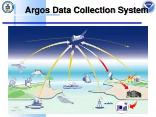
What is DCS? • Data Relay System • From Surface Based Systems • Through Satellite Transponder • To Ground Receiving System
Who? • Government Users • Federal • State • Local • International • Canada • Mexico • Central and South America • Island nations in the Pacific, Atlantic, Carribean • Western Hemisphere in GOES footprint
What? • Meteorological Observations • Land Based Platforms • Ocean (fixed) buoys • Oceanographic Observations • Ship Observations • Tide Monitoring • Hydrologic Observations • River and Dam Monitoring • Reservoir Levels • Water Quality
MAJOR U.S. USERS • United States Geological Survey and Army Corps of Engineers • Flood Monitoring • Dam Management • U.S. Forest Service and other Land Management Agencies • Fire Monitoring • National Weather Service • Weather, Flood Monitoring, Ocean Buoys • State and Local Agencies • Reservoir Levels, Fire Monitoring, Flood Monitoring
Major International Users • Canadian Environment Service • Weather, Ocean Buoys • Mexico National Weather Service • Weather, Fire Monitoring • Central and South American Hydromet • Chile, Colombia, Peru, Guatamala, Nicaragua, Venezuela, Costa Rica, Ecuador, etc…
Usage Regulations • Regulated by Federal Law • Government Users, or Data of Government Interest • Environmental Applications • Limited National Security • Non Competition with Private Sector
Statistics • Approximately • 16,000 Active Platforms • 400 User Agencies • 100,00 messages per day
Transmitter Characteristics • Transmission Rates of 100, 300 or 1200 BPS • Most Have Multiple Sensors • Battery or Solar Powered, Some Electric • Remote Locations • Infrequent Maintenance Required • Most Newer Platforms have GPS for Timing Accuracy
Assignment Characteristics • 200 Channels Available for Domestic Use • Most New Assignments Hourly • Most at 300 baud • No New 100 Baud Assignments Allowed • 1200 Baud Requires 2 Channels • Stringent Requirements for Message Length • Most Use Primary Self-Timed and Secondary Random Assignments
Random Messages • Event Triggered • May Occur as Often as Every 2 Seconds • No Time Allocation Required • Specific Channels Set Aside for Random • Messages Transmitted Multiple Times to Avoid Collisions • Useful for Emergency Conditions When More Frequent Observations Required
User Responsibilities • Keep Platforms Operating Properly • Regular Maintenance • Immediately Repair Improperly Operating Platforms • Keep Database Records Up to Date • User Contact Information • Platform Location • Parameters Reported
Data Reception Options • DCS Automated Processing System (DAPS) • Direct Readout Ground System (DRGS) • Directly from GOES satellite • Commercial Satellite Broadcast • Continental U.S. • Limited Canada, Limited Central and South America • Not Dictated by Contract, so may change • Global Telecommunication System (GTS)
Benefits • Low Cost • Ideal for Remote Locations • Real Time Data Reception • Easily Shared Among Users
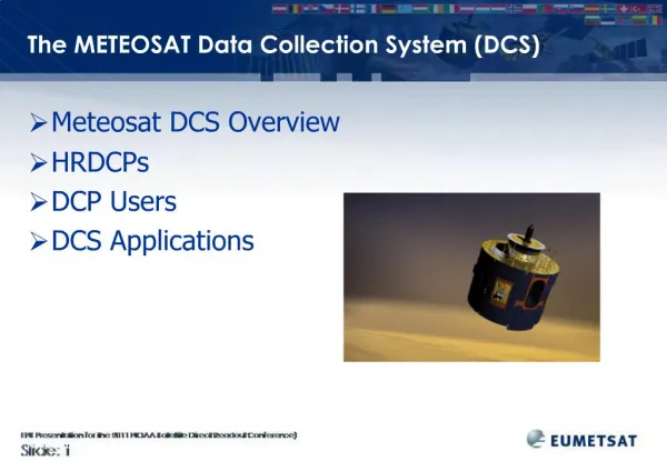
Other DCS Systems • Eumetsat Meteosat (MSG) • Japanese GMS • Russian GOMS • China FY-2 • India INSAT • Argos DCS • French Instrument on NOAA Satellite
How to Access International Satellite Systems • Most have web sites • Most are Members of the WMO Committee on Geostationary Meteorological Satellites (CGMS) • Contact your WMO Representative • NOAA HAS NO INFORMATION ON INTERNATIONAL ACCESS POLICIES
HOW TO CONTACT US • On the Internet: • http://noaasis.noaa.gov/DCS • Through Email: • Goes.dcs@noaa.gov • By Phone: • 301-457-5681 • By Fax: • 301-457-5620