Download
1 / 14
140 likes | 259 Vues
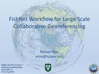
FishNet Workflow for Large Scale Collaborative Georeferencing . Nelson Rios nrios@tulane.edu. i DigBio Train the Trainers 2 Georeferencing Workshop Gainesville, FL 12-16, Aug 2013. History. 1999: C reation of original FishNet Network. Z39.50 protocol for sharing data.

E N D
FishNet Workflow for Large Scale Collaborative Georeferencing Nelson Rios nrios@tulane.edu iDigBio Train the Trainers 2 Georeferencing WorkshopGainesville, FL 12-16, Aug 2013
History 1999: Creation of original FishNet Network Z39.50 protocol for sharing data Search via Species Analyst (distributed query model) 2005: FishNet 2 created Transition to DiGIR Protocol Search via DiGIR Portal (distributed query model) 2010: FishNet 2 (centralized query model) Harvesting of DiGIR, DwCA, IPT, Static Spreadsheets Search via FishNet 2 Portal (centralized query model) 2012-2016:Portal &data expansion and enhancement
Global network of fish collections 71 data providers 3.7 million lots 35+ million specimens 57% georeferenced
Current Activity To expand the number of records within FishNet to approximately 4 million lots representing over 30 million specimens To georeference all "georeferencable" records lacking geographic coordinates To repatriate results to source data providers 321,102 collecting events representing 1,568,695 specimen lots have been identified for georeferencing from FishNet2
Georeferencing FishNet • 250,000 collecting events • 18 months • 12 technicians • 5+ volunteers • GEOLocate • Collaborative
Workflow: Integrating API’s produce datasets for CoGe based on institution and anticipated difficulty of verification pre-georeference, assess verification difficulty, identify problematic records clean data, add to locality gazetteer & match against locality gazetteer Assign workloads by institution, difficulty & region verify, correct & annotate final review of results repatriate data providers http://geolocate.fishnet2.net/workflow.html
Measuring Uncertainty Point Point Radius Point Radius Polygon
Georeferencing Output Base Map - 1:2M 8-Digit HUCs
11 January - 12 June 2013 Stats • 90,301 total locality verifications • 6,009 verifications were re-evaluations • 73,639 corrected • 36,549 associated with polygons • 10,653 skipped • Total: 84,292 localities “completed”
Georeferencing Efficiency 11 January – 12 June 2013 excluding volunteer data
Georeferencing Status 366K Specimens / 84K Localities / 6 Months 11 January – 12 June 2013