Download
1 / 37
370 likes | 584 Vues
Blizzard of 2005 ARES and SKYWARN Operations. Rob Macedo, KD1CY Eastern Massachusetts ARES Section Emergency Coordinator ARES SKYWARN Coordinator for NWS Taunton, Massachusetts. Blizzard of 2005 Brief Facts & Figures.

E N D
Blizzard of 2005 ARES and SKYWARN Operations Rob Macedo, KD1CY Eastern Massachusetts ARES Section Emergency Coordinator ARES SKYWARN Coordinator for NWS Taunton, Massachusetts
Blizzard of 2005 Brief Facts & Figures • Top 5 snowstorm in Boston, Massachusetts climatological Records with 22.5” of snow. • Snowfall amounts of 30-38” in isolated locations of Southeast Coastal Massachusetts and Cape Cod and the Islands. • General 20-30” snowfall across Eastern Massachusetts. • Hurricane Force Wind Gusts as high as 83 MPH recorded across portions of Southeast Coastal Massachusetts. • Moderate Coastal Flooding affected the Eastern Massachusetts coast along north and east facing beaches. • General 15-25” snowfall across Rhode Island, Central Massachusetts and Southeast New Hampshire. • General 8-15” snowfall across Western Massachusetts, Northern Connecticut and Southwest New Hampshire. Blizzard of 2005 ARES and SKYWARN Operations
Timeline of Events Prior to the Blizzard • First signs of a pending major event was Tuesday Evening. • GFS Weather Model showed the potential for around 2” or more of liquid precipitation over Southern New England and the Mid Atlantic States. • Wednesday model run of the GFS backs way off on the storm suggesting an offshore solution. • Other long range European models (ECMWF and UKMET) suggested a major event remains likely. • Uncertainty in the long range on a potential major event. • Potential event leads to monitoring by ARES and SKYWARN Coordinators for further info from NWS Taunton. Blizzard of 2005 ARES and SKYWARN Operations
Timeline of Events Prior to the Blizzard • NAM model locks on to a potent storm solution at 84 hours for Southern New England similar to the European models. • GFS model continues to imply a track much further south with fringe effects for Southern New England. • NAM model at 48 hours continues a potent system and gets even more potent as we get closer to the event. • Winter Storm Watches are posted for Eastern Massachusetts, Rhode Island, Northern Connecticut, Central and Southwest Massachusetts at 4:38 AM Friday January 21st, 2005. • First Storm Coordination Message email was sent to the 1,000+ person email list and an alphanumeric page sent to SKYWARN Coordinators to review their emails at approximately 8 AM, Friday January 21st, 2005. • The Winter Storm Watch was expanded to include Northwest Massachusetts and Southern New Hampshire at 1232 PM Friday January 21st, 2005. • An alphanumeric page was sent to update the Winter Storm Watch area. Blizzard of 2005 ARES and SKYWARN Operations
Timeline of Events Prior to the Blizzard • Page received from NWS Taunton, Massachusetts Senior Forecaster Joseph Dellicarpini. • SKYWARN Amateur Radio Operations with ops at NWS Taunton were to activate at 4 PM January 22nd, 2005 and last until the storm ends. • Preparations for a long duration blizzard activation were requested. • Alphanumeric page sent to SKYWARN Coordinators updating the threat for a major nor’easter/Blizzard scenario. • Heavy Snow Warning and a “rare” Blizzard Watch issued for Rhode Island, Southeast Massachusetts including the Boston Metropolitan area, the North Shore of Massachusetts (from Boston north to Cape Ann, Massachusetts) as well as Cape Cod and the Islands. • Heavy Snow Warnings issued for Northern Connecticut, interior Northeast Massachusetts, and the Mass. Pike region of South-Central Massachusetts. • Winter Storm Watch remained in effect for Northwest and North-Central Massachusetts and Southern New Hampshire. Blizzard of 2005 ARES and SKYWARN Operations
Timeline of Events Prior to the Blizzard • Informed that the Massachusetts State EOC would activate at 4 PM ET Saturday January 22nd, 2005 per local Emergency Management Directors. • Second Coordination Message sent to the 1,000+ person email list and was titled “Blizzard Coordination Message” due to the increased threat of the system. • Alphanumeric page sent to highlight to all that the email had been sent. • Internal ARES Coordination Message sent to the Eastern Massachusetts ARES staff concerning the threat from the potential major weather system. • Good night’s sleep obtained after the messages were sent. It would be the last good sleep until AFTER the blizzard. Blizzard of 2005 ARES and SKYWARN Operations
Timeline of Events Prior to the Blizzard • Wake up next morning to find a Blizzard Warning issued for a large portion of the NWS Taunton, Massachusetts County Warning Area. • The Blizzard Warning included Northern Connecticut, South Central and most of Eastern Massachusetts and all of Rhode Island and is in effect through Sunday. • Heavy Snow Warning posted for Southern New Hampshire and Northwest and North Central Massachusetts through Sunday. • Coastal Flood Warning issued for the entire Eastern Massachusetts coastline for north and east facing beaches. • Blizzard Coordination email and pages sent out. Bags packed to stay overnight at NWS Taunton for full operations through the night time hours. • Left for a meeting that was scheduled at the Massachusetts State EOC prior to the blizzard of Massachusetts ARES, RACES, SKYWARN and MARS leadership prepared to do a briefing on the blizzard. Blizzard of 2005 ARES and SKYWARN Operations
Timeline of Events Prior to the Blizzard • Had lunch after the meeting with the Massachusetts State RACES Radio Officer, Tom Kinahan-N1CPE and Eastern Massachusetts ARRL Section Manager and former ARES SEC, Mike Neilsen-W1MPN. • Made one brief stop to top off fuel and headed to NWS Taunton for 345 PM, 15 minutes before the official start of SKYWARN Net Operations for the region. • SKYWARN Operations begin promptly at 4 PM under the NWS Taunton, Massachusetts Call Sign, WX1BOX. Blizzard of 2005 ARES and SKYWARN Operations
Net Operations • 18 local nets were active across the region. Breakdown was as follows: • Massachusetts 12 Nets • Rhode Island 2 Nets • Northern Connecticut 2 Nets • Southern New Hampshire 2 Nets • 3 Regional Command Nets were setup • New England Network Echo-IRLP Voice Over IP system. • For more information, go to http://www.new-eng.com • Effective in linking anyone in the area with Echolink or IRLP capability. • 53.31-Mount Wachusett, Massachusetts 6 Meter Net • Effective for liaison to Connecticut and Southern New Hampshire as well as most of Massachusetts. • 3943 KHz 75 Meter Net • Nets utilized roll calls at different time intervals, semi-formal activation and other monitoring modes during the course of the blizzard. Blizzard of 2005 ARES and SKYWARN Operations
Net Operations • NWS Taunton Ham Station Consists of one 2 Meter/440 MHz Radio. One HF/6 Meter Radio, One 2 Meter Radio dedicated to Packet, and a PC capable of Internet including Echolink via dial-up. • Another HF Radio has been donated by Carl Aveni-N1FY but cannot be hooked into the station due to facility issues at NWS Taunton, Massachusetts. • Limited capability means not all 18 local nets can be monitored. Roving of local nets is done based on where the most severe events are occurring. • Command Net liaisons are utilized to provide the “always on” liaison monitoring capability. Only one that can’t be monitored is HF and that will change once the additional HF radio is installed. • If we can’t reach the local nets and important data needs to reach NWS Taunton, liaisons/coordinators are asked to go to the command nets to relay information. Diagram on the next slide attempts to visually describe it. Blizzard of 2005 ARES and SKYWARN Operations
Net Operations 6 Meter Net New-ENG HF Net WX1BOX Local Local Local Local Local Blizzard of 2005 ARES and SKYWARN Operations
Net Operations • The next slide shows a picture of the NWS Taunton station. This picture was not taken during the blizzard. It was taken during SKYWARN Recognition Day when forecaster Mike Jackson was talking to the New Hampshire State SKYWARN Coordinator via Echolink through a repeater. • Other folks in the picture are Ron Trainor-KC8CEV (standing behind Mike Jackson) and Jim Palmer-KB1KQW (has the headphones on). Blizzard of 2005 ARES and SKYWARN Operations
Stage One of the Blizzard 4 PM-12 AM Saturday 1/22/05 • Storm begins with snowfall rates of 1” per hour common. • Northern Connecticut the first area hit. • SKYWARN Active on the 146.790-Vernon, CT Repeater. • Contact made via IRLP node to node connection to that repeater to pick up reports. • Arrangements made to have Northern Connecticut liaison into the 6 Meter Command Net for the duration of the event. • Rhode Island SKYWARN contacted directly. Reports forwarded from their net meeting the 2” snowfall criteria. • Snowfall rates intensify across Eastern Massachusetts with 1-2” per hour rates common and isolated 3-4” per hour rates occurring. • The governors of Massachusetts and Rhode Island declare a State of Emergency due to the blizzard. Blizzard of 2005 ARES and SKYWARN Operations
Stage One of the Blizzard 4 PM-12 AM Saturday 1/22/05 • Reports from Southern New Hampshire came in through the 53.31 6-Meter Mount Wachusett Repeater. • Liaison to the Massachusetts State EOC and Regional Massachusetts Emergency Management Agency HQ also maintained via 6 Meters. • Reports from North Shore Mass. SKYWARN, South Coast Mass. SKYWARN, Rhode Island, Central Mass. and other areas came in via the New England Network. • Roving of the various SKYWARN Nets on various repeaters also obtained many reports. • Numerous city and town EOC’s were on the air and active in addition to the State EOC. (There is no county government throughout much of Southern New England). • Reports were all snowfall reports. Winds did not intensify during this stage. • Highest snowfall reports of 8-12” were in Northeast/North Central Massachusetts Southeast New Hampshire with 4-8” across the rest of the region. Blizzard of 2005 ARES and SKYWARN Operations
Stage Two of the Blizzard 12 AM-5 AM Sunday 1/22/05 • Despite the overnight hours reports trickled in from the region as winds picked up across the region and snowfall accumulated rapidly. • Amounts rapidly increased across Cape Cod and the Islands and the South Coast of Massachusetts. • Snowfall rates as high as 8” in 75 minutes occurred!! • Thunderstorms with heavy snow occurred. • Amounts went from 4-8” to 12-18” in stage two of this event. • Winds gusted as high as 72 MPH in Barnstable, Massachusetts during this timeframe. • Additional wind gusts of 46-54 MPH occurred during this timeframe. Blizzard of 2005 ARES and SKYWARN Operations
Stage Three of the Blizzard 5 AM-4 PM Sunday 1/22/05 • The final significant impact from the blizzard. • Hurricane force wind gusts. • Significant snowfall rates of 2-3” per hour with isolated areas having snowfall amounts of 6-7” per hour. • Amounts adjusted to 28-38” across Eastern Massachusetts, 20-30” in Rhode Island, 12-22” for Nantucket Island and 12” or more across the remainder of the area. • Moderate Coastal Flooding pounds the north and east facing shoreline. • Power Outages grip Southeast Coastal Massachusetts and Nantucket Island. 30,000 people are without power at the height of the blizzard. • Snow drifts up to 7 Feet occur across much of Eastern Massachusetts and Rhode Island. Blizzard of 2005 ARES and SKYWARN Operations
Stage Three of the Blizzard 5 AM-4 PM Sunday 1/22/05 • Storm to Hurricane Force Wind Gusts as measured by spotters. • Barnstable, Massachusetts: 83 MPH Gust at 150 Feet Above Sea Level. • Nantucket, Massachusetts: 75 MPH Gust at 9:05 AM. • Plymouth, Massachusetts: 72 MPH Gust at 9:45 AM. • Walpole, Massachusetts: 70 MPH Gust at 6:00 AM. • New Bedford, Massachusetts: 66 MPH Gust at 7:00 AM. • West Island (Fairhaven), Massachusetts: 63 MPH Gust at 7:12 AM. • East Falmouth, Massachusetts: Sustained 45 MPH with gust to 62 MPH at 9:05 AM. • Block Island, Rhode Island: 62 MPH Gust at 9:38 AM. • North Kingstown, Rhode Island: 60 MPH Gust at 8:14 AM. • Attleboro, Massachusetts: 60 MPH Gust at 1:30 PM. • Exeter, Rhode Island: 59 MPH Gust at 7:48 AM. • Lawrence, Massachusetts: 57 MPH Gust 515 AM. Blizzard of 2005 ARES and SKYWARN Operations
Stage Three of the Blizzard 5 AM-4 PM Sunday 1/22/05 • Storm to Hurricane Force Wind Gusts as measured by spotters. • Wellfleet, Massachusetts: 55 MPH gust at 9:15 AM. • Manchester-By-The-Sea, Mass.: 54 MPH gust at 9:00 AM • Providence, Rhode Island: 52 MPH gust at 7:15 AM. • Dartmouth, Massachusetts: 53 MPH gust at 8:00 AM. • Brewster, Massachusetts: 52 MPH gust at 7:00 AM. • Westerly, Rhode Island: 52 MPH gust at 7:47 AM. • Mansfield, Massachusetts: 50 MPH gust at 7:36 AM. • Brockton, Massachusetts: 50 MPH gust at 8:32 AM. Blizzard of 2005 ARES and SKYWARN Operations
Stage Three of the Blizzard 5 AM-4 PM Sunday 1/22/05 • Moderate Coastal flooding reported: • Marshfield, Mass. at 8 AM: 2 feet of ocean water floods the esplanade in the Brant Rock section of Marshfield per Amateur Radio report from the town EOC. • Hull, Mass at 8:40 AM: The Gunrock section of Atlantic Avenue is closed due to coastal flooding. 3-4 feet of water in the road per the Metro Boston ARES DEC who is the Hingham Deputy Fire Chief and EMA Director. • Scituate Mass. at 8:55 AM: National Guard evacuates homes in the Blaes Road Section of Scituate. • Marshfield, Mass at 9:55 AM per Amateur Radio relayed EOC report: Brant Rock area continues coastal flooding and Green Harbor areas are now into coastal flooding. • Scituate, Mass. at 10 AM per Amateur Radio report….Coastal Flooding of numerous shore roads in the Sand Hills Section. Water spread 400-500 feet inland and was 1-2 feet deep. Evacuations continued in the Blaes Road Section of Scituate. Blizzard of 2005 ARES and SKYWARN Operations
Stage Three of the Blizzard 5 AM-4 PM Sunday 1/22/05 • Wind/Snow Damage Reports • Trees and Wires Down reported at 7:45 and 9:05 AM on Nantucket Island. Entire island of 6,000 residents lose power, roads impassable. • Power Outages reported on Cape Cod in the towns of Mashpee, South Dennis, East Falmouth, Centerville and Osterville, Massachusetts. • Marshfield, Mass at 9:45 AM, several poles blown down. • Scituate, Mass. at 10:00 AM, Wires Down and a tree blown down into a house. • More damage occurred but Public Safety could not even reach the areas of damage. • There were actually more wind measurement reports than damage reports which was very unusual. • Route 3A in the town of Hingham was closed by Mark Duff-KB1EKN as people ventured out into the storm and numerous accidents occurred due to impassable roads and whiteout conditions. Report made CNN News. Blizzard of 2005 ARES and SKYWARN Operations
Stage Three of the Blizzard 5 AM-4 PM Sunday 1/22/05 • A sampling of the Highest Snowfall Totals • Plymouth, Mass. 38” • Sagamore Beach 36” • Eastham on Cape Cod 32” • Beverly, Mass. 32” • Yarmouth on Cape Cod 30” • New Bedford, Mass. 30” • Peabody, Mass. 30” • Saugus, Mass. 30” • Cambridge, Mass. 30” • Weymouth, Mass. 28.5” • Wareham, Mass. 26” • Smithfield, RI 21” • Hollis, NH 19” • Nashua, NH 18.5” Blizzard of 2005 ARES and SKYWARN Operations
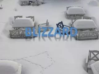
Now for Some Pictures of the Blizzard of 2005 • You’ve read the damage reports. • You’ve gone through the presentation. • But Pictures are worth a thousand words!! • On to the Pictures!!! Blizzard of 2005 ARES and SKYWARN Operations
Final Summary • Several shelters were open on Cape Cod and the Islands and remained open for 3 days after the blizzard passed. • Roughly 6 Amateurs from Cape Cod ARES deployed at the shelters and at the Red Cross in Hyannis. • Amateurs provided communications for Red Cross on Cape Cod for close to 48 hours. • Operations at NWS Taunton, Massachusetts lasted 24 hours. • 64 log pages of reports were handled. Each log sheet takes 19 reports per sheet so 1,219 crtiteria related reports were handled via Amateur Radio. • An additional 500+ reports were handled via the NWS Spotter line and the Internet Web Form. Blizzard of 2005 ARES and SKYWARN Operations
For More Information • Here are a couple of good links to data, pictures etc. from the Blizzard of 2005. • http://www.boston.com/news/weather/blizzard05/ • http://www.erh.noaa.gov/box/snowstormJan22-24.html Blizzard of 2005 ARES and SKYWARN Operations