
Abstract
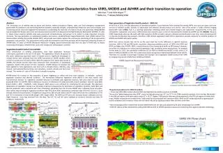
Building Land Cover Characteristics from VIIRS, MODIS and AVHRR and their transition to operation Wei Guo [1] and Felix Kogan [2] [1] IMSG Inc, [2] NOAA/NESDIS/STAR. Next generation of Vegetation Health product : VIIRS-VH

Abstract
E N D
Presentation Transcript
Building Land Cover Characteristics from VIIRS, MODIS and AVHRR and their transition to operation Wei Guo[1]and Felix Kogan[2] [1] IMSG Inc, [2] NOAA/NESDIS/STAR Next generation of Vegetation Health product : VIIRS-VH At the end of 2011, the new generation of operational satellite, Suomi National Polar-orbiting Partnership (NPP), was sent into space with new sensors to enhance quality, quantity of observation and enhance climate product and service. One of the sensor is Visible Infrared Imaging Radiometer Suite (VIIRS), that is a scanning radiometer collecting visible and infrared imagery and radiometric measurements of the land, atmosphere, cryosphere, and oceans. VIIRS extends and improves upon a series of measurements initiated by AVHRR and the (MODIS). Because VIIRS image bands observes the earth with high resolution (375m at nadir), data are collected and distributed in real time, more channels permit to improve and develop new products, therefore, VIIRS derived vegetation health (VH) is expected to provide continuity to scientific products of MODIS and AVHRR with better quality. Abstract The increasing use of satellite data by policy and decision makers throughout federal, state, and local emergency management government for prediction and monitoring weather disasters, especially drought, understanding climate and land cover changes, and monitoring natural resources triggered the demands for accelerating the transition of research results into operations. NOAA/NESDIS has developed the 30-year land cover and climate products (LCCP) from Advanced Very High Resolution Radiometer (AVHRR). In order to obtain these products satellite data were processed comprehensively and proved to be useful to make important economic decisions. The new generation of operational satellites and sensors, Visible/Infrared Imager/Radiometer Suite (VIIRS) onboard the National Polar-orbiting Partnership satellite (NPP), will provide much better options for continuously monitoring of the environmental parameters and products. This presentation will provide the information how these products will be improved combining 30 years of AVHRR data, 10 years of MODIS (Moderate Resolution Imaging Spectro-radiometer) data and one year of VIIRS data for better monitoring of droughts, climate trends, land cover change and anthropogenic activities. NDVI from various sensors may not be on the same level due to the difference in spectral response functions (SRF) of VIR and NIR bands, resolution, observing conditions and et. al. NDVI from VIIRS and NDVI are higher than AVHRR –NDVI, majorly because of the narrow band width on NIR channel. However, since they are indicators for surface ground vegetation, high correlation exists among them. For example for the week 29, 2012, the correlation coefficient (CC) of NDVI of AVHRR and MODIS is 0.80, while CC of NDVI of VIIRS and MODIS is 0.90. The scatter plots shows strong linear relationship between these indices. Therefore, it is possible to build high resolution (for example: 1km) vegetation health product from VIIRS by merging long record of NDVI from AVHRR and MODIS. Vegetation Health Product from AVHRR Since introduction of satellite observations, their data application increases enormously, especially in the last 15-20 years. The applications include all aspects of the earth, addressing important issues of climate services. Significant advantages in climate service were achieved from the AVRR instrument on NOAA satellites which service to society since the early 1970s. With the long term (32+ years) data record of AVHRR, the climate services have been enhanced with introduction of operational vegetation health (VH) product of 4km resolution. AVHRR derived VH product has been applied to many applications over land such as drought (status, intensity, area, impact), land wetness/thermal stress and saturation, malaria, climate and land cover change. The number of users of VH product is steadily increasing. AVHRR-based VH is based on the properties of green vegetation to reflect and emit solar radiation. It evaluates surface’s vegetation condition and thermal condition. The Normalized Difference Vegetation Index (NDVI) is the most widely used environmental indicator for vegetation condition because it correlates with vegetation biomass, leaf area index and crop yield (Cracknell 1997). For AVHRR, NDVI is defined as function of reflectance of visible band (VIS, 0.6um) and Near- Infrared band (NIR, 0.8um) [NDVI = (NIR − VIS)/(NIR + VIS)]. However, NDVI alone is not sufficient for monitoring VH and drought. The afternoon temperature of vegetation canopy is an extremely important characteristic for estimation of vegetation condition. Both NDVI and thermal parameter were compared with their climatology calculated from the 32-year AVHRR data. Following these principles, three indices were developed; vegetation condition index (VCI) from NDVI, temperature condition index (TCI) from 10.3 to 11.3 μm infrared channel’s measurements of brightness temperature (BT) of land surface and VH index (VHI) from the combination of VCI and TCI for estimation of total health (Kogan 1997, Kogan 2002). The NDVI and BT were pre- and post-launch calibrated and low-/high frequency noise was removed from the data. The VCI, TCI and VHI were validated as moisture, thermal and total VH conditions, respectively. Comparison on NDVI derived from MODIS,VIIRS and AVHRR, • The general procedures for VIIRS VH product • Processing VIIRS 500m noised reduced NDVI and Brightness by similar procedure as AVHRR: • The area for “global vegetation index (GVI)” covers the latitude zone from 55° S to 75° N. For 500m resolution product, this is too big. We divided it into 8x8 sub regions with each region covers 45° x 16.27° degree. VIIRS granule data were then projected to the GVI sub-regions to make daily maps. Weekly composite was created from 7 daily maps by choosing pixel with maximum NDVI. NDVI and BT maybe adjusted by applying post-launch calibration and correction. Noise will be further reduced by applying median filter and time series filter. • New climatology will be created from 10 year MODIS NDVI and LST data and adjusted by 30 years climatology from AVHRR. • VIIRS VH indices will be calculated by scaling VIIRS NDVI and BT to AVHRR equivalent values and comparing them against adjusted climatology. Noise reduced NDVI derived from AVHRR (left, 4km resolution) and VIIRS( right, 500m resolution). The higher resolution of observation from VIIRS not only provides more detail on land characteristics, but also increase the chance to obtain cloud free observations. Examples of applications of Vegetation Health products, copied from published papers of Dr. Felix Kogan.


