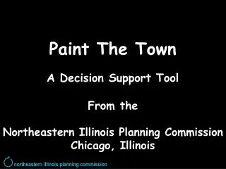
Paint The Town A Decision Support Tool
500 likes | 528 Vues
An innovative GIS tool for year 2030 transportation planning, incorporating demographics, economics, and land use probabilities for 15,000+ zones. Utilizes digital mapping and user-friendly features to forecast development needs effectively.

Paint The Town A Decision Support Tool
E N D
Presentation Transcript
Paint The Town A Decision Support Tool From the Northeastern Illinois Planning Commission Chicago, Illinois northeastern illinois planning commission
PaintTheTown A Decision Support Tool From the Northeastern Illinois Planning Commission Chicago, Illinois northeastern illinois planning commission
Financial Support from • Illinois Department of Transportation • Voluntary contributions of local governments in northeastern Illinois northeastern illinois planning commission
The Task: Produce year 2030 forecast allocations for 15,000+ transportation zones
The Task: Produce year 2030 forecast allocations for 15,000+ transportation zones Reflect demographic, economic and land use probabilities
The Task: Produce year 2030 forecast allocations for 15,000+ transportation zones Reflect demographic, economic and land use probabilities Meet the needs of 6 counties and 272 municipalities for use in transportation planning, water supply allocation and waste treatment facility planning
A Central Element of the Solution Is a GIS Tool Designed to …
A Central Element of the Solution Is a GIS Tool Designed to … … compile information about local expectations for growth out to the year 2030
A Central Element of the Solution Is a GIS Tool Designed to … … compile information about local expectations for growth out to the year 2030 … from 272 municipalities, one at a time
A Central Element of the Solution Is a GIS Tool Designed to … … compile information about local expectations for growth out to the year 2030 … from 272 municipalities, one at a time … between October 2002 and March 2003 !!!
The Solution! Sophisticated computer modeling Easy enough for inexperienced users
…digital orthophotography, The process brings together…
Rail Roads …geographic reference, The process brings together…
Major Roads …geographic reference, The process brings together…
Municipal Boundaries …geographic reference, The process brings together…
Census Block Geography The process brings together… …census block data,
Census Block Data The process brings together… …census block data,
Transportation Zones The process brings together… …transportation zone data,
Transportation Zone Data The process brings together… …transportation zone data,
Lakes & Streams …natural resource constraints to growth,
Watershed boundaries …natural resource constraints to growth,
Wetlands …natural resource constraints to growth,
Flood Zones …natural resource constraints to growth,
…existing land use data. The process brings together…
Current Boundary Next you edit linework… …to establish future boundaries.
Future Boundary Current Boundary Next you edit linework… …to establish future boundaries.
Future Boundary Next you edit linework… …to establish future boundaries.
…focus on vacant land (light green). Then you…
Preview future land uses from a palette of choices… …what about: commercial?…
Preview future land uses from a palette of choices… …see its characteristics…
Preview future land uses from a palette of choices… …then see it from the ground…
Preview future land uses from a palette of choices… …then see it from the ground…
Preview future land uses from a palette of choices… …or view it from the air…
Preview future land uses from a palette of choices… …or view it from the air…
When satisfied, choose land use from the palette… …Select the polygon… …”Paint” the polygon…
Assess the decision… …What is the impact? …How big an area? …How many new jobs?
…and calculate a possible forecast… …that is translated to transportation zones.
For additional information, contact: Max Dieber Northeastern Illinois Planning Commission 312-454-0400, maxdbr@nipc.org Or Eliot Allen Criterion Planners/Engineers, Inc. 503-224-8606, eliot@crit.com northeastern illinois planning commission