Download
1 / 69
890 likes | 1.25k Vues
Delineation of the Landward Extent of Wetlands and Surface Waters Chapter 62-340 F.A.C. . Florida Department of Environmental Protection Instructors: John Tobe john.tobe@dep.state.fl.us Eric Hickman eric.hickman@dep.state.fl.us.

E N D
Delineation of the Landward Extent of Wetlands and Surface Waters Chapter 62-340 F.A.C. . Florida Department of Environmental Protection Instructors: John Tobe john.tobe@dep.state.fl.us Eric Hickman eric.hickman@dep.state.fl.us
Unified Wetland Delineation Methodology (Rule 62-340, F.A.C.) • Must use 62-340, F.A.C. to identify and delineate wetlands in all of Florida EXCEPT in the Northwest district, here you must use 62-312, F.A.C. to identify wetlands and 62-340, F.A.C. to delineate wetlands • see the Florida Wetland Delineation Manual for assistance on use of 62-340, F.A.C. • visit our website to download a copy of the • Florida Wetland Delineation Manual • www.dep.state.fl.us/water/wetlands/delineation/index.htm
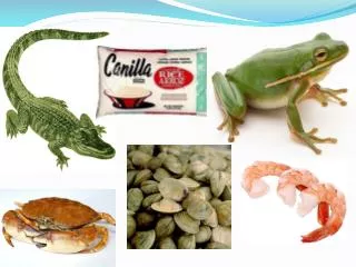
There are several good references for use with the plants and plant communities of the Florida Keys: 1. Native Trees and Shrubs of the Florida Keys. By J.Paul Scurlock, Laurel Press. This is the best picture plant ID manual and it’s easy to use if you know plant families and genera. 2. A field guide to Coastal Wetland Plants of the southeastern U.S. By Ralph Tiner. 3. Marine Plants of the Caribbean, A field guide from Florida to Brazil. Diane Scullion Littler, et. al. Color photographs of algea and seagrasses. No key for algal species. 4. Ecosystems of Florida. By Myers and Ewel. This is the best text for descriptions of Florida’s plant communities, also gives an overview of the geology, hydrology, natural history. 5. Florida Wetland Plants, An Identification Manual. By John Tobe,et.al. From IFAS 1-800-226-1764 Go to: http://www.dep.state.fl.us/water/wetlands/delineation/wetcomm/wetcomm.htm for more information about wetland plants and plant communities in the Florida Keys
ATLAS OF FLORIDA VASCULAR PLANTS: advance search tool - can search by county, wetland status, federal listing, images of plants, etc. http://www.plantatlas.usf.edu/ FAIRCHILD TROPICAL GARDEN VIRTUAL HERBARIUM: http://www.virtualherbarium.org/ USDA PLANT DATABASE: Profile Information for classification, distribution, images, invasive, wetland status http://plants.usda.gov/ INVASIVE AQUATIC PLANTS http://aquat1.ifas.ufl.edu/ http://aquat1.ifas.ufl.edu/allplants.html also see Identification & biology of Non-Native Plants in Florida’s Natural Areas by Kathy Burks. 1998. University of Florida.
Visit our webpage for more • information about Florida’s wetlands • Hydric soils • Wetland plants and wetland plant • communities, plant ID cards • links to Florida DEP rules • download a copy of the • Florida Wetland Delineation Manual • links to other websites related to • wetlands • download an application for a formal • wetland delineation www.dep.state.fl.us/water/wetlands/delineation/index.htm
Wetlands Definitiondefined in subsection 62-340.200(19), F.A.C. • Wetlands, as also defined in subsection 373.019(17), F.S., means those areas that are inundated or saturated by surface water or ground water at a frequency and a duration sufficient to support, and under normal circumstances do support, a prevalence of vegetation typically adapted for life in saturated soils. Soils present in wetlands generally are classified as hydric or alluvial, or possess characteristics that are associated with reducing soil conditions. The prevalent vegetation in wetlands generally consists of facultative or obligate hydrophytic macrophytes that are typically adapted to areas having soil conditions described above. These species, due to morphological, physiological, or reproductive adaptations, have the ability to grow, reproduce or persist in aquatic environments or anaerobic soil conditions. Florida wetlands generally include swamps, marshes, bayheads, bogs, cypress domes and strands, sloughs, wet prairies, riverine swamps and marshes, hydric seepage slopes, tidal marshes, mangrove swamps and other similar areas. Florida wetlands generally do not include longleaf or slash pine flatwoods with an understory dominated by saw palmetto.
Southeast Florida contains the following plant communities Upland Wetland Sandhill Cypress swamp Coastal Scrub Hydric Pine Flatwoods Xeric Hammock Marl Prairie Coastal Hammock Freshwater Marsh Beach Dune Bayhead Pine Flatwoods Floodplain Marsh Pine Rocklands Lakeshore Marsh Subtropical Hammocks Brackish Marsh Dry prairie Mangrove Swamp see our webpage for more information about plant communities: http://www.dep.state.fl.us/water/wetlands/delineation/index.htm
Florida wetlands generally include swamps, marshes, bayheads, bogs, cypress domes and strands, sloughs, wet prairies, riverine swamps and marshes, hydric seepage slopes, tidal marshes, mangrove swamps and other similar areas.
Florida wetlands generally include swamps, marshes, bayheads, bogs, cypress domes and strands, sloughs, wet prairies, riverine swamps and marshes, hydric seepage slopes, tidal marshes, mangrove swamps and other similar areas. The Florida Everglades our largest freshwater marsh.
Florida wetlands generally include swamps, marshes, bayheads, bogs, cypress domes and strands, sloughs, wet prairies, riverine swamps and marshes, hydric seepage slopes, tidal marshes, mangrove swamps and other similar areas.
Florida wetlands generally include swamps, marshes, bayheads, bogs, cypress domes and strands, sloughs, wet prairies, riverine swamps and marshes, hydric seepage slopes, tidal marshes, mangrove swamps and other similar areas.
Florida wetlands generally include swamps, marshes, bayheads, bogs, cypress domes and strands, sloughs, wet prairies, riverine swamps and marshes, hydric seepage slopes, tidal marshes, mangrove swamps and other similar areas.
To begin the delineation process you must first, identify where the wetland is located in the landscape Aerial view of depression marsh in a pine flatwood forest, Martin County, Florida Can the landward extent of the wetland be determined using the definition of “wetlands” in 62-340, F.A.C. ? If the wetland boundary cannot be accurately delineated the regulating agency must use one of the “tests” or methodologies outlined in 62-340, F.A.C.
Aerial view of depression marsh in a pine flatwood forest, Martin County, Florida Can the landward extent of the wetland be determined using the definition of “wetlands” in 62-340, F.A.C. ? If the wetland signature is clearly evident and the ecotone between the upland and the wetland is relatively narrow then an aerial determination can be made BUT this should always be verified in the field.
Ecotones: 62-340, F.A.C. is also known as the unified wetland delineation rule and this rule was written to identify and delineate wetlands. Often this involves evaluating the transition zone between wetlands land uplands. This zone is called an ECOTONE. An ECOTONE is an area where two or more plant communities grade into each other.
62-340.100 Intent. The landward extent of wetlands shall be determined by the dominance of plant species, soils and other hydrologic evidence indicative of regular and periodic inundation or saturation.
Wetlands Definitiondefined in subsection 62-340.200(19), F.A.C. • Wetlands, as also defined in subsection 373.019(17), F.S., means those areas that are inundated or saturated by surface water or ground water at a frequency and a duration sufficient to support, and under normal circumstances do support, a prevalence of vegetation typically adapted for life in saturated soils. Soils present in wetlands generally are classified as hydric or alluvial, or possess characteristics that are associated with reducing soil conditions. The prevalent vegetation in wetlands generally consists of facultative or obligate hydrophytic macrophytes that are typically adapted to areas having soil conditions described above. These species, due to morphological, physiological, or reproductive adaptations, have the ability to grow, reproduce or persist in aquatic environments or anaerobic soil conditions. Florida wetlands generally include swamps, marshes, bayheads, bogs, cypress domes and strands, sloughs, wet prairies, riverine swamps and marshes, hydric seepage slopes, tidal marshes, mangrove swamps and other similar areas. Florida wetlands generally do not include longleaf or slash pine flatwoods with an understory dominated by saw palmetto.
In determining the uppermost strata facultative plants are not considered.
The uppermost stratum is not used when the indicator status of the uppermost stratum is clearly in conflict with the hydrologic conditions on site.
The burden of proof for dropping strata falls on us. We must be able to defend our decision to drop strata. Some reasons for dropping strata include: presence of hydrologic indicators, dominance of obligate vegetation in lower strata, change in hydrology at the site. We might have relictual obligate vegetation in an area which is no longer functioning as a wetland!
Once you have looked over the site and began the mental process of understanding the hydrology, soils, vegetation, topography, history, etc., you’re ready to apply the wetland delineation “tests” Always use reasonable scientific judgement when evaluating on-site evidence of wetland hydrology.
Wetland Determinations Hydrologic Indicators (consistent with inundation or saturation on-site) Hydric soils with: frequently flooded and depressional map units; saline sands; or either Histosols (except Folists), Humaquepts, Hydraquents, Sulfaquents, Umbraqualfs, Umbraquults, Argiaquolls “A” Test O > U “B” Test O + FACW > 80% Or Or Or Yes Hydrologic Indicators (consistent with inundation or saturation on-site) Yes Or Yes “D” Test Or “C” Test Yes Area is adjacent to stream, lake, or tidal waters Hydric soils and/or Riverwash present (based on in-situ) (analysis - Fla SCS criterion) Wetlands Yes Yes Other Surface Waters Area is within ordinary high water line for non-tidal, or mean high water line for tidal waters Yes No No Uplands No
Wetland DeterminationsVegetation Test “A” Test “B” Test Obligate > Upland Obligate + FACW > 80% Yes Yes Hydric soils and/or Riverwash present (based on in-situ) (analysis - Fla SCS criterion) Hydrologic Indicators (consistent with inundation or saturation on-site) OR Yes Wetlands
Wetland DeterminationsVery Wet Soils Test“C test” Hydric Soils which are: 1. Histosols (except Folists), and Argiaquolls, Sulfaquents, Hydraquents, Humaquepts, Umbraqualfs, and Umbraquults; 2. saline sands; 3. frequently flooded and depressional map units Yes Wetlands
“C” Test • The “C” test cannot be used in pine flatwoods,improved pastures and drained soils. • Pine flatwoods are those plant communities with a canopy of slash and/or longleaf pine and with a groundcover dominated by saw palmetto, wiregrass, gallberry and other shrubs typical of a pine flatwoods.
Wetland DeterminationsHydrologic Indicators Test“D” Test Hydrologic Indicators (consistent with inundation or saturation on-site) Yes Hydric soils and/or Riverwash present (based on in-situ) (analysis - Fla SCS criterion) Yes Wetlands
Definition - “Riverwash” means areas of unstabilized sandy, silty, clayey, or gravelly sediments. These areas are flooded, washed, and reworked by rivers or streams so frequently that they may support little or no vegetation. riverwash
Altered Sites • Subsection 62-340.300(3)(a), F.A.C. • If the vegetation or soils have been altered by natural or man-induced factors such that the boundary between wetlands and uplands cannot be delineated reliably by use of the methodology or “tests” in 62-340.300(2) and the area has hydric soils or evidence that hydric soils indicators would be present but for the disturbance, then the most reliable available information shall be used with REASONABLE SCIENTIFIC JUDGEMENT.
Altered sites We ask the question of what was the ecologic community prior to the alteration?Has the site been permanently hydrologically altered?
62-340.550 Wetland Hydrology A wetland delineation can be refuted by reliable hydrologic records or site specific hydrologic data which indicate that neither inundation for at least seven consecutive days, nor saturation for at least twenty consecutive days.
Hydrologic Indicatorssection 62-340.500, F.A.C. • Algal mats • Aquatic mosses or liverworts on trees or substrate • Aquatic plants • Aufwuchs • Drift lines and rafted debris • Elevated lichen lines • Evidence of aquatic fauna • Hydrologic data • Morphological plant adaptations • Secondary flow channels • Sediment deposition • Vegetated tussocks or hummocks • Water marks
Hydrologic Indicators, continued. The presence of non-vascular algal or plant remains. Algae growth during periods of inundation and are indicators of inundation. Algal mats are often associated with water marks, aufwuchs and other hydrologic indicators. • Algal mats A newly exposed algal mat will often be green Algal mats that have been exposed to the sun are often brown or may be bleached white
Hydrologic Indicators, continued. • Aquatic mosses or liverworts on trees or substrate Mosses and liverworts are non-vascular plants, like algae they are generally confined to wet places. Some mosses and liverworts only grow underwater. We use these species to identify landscapes with prolonged, seasonal inundation. enlargement Aquatic moss Fontinalis sp. Floodplain tree with aquatic mosses and liverworts See, Mosses of Florida by Ruth Schornherst, 1963, and Mosses of the Gulf South by William D. Reese, 1984
Hydrologic Indicators, continued. • Aquatic plants These are plants that typically float on water or use water for structural support or cannot survive outside of water. The presence of aquatic plants may indicate the level of seasonal inundation. Water lettuce or Pistia a floating aquatic plant See,Aquatic and Wetland Plants of the Southeastern U.S., by Bob Godfrey, 1979 to aid in aquatic plant identification. Drying pond edge, note the exposed waterlilies
Hydrologic Indicators, continued. • Aufwuchs is the presence or remains of the assemblage of very small plants and animals which grow on submerged objects. Like algal mats they are important indicators of seasonally inundated areas. Aufwuchs on emergent vegetation Dried aufwuchs produce a white crust on this vegetation
Hydrologic Indicators, continued. • Drift lines and rafted debris This is the vegetation, litter, etc. deposited in lines in a form or manner that indicates that the material was rafted by water. Scene showing the drift line in the high marsh of Choctawhatchee Bay, in Northwest Florida.
Hydrologic Indicators, continued. • Elevated lichen lines Lichens are not tolerant of inundation. Extended inundation around the trunks of trees and other objects abruptly limits the growth of lichens. Elevated lichen line on bald cypress. This line is often useful for determining the ordinary high water line or seasonal high water line.
Hydrologic Indicators, continued. • Evidence of aquatic fauna This is an indicator that considers the presence or indications of animals which spend all or portions of their lifecycle in water. Crayfish burrow in a floodplain Fiddler crabs in a salt marsh
Hydrologic Indicators, continued. • Hydrologic data Reports, measurements, or direct observations of inundation or saturation which support the presence of water consistent with the provisions of the definition of wetlands. These observations should be used in conjunction with observations from the field, published reports and local residents.
Hydrologic Indicators, continued. Hydrologic data - including evidence of a seasonal high water table (SHWT) at or above the surface according to methodologies set forth in Soil and WaterRelationships of Florida’s Ecological Communities(Florida Soil Conservation Service Staff. 1992). - hydric soil field indicators having a SHWT at or above the surface: Indicators A8 and A9. Muck Indicator A4. Sulfidic Odor in the upper 12” Indicator A7. Mucky Mineral (at least 2” thick) Indicator F2. Loamy Gleyed Matrix in the upper 12”
Hydrologic Indicators, continued. • Morphological plant adaptations These are specialized structures produced by plants in response to inundation or saturation. Expanded lenticles Adventitious roots
Adventitious roots on wax myrtle
Hydrologic Indicators, continued. • Secondary flow channels These are obvious natural flow ways landward of the primary stream or river.
Hydrologic Indicators, continued. • Sediment deposition Sediment deposited in rings indicating the seasonal high water Sediment deposited into a sandbar along the Suwannee River The mineral and organic matter deposited by water will usually indicate the direction of flow and level of inundation.
Silt on red maple leaves
Hydrologic Indicators, continued. • Vegetated tussocks • or hummocks These are areas where the vegetation is elevated above the natural grade. Look for this indicator in saturated soils or in areas of shallow but prolonged inundation.
Hydrologic Indicators, continued. • Water marks are created by the staining effects of water on fixed objects, such as tree trunks and rocks. This indicator is often found in conjunction with elevated lichen lines, aquatic mosses and liverworts and sediment deposition. Water marks are found below the lichen lines Long term inundation in the gum swamp, pictured above, creates favorable conditions for water marks