Download
1 / 32
360 likes | 646 Vues
Unit 1: Geography of Georgia. SS8G1: The student will describe Georgia with regard to physical features and location. Vocabulary Terms to Know SS8G1a. Region: An area with common characteristics such as soil, vegetation, climate, landforms, recreation and economic opportunities.

E N D
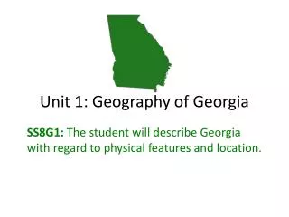
Unit 1: Geography of Georgia SS8G1: The student will describe Georgia with regard to physical features and location.
Vocabulary Terms to KnowSS8G1a • Region: An area with common characteristics such as soil, vegetation, climate, landforms, recreation and economic opportunities. • Nation: A territory or country. • Continent: One of seven large land masses on Earth. • Hemisphere: A half of a sphere or the Earth.
Location SS8G1a • Located on the continent of North America • Located in the southeastern region of the USA • Georgia is bordered by five states on the: • Florida • South Carolina • Alabama • Tennessee • North Carolina
Absolute & Relative Location • Absolute Location: Georgiais between 30 ° 31‘ and 35 ° north latitude; between 81° and 85 ° 53' west longitude. • Relative Location: Georgia is surrounded by Tennessee, Alabama, Florida, South Carolina, & North Carolina (5 border states…Review). • Georgia is positioned in both the northern and westernhemispheres.
Location • Georgia has 159 counties • Georgia is ranked 24th in size among the 50 U.S. states. • Largest state east of the Mississippi River. • Highest mountain point in Georgia is Brasstown Bald (4,784 feet), which is located in Twiggs County • Atlanta is the capital city.
Where in the World is Georgia?Let’s Review Absolute Location: Relative location: Georgia is bordered by ---states. It is located north of ----, south of -----, etc. Georgia is also bordered by the ----- Ocean Region of the USA: Continent: Hemisphere:
Homework for August 16, 2012Frayer Models • Define the following vocabulary terms • using the Frayer Model template: • 1. Absolute Location • 2. Continent • 3. Hemisphere • 4. Nation • 5. Region • 6. Relative Location
5 Geographic Regions • Each of these regions has soil, physical features, and climate that help determine what kinds of animals and plants can live and thrive in it.
5 Geographic Regions • Appalachian Plateau Region: The mountainous region found in the northwestern corner of Georgia. • Its most prominent features are Lookout and Cloudland Canyon.
5 Geographic Regions • Ridge and Valley Region: It occupies most of the northwestern part of Georgia. • Forms a series of parallel valleys separated by ridges in the northwest corner of the state. • The valleys contain fertile land for farming.
5 Geographic Regions • Blue Ridge Region: It is located in the northeastern part of Georgia. • It consists of mountains, ridges, and basins. • Brasstown Bald, Georgia’s tallest mountain, is located in this region.
5 Geographic Regions • Piedmont Region: It contains a series of rolling hills and occasional isolated mountains (Stone Mountain and Pine Mountain). • Rivers and ravines are found throughout this region. • Red clay soil is found in this region. • ½ of Georgia’s population lives in the Piedmont Region. • We live in this region.
Fall Line • Also known as the Fall Zone • It stretches across the state from Augusta to Columbus. • It is the natural boundary that separates the Piedmont and Coastal Plain Regions. • Land elevation drops and the water flows at an increase rate. • Georgia’s waterfalls are located along the fall line.
5 Geographic Regions • The Georgia coast is associated with the Coastal Plain Region, a low, flat region of well-drained, gently rolling hills and poorly drained flat woods. • The Atlantic Ocean forms the eastern border of the Coastal Plain. • The southern border of this province is formed by the Gulf of Mexico, in the state of Florida. • This region is divided into the inner and outer Coastal Plains. • The Coastal Plain is the largest region in Georgia.
5 Geographic Regions SS8G1b Add to your map: Atlanta Atlantic Ocean Brasstown Bald Mountains Chattahoochee River Okefenokee Swamp Label where Alabama, Tennessee, Florida, North Carolina, and South Carolina are located on your map
Physical Features SS8G1c • Fall Line is located between the Piedmont Region and Coastal Plain Region. • Itis the point at which hilly or mountainous lands meet the coast plain. • This is where Georgia’s waterfalls and rapids are found.
Physical Features • Okefenokee Swamp is a wetland haven for hundreds of plants, animals, and reptiles. • This swamp is located in the outer Coastal Plain Region.
Physical Features • Georgia two major seaports are: Savannah & Brunswick, GA. • Georgia’s rivers are important to the state. • Provides habitat for thousands of plant and animal species • Transportation routes for ships carrying goods • Provide drinking water for many areas • Generate hydroelectric power at many dams and cool the reactors at facilities that provide nuclear power in the state • Source of recreation for people who like to canoe, kayak, and swim
Physical Features • 11 Major state rivers are: • Etowah River • Coosa River • Chattahoochee River • Oostanaula River • Flint River • Chattooga River • Savannah River • Ogeechee River • Oconee River • Ocmulgee River • Altamaha Rivers
Physical Features • Along Georgia’s eastern coastline are the Barrier Islands. • They are all located in Glynn County. • These islands protect Georgia’s beaches on the eastern coastline by blocking wind, sand, and water from eroding the land. • These islands are wildlife sanctuaries, recreation, and tourist attractions. • Also, known as the “Golden Isles” these islands are named: Tybee, St. Simon, Jekyll, Cumberland, Sea Island, Wassaw, Ossabaw, St. Catherines, and Sapelo.
Secret Seashore: Georgia’s Barrier Islands (Georgia Public Broadcast, 2011) Media Clip: http://bcove.me/kulrqy1k
Georgia’s Climate SS8G1d • Climate refers to the average weather and patterns of weather of a region over a long period of time. • Climate of a region influences the types of homes built, the types of industries that develop, the clothing people wear, and what crops are grown. • Georgia’s climate is temperate/mild, which means it rarely has extremes of weather.
Climate • Georgia’s population continues to grow, with new businesses moving to the state. • People have migrated to Georgia from other regions of the USA, due to its temperate/mild climate.
Climate • Georgia’s rainfall allows for: • Agriculture in much of the state • The many rivers and streams provide drinking water • Transportation • Electric power
Climate • Georgia is subject to two extreme forms of weather: tornadoes and hurricanes. • On average, Georgia has about 20 tornadoes a year (March through May). • Tropical storms can turn into hurricanes if their wind speed increases. • Hurricanes that affect Georgia begin in the tropical area of Atlanta Ocean, Caribbean Sea or Gulf of Mexico.
References Caldwell, L. A. (2010). Georgia: Its heritage and its promise. Atlanta, GA: Clairmont Press. Klein, P. (2005). Georgia: In the American Experience. Atlanta, GA: McDougal Littell