Download
1 / 5
60 likes | 349 Vues
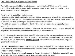
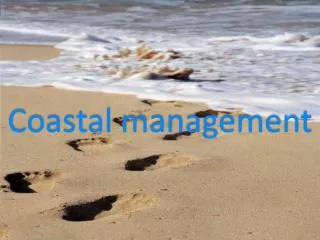
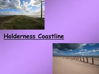
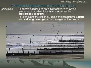
Wednesday 19 th October 2011. Coastal Management at Holderness. Objectives: - To annotate maps and draw flow charts to show the processes that affect the rate of erosion on the Holderness coastline .

E N D
Wednesday 19th October 2011 Coastal Management at Holderness Objectives: - To annotate maps and draw flow charts to show the processes that affect the rate of erosion on the Holderness coastline. - To understand the nature of, and difference between, hard and soft engineering coastal management techniques.
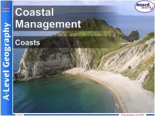
Starter Watch coastal defences ‘movie’ clip. List hard and soft approaches and costs, i.e • HARD ENGINEERING - involves structures built along the coast, usually at the base of a cliff or on a beach, e.g. sea walls, groynes and revetments. • SOFT ENGINEERING – is designed to work with natural processes in the coastal system to try to manage – and not necessarily prevent – erosion. http://gatm.org.uk/geographyatthemovies/coasts.html
Objectives: -To understand why erosion on the Holderness coastline is so rapid. - To annotate maps and draw flow charts to show the processes that affect the rate of erosion on the Holderness coastline. • 2] Activities • Case Study: The Holderness coast … going … going … • Read pg. 192 to 197 in ‘AS Geography.’ • Complete Acts. 1, 2 and 4 (Qu. 5 if time allows at end of lesson) • Define the following terms: boulder clay, fetch,swell and longshore drift (including swash and backwash) • Complete Acts 6 & 7 as one PowerPoint. • Complete Act. 9 • Using the R/S ‘Coastal Management’ complete a table similar to the one below. Identify whether each method is either a ‘soft’ or ‘hard’ approach. Add further methods to the list below:-
Extension Coasts vary enormously, and are always changing. Using the internet complete the power point in the ‘shared area’ with annotated photographs for each of the coastal features described on the slides. LINK:W:\Humanities\Geography\AS_A2LevelGEOGRAPHY\EDEXCEL AS Unit_2_a Physical option 09-10\L3 'Crowded Coast' activity.ppt
Objectives: - To understand why erosion on the Holderness coastline is so rapid. - To annotate maps and draw flow charts to show the processes that affect the rate of erosion along the Holderness coastline. PLENARY: Should the government pay compensation to people whose homes are threatened by erosion (refer to Peter Johnson’s story on pg. 192)? Should Peter Johnson get compensation for the loss of his home, or is it just bad luck?. ASSIGNMENT AS Geography for Edexcel Unit 4.7 Exam question: Referring to a stretch of coast, explain the factors that have led to this coast suffering from erosion.(10 marks) [Due: Fri 11th December]