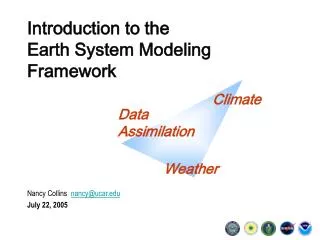
Introduction to the Earth System Modeling Framework
150 likes | 196 Vues
Explore the Earth System Modeling Framework (ESMF) evolution, milestones, development plan, and community response in climate research and weather prediction. Learn about the ESMF architecture, codes, and objectives for data assimilation applications. Discover the ESMF's role in unifying scientific codes, promoting software reuse, and achieving interoperability. Join the ESMF community for upcoming events and discussions on advancing climate modeling technology.

Introduction to the Earth System Modeling Framework
E N D
Presentation Transcript
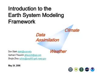
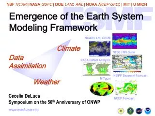
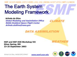
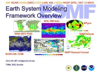
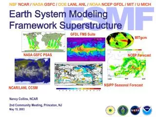
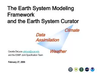
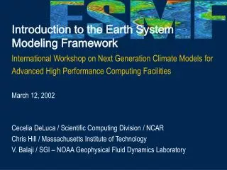
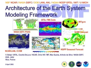
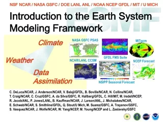
Introduction to the Earth System Modeling Framework International Workshop on Next Generation Climate Models for Advanced High Performance Computing Facilities March 12, 2002 Cecelia DeLuca / Scientific Computing Division / NCAR Chris Hill / Massachusetts Institute of Technology V. Balaji / SGI – NOAA Geophysical Fluid Dynamics Laboratory
Outline • Background and Motivation • ESMF Design Overview • ESMF Codes • Milestones • Development Plan • Beyond 2004: ESMF Evolution • Additional Information and Events
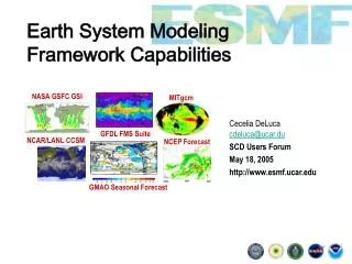
Trends in Earth System Modeling In climate research and numerical weather prediction … • Increased emphasis on detailed representation of individual physical processes • Requires many teams of specialists to contribute components to a coupled system In computing technology … • Increase in complexity and variety in high-performance computing hardware Community Response • Abstraction of underlying hardware to provide uniform programming model across architectures • Modular design for interchangeable dynamical cores and larger components • Development of prototype frameworks - GFDL (FMS), NASA/GSFC (GEMS), others The Earth System Modeling Framework (ESMF) aims to unify and extend these efforts
Project Background NASA’s Earth Science Technology Office (ESTO) proposed the creation of the ESMF in a September 2000 Cooperative Agreement Notice Large collaboration developed three linked proposals in response:Part I: Core ESMF Development (PI: Killeen, NCAR)Part II: Modeling Applications (PI: Marshall, MIT)Part III: Data Assimilation Applications (PI: da Silva, NASA DAO)
Project Organization NASA ESTO Part I Part II Part III Core Framework Development Data Assimilation Deployment Prognostic Model Deployment NSF NCAR PI MIT PI NASA DAO PI Part I Proposal Specific Milestones Part II Proposal Specific Milestones Part III Proposal Specific Milestones Joint Milestones Joint Milestones Joint Milestones Joint Specification Team Requirements Analysis System Architecture API Specification
Objectives of the ESMF • Facilitate the exchange of scientific codes (interoperability) • Promote the reuse of standardized technical software while preserving computational efficiency • Focus community resources to preserve performance portability in a volatile computing environment • Share overhead costs of the housekeeping aspects of software development • Provide greater institutional continuity to model development efforts
Application Architecture Coupling Layer ESMF Superstructure Model Layer User Code Fields and Grids Layer ESMF Infrastructure Low Level Utilities External Libraries BLAS, MPI, NetCDF, …
Final Milestones • Tested, optimized core framework software and documentation • Support for many platforms, including commodity clusters • All ESMF codes will achieve full ESMF compliance • Will use coupling superstructure and utilities • 8 Interoperability demonstrations • Example: NCAR CAM with MITgcm ocean • Multiple time scales: • NWP, mid-range forecast experiments • Coupled seasonal forecasts • Interannual/decadal variability • Centennial simulations • Will require tuning and validation to be scientifically useful
Development Plan • Requirements • Intensive interaction involving ESMF collaborators and broader community, ESMF Community RequirementsMeeting • High-level results presented in General Requirements Document, detailed requirements documents prepared later • Design • Design study includes examination of FMS, GEMS, MCT, and other existing Earth science frameworks • Results presented in Architecture Report, detailed design documents for specific components prepared later • Community review of ESMF interface specification
Development Plan, cont. • Implementation • Implementation study will determine implementation language, language interoperability strategy, programming model • Examine viability of supporting software tools, e.g. CCA, Cactus • Results presented in Implementation Report • Best Practices • Early distribution of Software Developer’s Guide will encourage consistent standards, conventions and practices throughout the project
Beyond 2004:ESMF Evolution • Maintenance and management • NCAR commitment to maintain and support core ESMF software • Persistence of ESMF Executive Committee and Advisory Board • Technical evolution • Functional extension: support for advanced data assimilation algorithms, additional grids, new domains • Earth System Modeling Environment, including web/GUI interface, databases of components and experiments, links to GRID services
Additional Information and Upcoming Events ESMF Community Requirements Discussion and Review Open Meeting In conjunction with the Spring American Geophysical Union Meeting May 30, 2002 ESMF website: http://www.esmf.ucar.edu Questions: esmf@ucar.edu