Download
1 / 1
10 likes | 169 Vues
Breeding Season Home Range of Marbled Murrelets in Southeast Alaska Blake Barbaree | Department of Fisheries and Wildlife | GEO 580, Advanced GIS | Spring 2009 . Introduction:

E N D
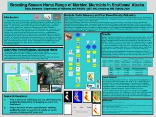
Breeding Season Home Range of Marbled Murrelets in Southeast Alaska Blake Barbaree | Department of Fisheries and Wildlife | GEO 580, Advanced GIS | Spring 2009 Introduction: The Marbled Murrelet (Brachyramphus marmoratus) is a small diving seabird that generally occurs near shore and is the most common seabird in the sheltered marine waters throughout most of southeast Alaska. This species breeds in coastal older-aged forests from Alaska to central California, but also nests on the ground and on rock ledges in parts of Alaska and British Columbia (Nelson 1997). Marbled Murrelets are currently listed as federally threatened in California, Oregon, Washington, and British Columbia, and a species of concern in Alaska. Prior to this study, relatively little was known about their breeding season activity patterns, home range, and few nest locations had been identified in Southeast Alaska. Knowledge of the at-sea distribution of seabirds is the key to locating foraging hot-spots and understanding most aspects of their interactions with the surrounding environment (Wood et al. 2000). An individual’s breeding season home range refers to the area utilized by an animal during its normal activities of food gathering, mating, and caring for young (Burt 1973). During 2008, extensive locational information of radio-marked Marbled Murrelets was collected for GIS analysis of individual home range and core foraging areas in relation to important environmental variables. Methods: Radio Telemetry and Fixed Kernel Density Estimation Radio Telemetry: Locations for individual Marbled Murrelets were collected using aerial and boat-based radio telemetry surveys. Direct location waypoints were taken during aerial surveys using a handheld GPS unit. Triangulated locations were derived from boat-based surveys using the telemetry triangulation software Locate II (Nams 1990). Kernel Density Estimation:Kernel density estimation is a widely accepted home range estimator (Kernohan et al. 2001) that produces a smoothed, continuous intensity surface of an animal’s utilization distribution (UD) based on point locations (Worton 1989). The kernel density estimation home range estimator is unique because it allows core areas to be delineated the principle behind kernel density estimation is that a density estimate is evaluated for each intersection of a user-defined grid. The fixed-kernel method was selected because it measures intensity of use (Kernohan et al. 2001). Hawth’s Tools Fixed Kernel Density Estimator (Beyer 2005) was used to calculate the fixed kernel density and percent volume contours (95%, 90%, and 50% UD). Results: Separate estimates for individual home range (ha) were calculated (95%, 90%, and 50% UD) including full polygon area, marine only polygon area, and marine only polygon area with coastline buffered for the intertidal zone. Significant differences (p-values < 0.0006; n = 15) were found between the full polygon mean home range area and both mean marine home range areas. No difference (p-value = 0.9563; n = 15) was found between the mean area of the non-buffered marine polygon and the mean area of the polygon buffered for the intertidal zone and the non-buffered polygon is preferred due to inherent uncertainty in all aspects of the analysis. Marine telemetry locations were used to calculate the statistical mean center of activity for each individual. The distance between each individual’s nest site location and mean center of marine activity was derived producing a mean distance of 23.171± 11.631 km (n = 15). Study Area: Port Snettisham, Southeast Alaska - Remote deep water inlet approximately 40 km south of Juneau, Alaska. - Nutrient-rich marine waters with surrounding terrestrial habitat rugged and uninhabited. Most forest stands are older-aged with minimal harvest in the area. - Land designation is the Tongass National Forest with the Tracy Arm Wilderness Area and Admiralty Island National Monument to the south and west, respectively. Future Research: The results of this project are the first step to an in depth GIS based analysis that will summarize the breeding season home range for all 119 Marbled Murrelets captured during three years of field research. The analysis will incorporate landscape, seascape, and terrestrial habitat variables in relation to home range and core use areas. The larger sample size will allow for proper statistical comparisons between demographic groups of individual murrelets. A second aspect of this research will involve a landscape level analysis of Marbled Murrelet nest sites. Photogrammetric methods will be utilized to analyze 0.5 km and 1.0 km radius circles around each nest site. The analysis will characterize nest site selection in southeast Alaska and assist land managers is designating critical Marbled Murrelet habitat. • Research Questions: • What is the marine home range size (ha) of adult breeding Marbled Murrelets during the breeding season in Port Snettisham? • What is the direct distance (km) between a breeding Marbled Murrelet’s mean center of activity for marine telemetry locations and it’s nest site? References: Beyer, H. 2005. Hawth’s Tools for ArcGIS. www.spatialecologylab.com Burt, W.H. 1973. Territoriality and home range as applied to mammals. Journal of Mammalogy 24: 346-352. Kernohan, B. J., R. A. Gitzen and J. J. Millspaugh. 2001. Analysis of animal space use and movements. In Radio Tracking and Animal Populations (J. J. Millspaugh and J. M. Marzluff, Eds.). Academic Press, San Diego, CA. Nams, V. O. 1990. Locate II Program. Pacer Publishing, Truro, Nova Scotia, Canada. Nelson, S.K. 1997. Marbled Murrelet (Brachyramphus marmoratus). In A. Poole and F. Gill, eds. Birds of North America, No. 276. The Academy of Natural Sciences, Philadelphia; The American Ornithologists Union, Washington, D.C. Wood, A. G., B. Naef-Daenzer, P. A. Prince and J. P. Croxall. 2000. Quantifying habitat use in satellite-tracked pelagic seabirds: application of kernel estimation to albatross locations. Journal of Avian Biology 31: 278-286. Worton, B. J. 1989. Kernel methods for estimating the utilization distribution in home-range studies. Ecology 70: 164-168. Point Raster Polygon Repeat for each individual


