Download
1 / 43
430 likes | 602 Vues
Clark County Fire and Rescue Geography and Mapping Course. Created by George V. Lingle CCFR Adapted by CCTD, 2012. 5 State roads SR 14 SR 500 SR 501 SR 502 SR 503 Hwy 99. Clark County Has. 2 Interstates I-5 I-205. Know how to use these map books. It’s a vital part of your job!.

E N D
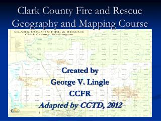
Clark County Fire and Rescue Geography and Mapping Course Created by George V. Lingle CCFR Adapted by CCTD, 2012
5 State roads SR 14 SR 500 SR 501 SR 502 SR 503 Hwy 99 Clark County Has... • 2 Interstates • I-5 • I-205
Know how to use these map books. It’s a vital part of your job!
County Mapping and Addressing • East West roads: • Streets • Circles • Ways • North South roads: • Avenues • Courts • Places
Clark County … (cont.) • Drives and Roads run diagonally or irregularly in relation to streets or avenues • Loops are roads that are connected on both ends to another road and are named from that road. • Blvds, Hwys, Expressways, Parkways, SRs, and Interstates are major arterials that can run any direction. • There are 20 blocks to a mile. One block is 264 ft
Clark County ... (cont.) • All but the last two digits of an address are the block number. • The last two digits indicate the position in the block and the side of the road the address is on. • An even address is always on the north - west side of the road • An odd address is always on the south – east side of the road • Except in Ridgefield and LaCenter
Clark County … (cont.) • All addresses increase as they move away from the point of origin which is the foot of the interstate bridge. • The north/south divider is SE 1st St extended. One block north is NE 2nd St. • The east/west divider is NE 1st Ave extended. One block west is NW 2nd Ave
Clark County … (cont.) • Multiple residences off a private driveway will be given addresses based on the driveway being a private road • Apartment complex buildings are lettered and addressed counter clockwise • Businesses in multi unit buildings will get Suite numbers
Map page to county road atlas conversion chart CRESA Anomaly: R1W = 0
History of the USGS System • In the mid-1800’s the office of land survey (later the Bureau of Land Management) began a systematic survey of all land west of Ohio • Mostly for the purpose of record and settlement… • The great land give-away or “home steading” • They established primary meridians, a north-south latitude and base lines, an east-west longitude • The meridians were named for large geographical features or geographical regions • In Washington and Oregon it is the Willamette Meridian. It was adopted in 1851
History (Con’t) • A Township is a 36 square mile block of land. • Townships are numbered as measured by north or south of the baseline…(Their township number) and range as measured east or west of the principle meridian
What Does This Mean for Clark County? • The point of origin for our USGS mapping is in the west hills of Portland (The Willamette Stone at the corner of Washington and Multnomah counties) • The Willamette Meridian parallels and runs west of the I-5 corridor.
Where does the 4 digit “Map Page” come from? • United States Geological Survey • Township First digit North or South • Range Second digit East or West • Section Last 2 digits 01through 36 • Quarter Section etc. (ABCD) • Note: Each Township and Range is a 6 mile increment • CRESA range anomaly: R1W = 0
United States Geological Survey Township Designators A B C D
Why Is This Important to Know? • It allows you to predict the area of the call. • Range 1 is near the I-5 corridor • Township 1 is near the Columbia River south of Vancouver • For example: • Map page 14xx is going to put you near Camas or Washougal… • Map page 41xx will put you on the I-5 corridor near Ridgefield • Limits your search to a single square mile • Alternative to the conversion chart (page VI)
CCF&R Map Book Rules • The Map Page is a 4 digit number • Each page is one square mile • The connecting pages are noted on the edges of the page • All pages occur in numerical order • See 3205 and 3206
Battle Ground Specific Rules • Main St. is the north/south divider • One block off Main is 1st St. • Parkway Ave. is the east/west divider • One block off Parkway is 1st Ave. • Paths and Commons • Most roads are numbered • Some roads are named for historical significance
Ridgefield Specific Rules • Pioneer is the north/south divider • Most east/west roads are named • One block off Pioneer is 1st when #’d • Railroad Ave is the east/west divider • Most north/south roads are numbered • All roads are east of Railroad Ave. • Even addresses are north-east • Odd addresses are south-west • Roads with no specific direction also include Lanes, Parkways, and Terraces
La Center Specific Rules • 1st St. is the north/south divider. The city does not currently extend south of 1st St. • Most east/west roads are numbered • Aspen is the east/west divider. • Most avenues east of Aspen are named • Most avenues west of Aspen are lettered • Even addresses are on the south-west • Odd addresses are on the north-east
Vancouver Specific Rules • The 0/0 point is the foot of the I-5 Bridge • The north/south divider is 1st St. • Most east/west roads are numbered • The east/west divider is Division St extended • Main St is the east/west divider south of Fourth Plain
Vancouver Specific Rules (cont.) • Most north/south roads to the west are named alphabetically • The north/south roads in the first mile to the east are lettered alphabetically, then named, and then numbered
Main 100 Broadway 200 C St 300 D St 400 E St 500 F St 600 G St 700 H St 800 I St 900 J St 1000 L St 1200 N St 1400 P St 1600 R St 1800 T St 2000 V St 2200 X St 2400 Z St 2600 Vancouver Hundred Blocks East off Mill Plain
Hundred Blocks East off Fourth Plain • Grand 2800* • Fairmont 2900 • Watson 3100 • Norris 3200* • Laurel CT. 3300 • Neals LN 3400 • Wilson 3600 • Todd rd & Rossiter LN 3700 • Brandt 3900* • Falk 4200 • Wintler & Caples 4500 • General Andreson 4900* • Stapleton 5400* • Andresen 7000 • Burton rd 7300 • Whitman 7500 • Pacific 8300
Kaufman 800 Markle 900 Lincoln 1000 Roosevelt 1800 Simpson 1900 Thompson 2000 Vancouver Hundred Blocks West off Mill Plain or West off Fourth Plain • Washington 100 • Columbia 200 • Daniels 300 • Esther 400 • Franklin 500 • Grant 600 • Harney 700
Find and chart your route to…… • The Gardner School • Southridge Elementary • 26505 NE Septan Drive (MP: 4219) • 8109 NE Hyatt Road (MP: 4220) • 300 W. Main St (MP: 4234) • 1511 S. Phoebe Dr. (MP: 4130) • Camp Bonneville (Page 21)
Find and chart your route (cont.) • Clark County Fair (Page 69) • 1800 E. McLoughin Blvd. (MP: 2126) • WSU Vancouver (Page 71) • 1011 N. 1st Ave. (MP: 4013) • 1209 NE Highland St. (MP: 4102) • Smith Lake Road 45’ 47.102 122’ 46.502
And the Answer Is? • Where is the point of origin for Clark County? • What is the address for SWWMC? • What is the address for Legacy Salmon Creek? • What is the address for Station 2? • What does every Clark county atlas need? • Andreson is how many blocks East of Main?
Use your map book and find the following place • 12608 NE 18th Avenue Map Page: 3126 • What is that map page CRCA just gave you? • Map page 3126 is actually an abbreviation for map page “township 3 north, range 1 east, section 26” • The first number is the township, the second is the range and the last two numbers refer to the section • To understand what this means, we must first study the history…
Find the Following Places • 409 NE mother Joseph's way • MP 2229 • 12903 NE 3rd Avenue • 3127 • 1402 SE 75th Avenue • MP 2232 • 10201 NE 28th circle • MP 2221
PointsofInterest • AMR Clark county operations complex • 409 NE 76th street • South west Washington Medical center • 400 Mother Joseph way • Legacy Salmon Creek Hospital • 2211 NE 139th street • Memorial urgency care/ station II • 3400 Main street • CRCA • 710 W 13th street • Clark college • 1800 E McLoughlin BLVD • WSU • 14204 NE Salmon creek avenue • Clark county fair grounds • 17402 NE Delfel road • Westfield shopping center or Vancouver mall • 5001 NE Thurston way • Clark county court house and jail • W 11th & grant street - W 11th & Harney street
Hospital Addresses • SWMC: 400 NE Mother Joseph Place, Vancouver WA • Legacy Salmon Creek: 2211 NE 139th Street • St. Johns: 1614 Kessler Blvd, Longview WA • Vancouver VA: 1601 E Fourth Plain, Vancouver WA • Portland VA: 3710 SW U.S. Veterans Hospital Rd, Portland OR • Emanuel: 2801 N Gantenbein Avenue, Portland OR • OHSU: 3181 SW Sam Jackson Park Rd, Portland OR • Providence: 4805 NE Glisan, Portland OR • Sunnyside Kaiser: 10180 SE Sunnyside Rd, Clackamas OR • Portland Adventist: 10123 SE Market Street, Portland OR