Download

1 / 22
220 likes | 248 Vues
Explore the physical geography of Japan, its landforms, water systems, and climatic conditions. Learn how the Japanese prepare for earthquakes and the dangers skyscrapers face during seismic events. Discover the impact of tsunamis and the challenges related to water resources in Japan.

E N D
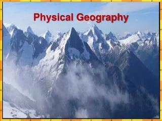
Physical Geography of Japan Ch. 29.1
Skyscrapers in Japaj • 1. What do the Japanese do to prepare for earthquakes? • 2. What are the dangers of a swaying skyscraper? • 3. How were buildings that survived the Kobe earthquake different from ones that were destroyed?
Answers to Skyscraper Video • They constantly go through drills and use simulators to get an idea of what it’s like. • The buildings could collide with each other, fall down and the people inside could get seriously hurt. • Older building collapsed and the newer ones made it through.
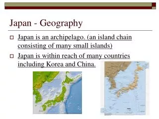
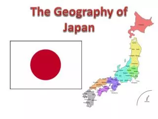
Physical Geography of Japan • Landforms • Although there are 6,800 islands in its archipelago, a group or chain of islands, Japan consists of four main islands: Hokkaidō, Honshū, Shikoku, and Kyūshū. • Most Japanese live along the coastal lowlands. • Japan’s location in the Ring of Fire results in volcanic activity and frequent earthquakes. • When earthquakes occur, a major tsunami, or huge wave, can form, causing massive property damage and many casualties.
Although there are 6,800 islands in its archipelago, a group or chain of islands, Japan consists of four main islands: Hokkaidō, Honshū, Shikoku, and Kyūshū.
Japan’s location in the Ring of Fire results in volcanic activity and frequent earthquakes.
When earthquakes occur, a major tsunami, or huge wave, can form, causing massive property damage and many casualties.
Physical Geography of Japan • Water Systems • Japan has short, swift rivers that flow from the mountains and plunge over cliffs, often as stunning waterfalls. • Japanese rivers cross alluvial plains before emptying into the sea. • Increasing demand for water byindustry and agriculture remains a challenge. • Many of Japan’s coastal lakes were formed when river valleys became dammed by silt or sandbars.
Japan has short, swift rivers that flow from the mountains and plunge over cliffs, often as stunning waterfalls.
Japanese rivers cross alluvial plains before emptying into the sea.
Increasing demand for water byindustry and agriculture remains a challenge.
Physical Geography of Japan • Climates, Biomes, and Resources • Overall, Japan has a mild climate with abundant rainfall. • The northern latitudes experience a humid continental climate, while further south is a humid, subtropical climate. • Most of Japan is forested, and large land mammals and birds still thrive in isolated mountain regions. • As an island nation, Japan relies heavily on the sea for food, but is also a leading rice producer.
The northern latitudes experience a humid continental climate, while further south is a humid, subtropical climate.
Most of Japan is forested, and large land mammals and birds still thrive in isolated mountain regions.
As an island nation, Japan relies heavily on the sea for food, but is also a leading rice producer.