Download
1 / 6
60 likes | 191 Vues
This initiative aims to develop a collaborative effort between geologists and geophysicists at the University of Chile to investigate the dynamics of subduction in Northern Chile and Southern Peru, focusing on the Arica Gap and surrounding areas. By combining seismology, GPS, and InSAR data within a Continuous GPS (CGPS) network, we strive to understand strain patterns, uplift rates, volcanic activity, and the effects of slab geometry. Our goal is to enhance our knowledge of seismic activity and geological processes, identify research interests, and assess existing data to inform future studies.

E N D
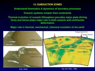
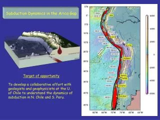
Subduction Dynamics in the Arica Gap Target of opportunity To develop a collaborative effort with geologists and geophysicists at the U. of Chile to understand the dynamics of subduction in N. Chile and S. Peru.
The Arica Gap Mejillones Peninsula and Atacama Desert viewed from Apollo
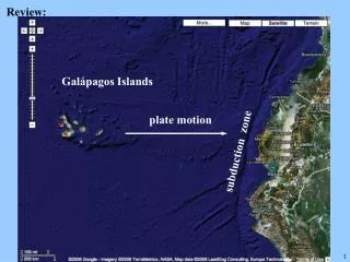
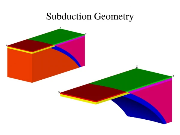
1995 Mw 8.1 postseismic slip history Pritchard and Simons, 2004 Combining seismology, GPS, and InSAR
Rationale for a CGPS network: • All “locked” SZ instrumented with CGPS have seen aseismic transients, InSAR sees hints of it in Chile. • Existing CGPS network in Chile/Peru too sparse to detect coherent transient motions • Long term strain and relationship to volcanism and slab geometry - Is there extension in the shallow crust in the Plateau? • Plateau Uplift rates (geodetic)? • ___________ • Other motivations/targets (speak up): • Structure, fluids, melt… • Permanent vs. elastic strain • Coastal terraces • Uplift rates (geologic/geodetic) • Role of slab geometry • Role of sediment flux • Volcanic flux/magma storage?
Who is interested? Specific activities? Existing Data? Seismic InSAR Geologic Geochronologic Petrologic New data (Chilean priorities)? CGPS Field geology Seismic deployments How to Proceed? We can look at maps now and return in a week after people have thought about it and possibly done some relevant homework