Download
1 / 1
10 likes | 259 Vues
MAEviz and NCSA-GIS an Open Source GIS Application Platform. N ational C enter for S upercomputing A pplications. MAE Center PI - Amr Elnashai MAEviz PI - Bill Spencer Co-PI - Jim Myers PM - Terry McLaren Software Team: Chris Navarro, Shawn Hampton, Jong Sung Lee, Nathan Tolbert.

E N D
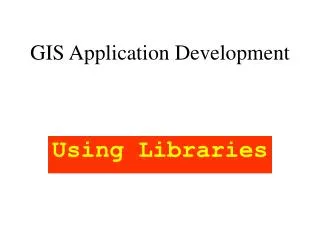
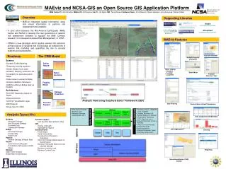
MAEviz and NCSA-GIS an Open Source GIS Application Platform National Center for Supercomputing Applications MAE Center PI - Amr Elnashai MAEviz PI - Bill Spencer Co-PI - Jim Myers PM - Terry McLaren Software Team: Chris Navarro, Shawn Hampton, Jong Sung Lee, Nathan Tolbert Overview Supporting Libraries • MAEviz integrates spatial information, data, and visual information to perform risk assessment and analysis. Ktable sourceforge.net/projects/ktable/ eclispe.org/rcp jasperreports.sourceforge.net/ JFreeChart sourceforge.net/projects/jfreechart • A joint effort between the Mid-America Earthquake (MAE) Center and NCSA to develop the next generation of seismic risk assessment software to support the MAE Center’s research in Consequence-based Risk Management, or CRM. • CRM is a new paradigm which applies seismic risk reduction across regions or systems that incorporates all components of seismic risk modeling and quantifies the risk to societal systems and subsystems. . geotools.org/ vtk.org/ MAEviz Features The CRM Model Roadmap Scenario Browser Multiple Regions of Interest • Science • Dynamic Traffic Modeling • Temporary housing algorithm • Shelter Needs (food, water, sanitation, sleeping, personnel, etc.) • Uncertainty for each attenuation model • Scale losses to account inflation • Analysis validation framework • HAZUS building & Bridge data via PostGIS • Architecture • Rich RDF Repository based on Tupelo • Data provenance • Common Visualization Layer • BIRT Reports • Single Sign On (SSO) Inputs Define Hazard • Data Catalog • WebDAV • PostGIS • Local File Style Editor Select Inventory Analysis Selection Tool Fragility Model Outputs Damage Prediction Analysis View using Graphical Editor Framework (GEF) Decision Support Data Filtering Context Aware Default Parameters • Data Types (Hazards, Buildings, etc.) • Analyses (Damage, Displacement, etc.) • Repository Types (WebDAV, Local, PostGIS) • Location Factories (US, Turkish Regions of Interest) • Visualization Renderers (VTK, GeoTools, etc..) • Analysis Execution (Local & Remote) • Units & Unit Conversions • Dataset Schemas • Base Geometries • Analysis Parameter Types • And many many more… Analysis Types (40+) Data supported with Metadata Extension Points • Building • Structural Damage • Non-Structural Damage • Economic Loss • Liquefaction Damage • Bridge • Structural Damage • Functionality • Repair Cost • Pipeline • Network Damage & Repair Rate • Hazard • Deterministic Earthquake • Probabilistic Earthquakes (USGS Maps) • Network • Static Traffic Analysis • Bridge Retrofit Optimization • Decision support • Cost benefit & Multi-attribute Utility • GIS • Overlay (intersect) • Aggregate by regions • Socioeconomic • Fiscal Impact • Social Vulnerability • Household and Population • Dislocation • Short Term Shelter Needs based on • Social Factors • Business Interrupted Sales loss from • physical damage • Business Inventory Loss • Business Content Loss Extension Points Data Aggregation Charting Reporting Internationalization (I18N) Turkish