Download
1 / 33
330 likes | 492 Vues
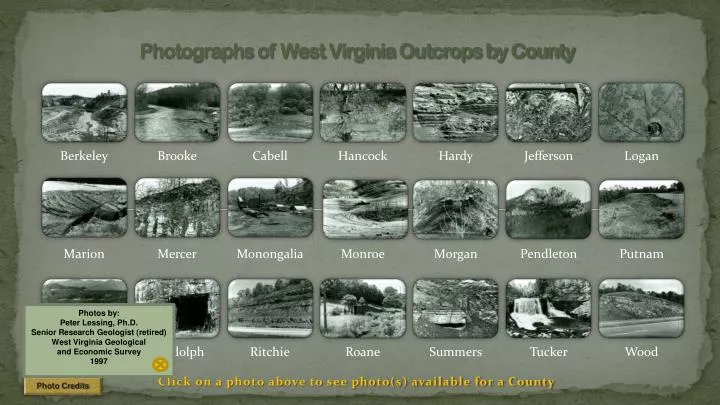
Photographs of West Virginia Outcrops by County. Click on a photo above to see photo(s) available for a County. Photo Credits. Photos by: Peter Lessing, Ph.D. Senior Research Geologist (retired) West Virginia Geological and Economic Survey 1997. Limestone Quarry. County: Berkeley

E N D
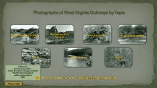
Photographs of West Virginia Outcrops by County Click on a photo above to see photo(s) available for a County Photo Credits Photos by: Peter Lessing, Ph.D. Senior Research Geologist (retired) West Virginia Geological and Economic Survey 1997
Limestone Quarry County: Berkeley Quadrangle: Inwood Location Info: Just east of Route 11, one mile SE of Inwood. Rock Formation(s): Ordovician New Market Limestone overlain by Ordovician Chambersburg Limestone. Strike/Dip (in degrees): N 25 E, dip about 45 SE. Comments: Overview from upper bench showing lower benches and standing water; dip is to the left. Contact of Chambersburg/New Market on wall of far quarry, about half way up. Chambersburg is dark limestone at top and New Market is light gray below. Mining is for the New Market. Next County List
Fossils County: Berkeley Quadrangle: Glengary Location Info: Along Back Creek, 0.6 miles SE of Glengary. Rock Formation(s): Devonian Mahantango Formation Strike/Dip (in degrees): N 30 E, 25 SE Comments: Fossils are brachiopods, all about ¼ to ½ inch in diameter. Previous County List
Meander Bend County: Brooke Quadrangle: Bethany Location Info: On Route 67, 2.5 miles W of Bethany and 3.5 miles E of Wellsburg Rock Formation(s): None Strike/Dip (in degrees): None Comments: Gravel deposit on left and steep, cut-bank on right, next to Route 67. Stream is flowing W (away from viewer), and named Buffalo Creek. County List
Landslide County: Cabell Quadrangle: Athalia Location Info: On Route 22, 2.5 miles S of Mason/Cabell line Rock Formation(s): Pennsylvania Monongahela Group Strike/Dip (in degrees): Horizontal Comments: Height of slide is about 100 feet. Composed mostly of soil and trees with a few blocks of rock. This is a very recent slide, perhaps less than a month old. County List
Meander Bend County: Gilmer Quadrangle: Glenville Location Info: On Cedar Creek in Cedar Creek State Park, 3.5 miles S of Glenville Rock Formation(s): Pennsylvanian Conemaugh Group Strike/Dip (in degrees): Horizontal Comments: Cut bank is on the right and deposition is occurring at the left bank. No bedrock is visible here, but can be seen across the road. County List
Quaternary Alluvial Gravel County: Hancock Quadrangle: East Liverpool South Location Info: One mile W of Newell on Route 2 Rock Formation(s): Quaternary Alluvium Strike/Dip (in degrees): None Comments: Sand and gravel deposit composed of quartzites, gneisses, sandstone, conglomerates, etc. Some gravel reaches 6 inches in diameter and all are very rounded. Source of clast is most likely Canada. County List
Mud Cracks County: Hardy Quadrangle: Baker Location Info: At limestone quarry, 0.3 miles east of intersection of Routes 55 and 29. Rock Formation(s): Silurian Tonoloway Formation Strike/Dip (in degrees): N 40 E, 55 NW Comments: Hammer (about 1 foot long) is parallel to dip and rock is dipping towards viewer. Next County List
Creep County: Hardy Quadrangle: Baker Location Info: On Route 29, 0.7 miles north of intersection with Route 55. Rock Formation(s): Devonian Brallier Formation Strike/Dip (in degrees): Nearly vertical dip; strike N 30 E Comments: Creep movement, downhill to left, shown along upper edge of outcrop due to gravity. Hammer in lower center is about one foot long. Previous County List
Stomatolites County: Jefferson Quadrangle: Charles Town Location Info: Vicinity of Charles Town. Rock Formation(s): Cambrian Conococheage Formation Strike/Dip (in degrees): Nearly horizontal, on axis of anticline. Comments: These Cambrian stromatolites are elongated parallel to elongation. Additional Photo (click on photo to left): Perpendicular to bedding showing Stomatolites in cross section and layers of algal mats. Exact location must remain unnamed because site must not be destroyed. County List
Fossil Leaves County: Logan Quadrangle:Amherstdale Location Info: One mile north of Amherstdale Rock Formation(s): Pennsylvanian Kanawha Formation (upper part of formation) Strike/Dip (in degrees): Horizontal Comments: Fossil leaves are Eusphenopterisobtusalopa. County List
Waterfall County: Marion Quadrangle: Fairmont East Location Info: Valley Falls State Park Rock Formation(s): Pennsylvanian Conoquesnessing Sandstone (Pottsville) Strike/Dip (in degrees): Horizontal Comments: Conoquenessing is conglomeratic and cross bedded (photos of both). Sight of old grist mill with race used in early 1800s. Next County List
Conglomerate County: Marion Quadrangle: Fairmont East Location Info: Valley Falls State Park Rock Formation(s): Pennsylvanian Conoquesnessing Sandstone (Pottsville) Strike/Dip (in degrees): Horizontal Comments: The pebbles in this rock are 1/8” to 1/4” in diameter. Previous Next County List
Crossbedding County: Marion Quadrangle: Fairmont East Location Info: Valley Falls State Park Rock Formation(s): Pennsylvanian Conoquesnessing Sandstone (Pottsville) Strike/Dip (in degrees): Horizontal, but dip of crossbedding is about 20. Comments: View shows side and top of crossbedding in sandstone that is partly conglomeratic. Entire bowl shape is about ten feet in diameter. Previous County List
Normal Fault County: Mercer Quadrangle: Princeton Location Info: On Route 460,2 miles east of interchange with I-77 (Princeton) and ¼ mile west of mile post 18. Rock Formation(s): Mississippian Hinton Formation Strike/Dip (in degrees): Horizontal Comments: This is a normal (or gravity) fault with a displacement of 4 feet. The left side has moved down relative to the right side. Strike fault is N 40 E and it dips 55 NW. Hammer handle (about one foot long) is parallel to fault. The Hinton at this location is interbedded red and light gray shale and gray siltstone and sandstone. County List
Landslides County: Monongalia Quadrangle: Morgantown North Location Info: On hillside just above Easton School Rock Formation(s): Pennsylvanian Conemaugh Group, specifically, just below the Pittsburgh coal. Strike/Dip (in degrees): Horizontal, but strata are not visible in this photo. Comments: Several landslides have formed above the school due to instability of soil and the removal of an old house. Also, water is a contributing factor coming off the Easton Hill road (Route 857). This water drains from abandoned Pittsburgh coal mines approximately 60 feet below the Mileground and airport. Next County List
Coal Mine Entry County: Monongalia Quadrangle: Morgantown South Location Info: On Mays Run, 1 mile SE of I-79, exit 146 (Goshen Road exit) Rock Formation(s): Pennsylvanian Allegheny Formation Strike/Dip (in degrees): Horizontal Comments: Four active portals (two shown here) into coal with conveyor belt that transports coal out and dumps coal into trucks. Coal seam also surface mined and reclaimed along this creek. Coal seam is the Upper Freeport. Previous County List
Spring and Cave County: Monroe Quadrangle: Gap Mills Location Info: 1.3 miles southeast of Gap Mills Rock Formation(s): Ordovician Black River Limestone Strike/Dip (in degrees): Strike is N 35 and dip is 16 NW Comments: Cave part in this photo has been partially blocked by limestone boulders that have fallen at cave entrance. Water still issues forth at several hundred gallons per minute. There is a big sink hole 50 yards behind this spring that is probably Patton Cave. Next County List
Sink Holes County: Monroe Quadrangle: Gap Mills Location Info:Waiteville Road at intersection with Gap Mills/Zenith Road Rock Formation(s): Ordovician Black River Limestone Strike/Dip (in degrees): N 60 E; 23 SE Comments: Several sink holes are shown in this photo. The rocks at this location are dipping away from the viewer. Previous County List
Syncline County: Morgan Quadrangle: Hancock Location Info: Along Potomac River and railroad, approximately 3.5 miles SW of Hancock, MD and 1.5 miles north of Sir Johns Run, WV. Rock Formation(s): Silurian Bloomsburg Formation Strike/Dip (in degrees): Left side; N 35 E, 60 SE: Right side; N 25 E, 25 NW. Comments: Bloomsburg is about 30 feet thick here, although only about 10 feet is visible in photo. Axis of syncline strike 35 NE and plunges 10 SW (towards viewer). Excellent cleavage perpendicular to bedding. Next County List
Anticline County: Morgan Quadrangle: Great Cacapon Location Info: Just downstream from old power dam and one mile SE of Great Cacapon. Rock Formation(s): Silurian Rose Hill Formation Strike/Dip (in degrees): None taken, but strike is about N 25 E and dips can be measured from water. Comments: Anticline with a fault on the right side just below right anticline; fault has steep dip 60 SE with drag folds. Same anticline with adjacent syncline on left side. CLOSE Click on photo above to zoomed view of the fold. Previous Next County List
Berkeley Springs County: Morgan Quadrangle: Hancock Location Info: In town of Berkeley Springs (Bath) on Route 522 Rock Formation(s): Devonian Oriskany Sandstone Strike/Dip (in degrees): N 25 E; 45 SE Comments: The Oriskany exposed in this spring is a quartzite; extensively faulted and fractured. Spring bubbles upward with white, Oriskany sand grains. Hammer is one foot long. Water rises from about 1800 feet below the surface through a complex fracture pattern. There is NO hot, subterranean magma needed to heat the water as the Park Museum would have one believe. Previous Next County List
Spring County: Morgan Quadrangle: Great Cacapon Location Info: 3.5 miles NE of Largent along Cacapon River Rock Formation(s): Devonian Helderberg Limestone Strike/Dip (in degrees): N 25 E; 85 SE overturned Comments: Spring issues from two cavities in the Helderberg, which also has some cement added to hold this outcrop together. Watercress can be seen in the lower left of the photo. The limestone dips steeply away from the viewer. The spring probably produces several hundred gallons per minute. Previous County List
Vertical Tuscarora County: Pendleton Quadrangle: Upper Tract Location Info: See comments Rock Formation(s): Silurian Tuscarora Sandstone Strike/Dip (in degrees): N 30 E, dip is vertical Comments: Seneca Rocks from visitors center area (many climbers on the face and at top). The Tuscarora at this location is approximately 200 feet thick with several faults parallel to bedding. Next County List
Overturned Devonian Oriskany Sandstone County: Pendleton Quadrangle: Upper Tract Location Info: Approximately 2 miles northwest of Route 220 on Smoke Hole Road Rock Formation(s): Devonian Oriskany Sandstone Strike/Dip (in degrees): Overturned and now dips 80 SE with Devonian Helderberg on southeast side. Strike is N 20 E. Comments: Also called “Eagle Rocks” and located on Cave Mountain. From Sign at this Location: “Eagle Rocks. Named for William Eagle, a Revolutionary War soldier who lived nearby. Enlisted at age fifteen, 12-24-1776, he served in the 3rd, 4th, 8th, and 12th, Virginia Regiments, Continental Line, at Valley Forge and Yorktown. Died 1848, and is buried here.” Grave is right behind this sign at Eagle Rocks. Click on photo above to zoomed view of the fold. Previous County List CLOSE
Top of Landslide County: Putnam Quadrangle: Bancroft Location Info: On Route 34, next to Lone Oak Church Rock Formation(s): Base of Permian Dunkard Group Strike/Dip (in degrees): None Comments: This is the top of a landslide showing the crown, scarp, and head. The upper scarp is about 15 feet high and the distance across is about 175-200 feet. Slide is mostly red soil of the Dunkard, which is notoriously unstable. County List
Coal Strip Mine Benches County: Raleigh Quadrangle: Arnett Location Info: 4.2 miles west of Bolt, WV on Route 99. Rock Formation(s): Pennsylvanian Kanawha Formation Strike/Dip (in degrees): Horizontal Comments: Five benches in photo. County List
Abandoned Limestone Mine County: Randolph Quadrangle: Bowen Location Info: South side of new Route 33 at Bowden. Rock Formation(s): Mississippian Greenbrier Limestone Strike/Dip (in degrees): Nearly horizontal. Comments: Opening to mine is about 30-40 feet high. There is another opening to the same mine at this same location. Route 33 that was built here disrupted springs that fed Bowden fish hatchery and so, this Corridor H was abandoned and ends at Shavers Fork; another screw up by the WV Highway Dept. County List
Sandstone and Shale Roadcut County: Ritchie Quadrangle: Schultz Location Info: On Route 50, just E of Bear Run Road and 4.5 miles W of Ellenboro Rock Formation(s): Permian Dunkard (may be Pennsylvanian) Strike/Dip (in degrees): Horizontal Comments: Entire road cut is about 100 feet high. Thick sandstone near base is about 10 feet thick and green on fresh surface. There are thinner sandstones in middle and upper sections. Interlayeredshales are red and green. Note different weathering characteristics. County List
Old Oil Well County: Roane Quadrangle: Gay Location Info: On Route 33, 0.5 miles E of Roane/Jackson line and 2.6 miles W of Peniel Rock Formation(s): Well is spudded in Permian Dunkard Group Strike/Dip (in degrees): None in photo, but horizontal Comments: This oil well is in the Buffalo-Peniel field (number 162) and oil was obtained from the Salt Sand (Lower Pennsylvanian). County List
Thrust Fault County: Summers Quadrangle: Dawson Location Info: On I-64 at mile post 147; 0.8 miles west of Summers/Greenbrier County line and 3.5 miles east of Green Sulphur Springs exit. Rock Formation(s): Mississippian Hinton Formation Strike/Dip (in degrees): Horizontal Comments: Hammer handle (about one foot long) is parallel to fault that dips 25 E. Displacement unknown. Right side has moved upwards towards upper left of photo. County List
Blackwater Falls County: Tucker Quadrangle:Blackwater Falls Location Info: At Blackwater State Park Rock Formation(s): Pennsylvanian Conoquesnessing and Homewood Sandstones Strike/Dip (in degrees): Horizontal Comments: Several frames from first overlook and from lower walkway. Good photo ops from “Gentle Trail” on other side also. Falls caused by resistant sandstones visible on right. County List
Landslide County: Wood Quadrangle: Rockport Location Info: On I-77, 0.7 miles N of Jackson/Wood County line and 0.7 miles N of mile post 157 Rock Formation(s): Permian Dunkard (may be Pennsylvanian) Strike/Dip (in degrees): Horizontal Comments: Large blocks of rock (the size of cars) with associated red shale have fallen to road level. Red shale here has no strength, and when combined with water, it will slide. Sandstone ledges now have no support, so they too tumble down. County List