Download
1 / 12
120 likes | 338 Vues
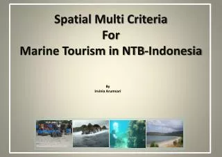
Spatial Multi Criteria For Marine Tourism in NTB-Indonesia. By Irvinia Arumsari. INDONESIA. Consists of 33 Province. One of them NTB (Nusa Tenggara Barat). Melaka. Jakarta. Komodo. Bali. NTB has of two major island:. Lombok Sumbawa. And Hundred of islet. P urpose and Objectives.

E N D
Spatial Multi Criteria For Marine Tourism in NTB-Indonesia By Irvinia Arumsari
INDONESIA Consists of 33 Province One of them NTB (Nusa Tenggara Barat) Melaka Jakarta Komodo Bali
NTB has of two major island: Lombok Sumbawa And Hundred of islet
Purpose and Objectives • Purpose Assist government to identify potential location of marine tourism and estimating the economic impacts for local community. • Research Objectives Analyze physical characteristic Identify unique object attraction Rank the potential location Recommendation
About NTB Tourism • Tourist Market Share NTB Bali (transit) tourist Komodo (transit) tourist Rinjani mount climbers (second highest volcano in Indonesia) • Potential Marine Tourism Natural white sand beach Private and quite island Various fish species and water plant (biodiversity of under water)
Spatial Analysis • Satellite Imagery Analysis Reef identification Road access network identification • DEM Analysis Slope classification Beach area identification • Basemap Analysis Distribution of public facilities Distance from nearest settlement
Work Flow Define Purpose Development Strategies and Planning Establish Criteria GIS Database Input and Suggestion from Local Government Spatial Analysis Calculated Economic Impact Field Survey Rank and Result Culture and Ground Truth Conclusion and Recommendation
Infrastructure Mataram NTB Capital City • Road network more dense on Lombok than Sumbawa • Electricity on some area on south part of Sumbawa is unavailable • Diving/Snorkeling and Surfing equipment center only available on Lombok • Public facility: restaurant are rare on east part of Sumbawa • Gas station at Sumbawa only available at north part of the island
Physical – Cultural Characteristic LOMBOK Mount Rinjani • North coast plain • Wide coastal area • 0.5 - 1.5 m wave • South coast steep • Narrow coastal area • 1.5-2.5 m wave N • Tribal majority : Sasak and Bali • Religion: Islam, still have influence from Hindu Bali • Well known as island of 1000 mosque
Physical – Cultural Characteristic • Tribal majority : Sumbawa (Coastal Area); Bali (cluster on inland); Bajo (Bima-Eastern part of island) • Bali livelihood of farmer, Bajo are seaman SUMBAWA • South coast narrow area • 1-2 m wave Mount Tambora • North coast plain • Wide coastal area • 0.5 - 1 m wave N
Result & Rank Strong: Diving GiliMeno Surfing Bangko Beach Advance Diving GiliSepatang Medium: Diving GiliRengit Adventure Satonda Island Weak: Slum site GiliBungin