Mohd Dzulkarnain Bin Mohd Jame
90 likes | 377 Vues
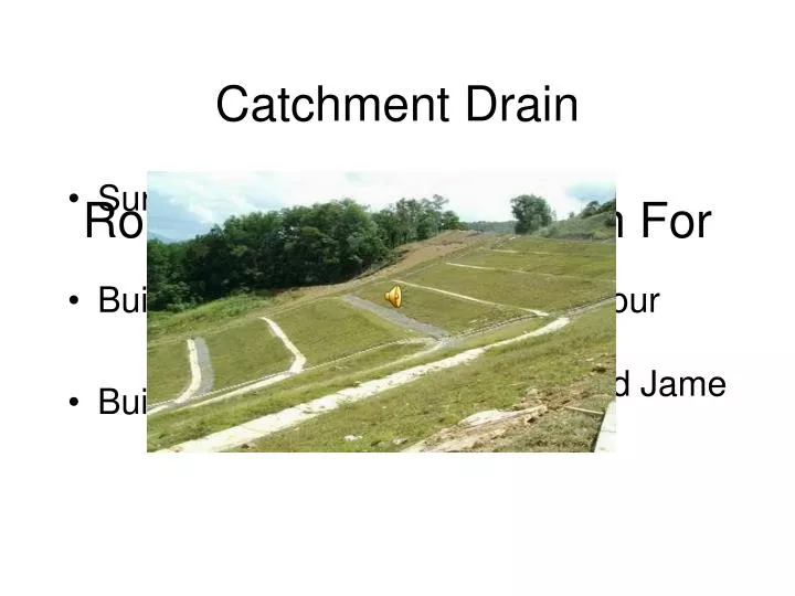
Catchment Drain. Surface Drainage Built lined to the earth slope contour Built to stabilize the earth slopes. Role Of Catchment Drain For Earth Slope Stability. Mohd Dzulkarnain Bin Mohd Jame. Rainfall. Surface runoff. Water penetration deep below drain. Problem Statement.

Mohd Dzulkarnain Bin Mohd Jame
E N D
Presentation Transcript
Catchment Drain • Surface Drainage • Built lined to the earth slope contour • Built to stabilize the earth slopes Role Of Catchment Drain For Earth Slope Stability Mohd Dzulkarnain Bin Mohd Jame
Rainfall Surface runoff Water penetration deep below drain Problem Statement • Erosion,land sliding still happens • Most surface water penetrates into the soil • Catchment drain not operating on it’s full capacity
Rainfall ? ? Surface runoff Water penetration is controlled Objective • To determine the optimum spacings requirement for lateral storm water catchments drain on hill slopes that can reduce soil moisture content and depth of soil water penetration into the ground from heavy rainfall downpours.
Site Study Location • 106.4 km from Kota Kinabalu,Sabah Slope at km 106.4
Field Test T Bar & Measuring tape Penetration test The site study
Data Analysis Start - Soil moisture content (%) - Catchment drain distance (m) - Wetted soil depth (mm) Site Data Change Q Values Initial Q = 0.4 l/s - Surface runoff (mm) - Inflow time (minutes) Refer to SCS Design Chart Determine Runoff/hr equivalent & Rainfall equivalent type NO - Rainfall intensity (mm/hr) - Duration (minutes) Refer to rainfall IDF curve to determine rain type Is rain application on slope ≈ runoff values? SCS formula Calculations -Actual rain application on slope (mm) -Intake into soil (mm) -Wetted soil depth (mm) -Surface runoff (mm) YES Catchment drains interval height comparison to JKR requirement.
Conclusion Recommendation • Depth of soil water penetration into the ground from heavy downpour and soil moisture content can be reduced by minimizing the wetted soil depth on the hill slope . • Equation method shows a potential to be used as a design method for earth slope drainage . • This study has been successfully shows that the SCS charts and equations can give a close resemblance to the actual measured wetted soil depth . • Conservation Service (USDA, 1974) design of gradient furrows equation should need some calibration to be used in Malaysia • A localized design chart for slope rain water flow similar to the SCS design chart should be developed